Field journal #10 — Upper Mount Tam

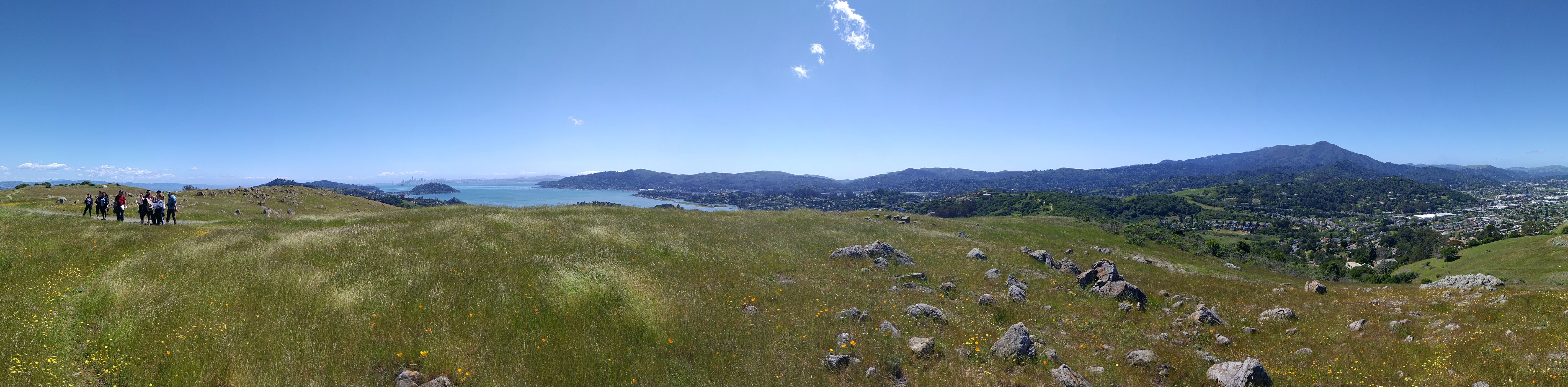
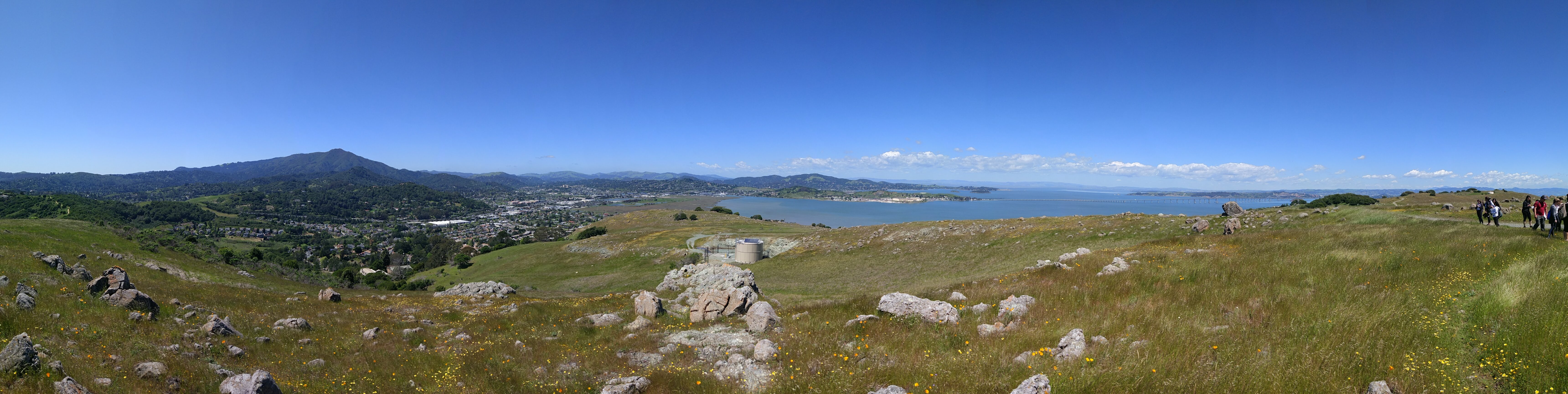
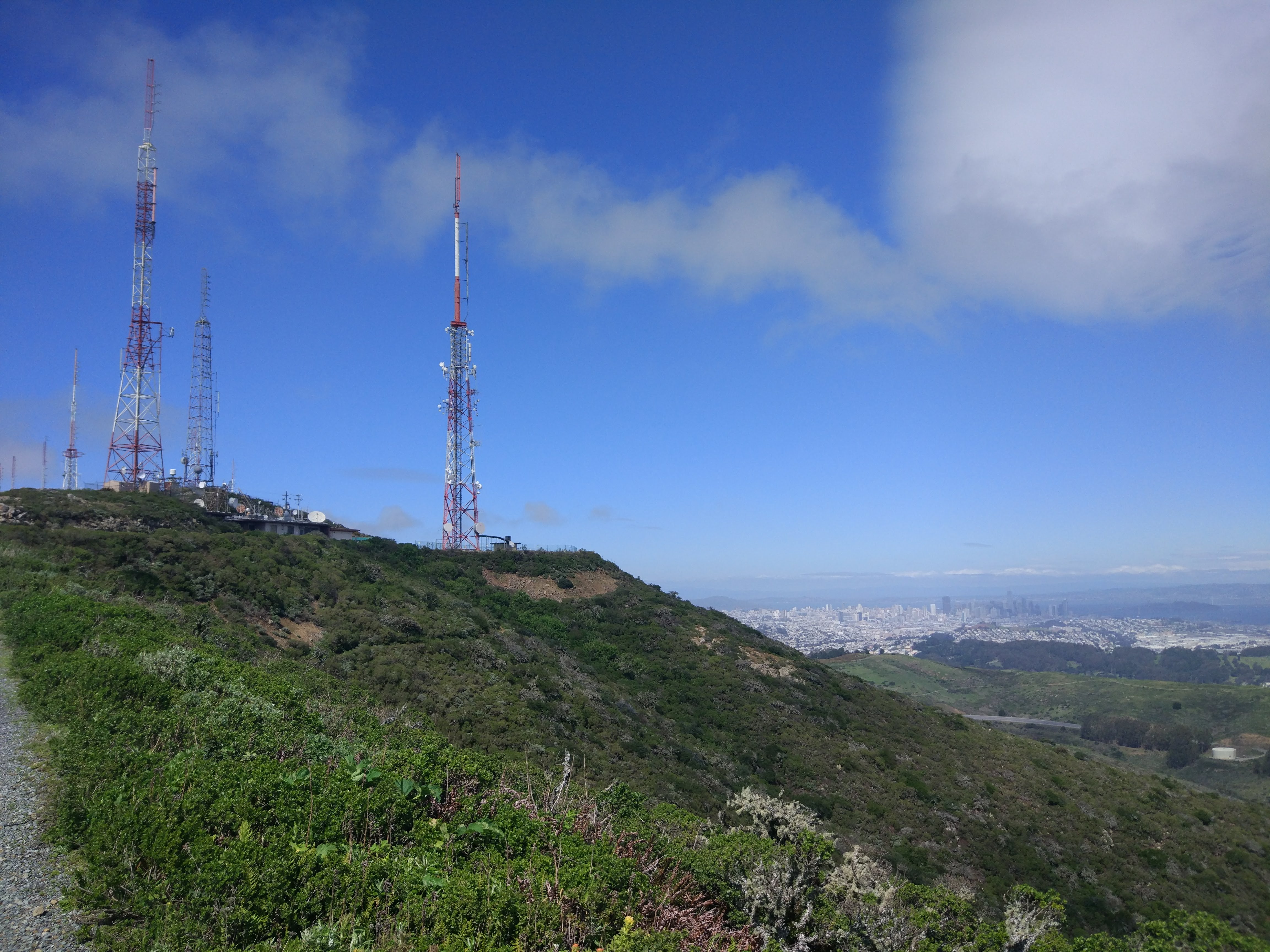
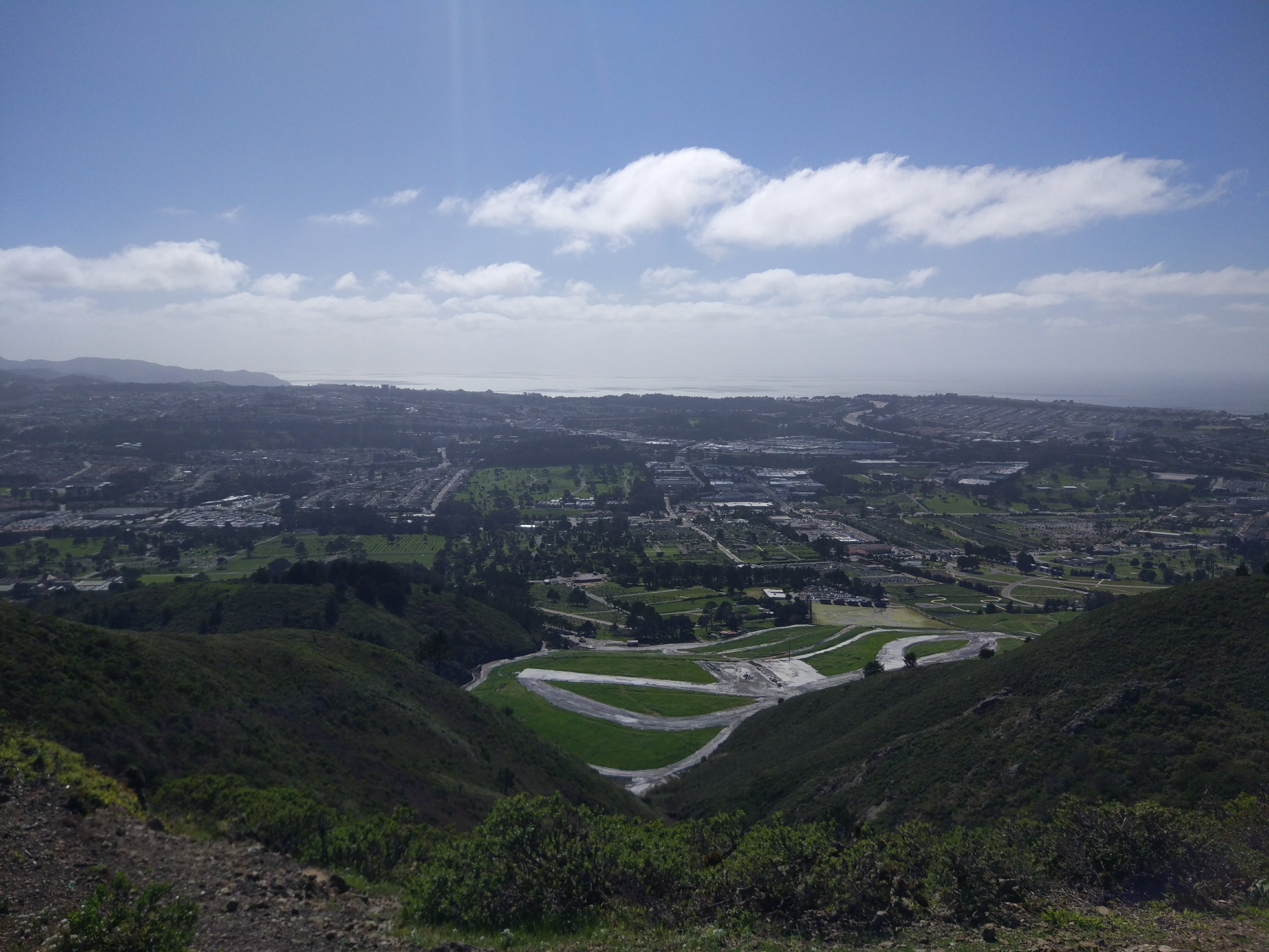
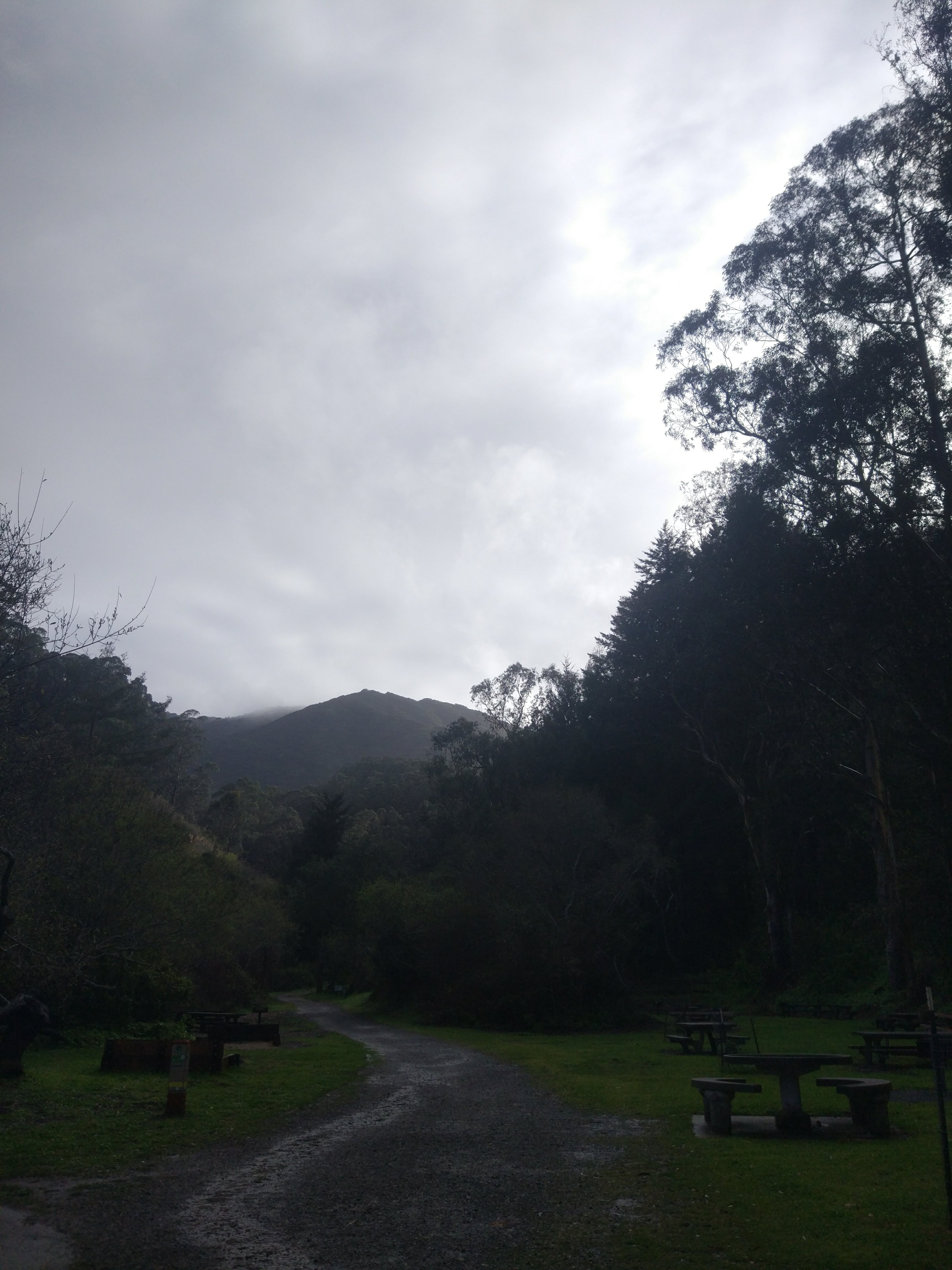
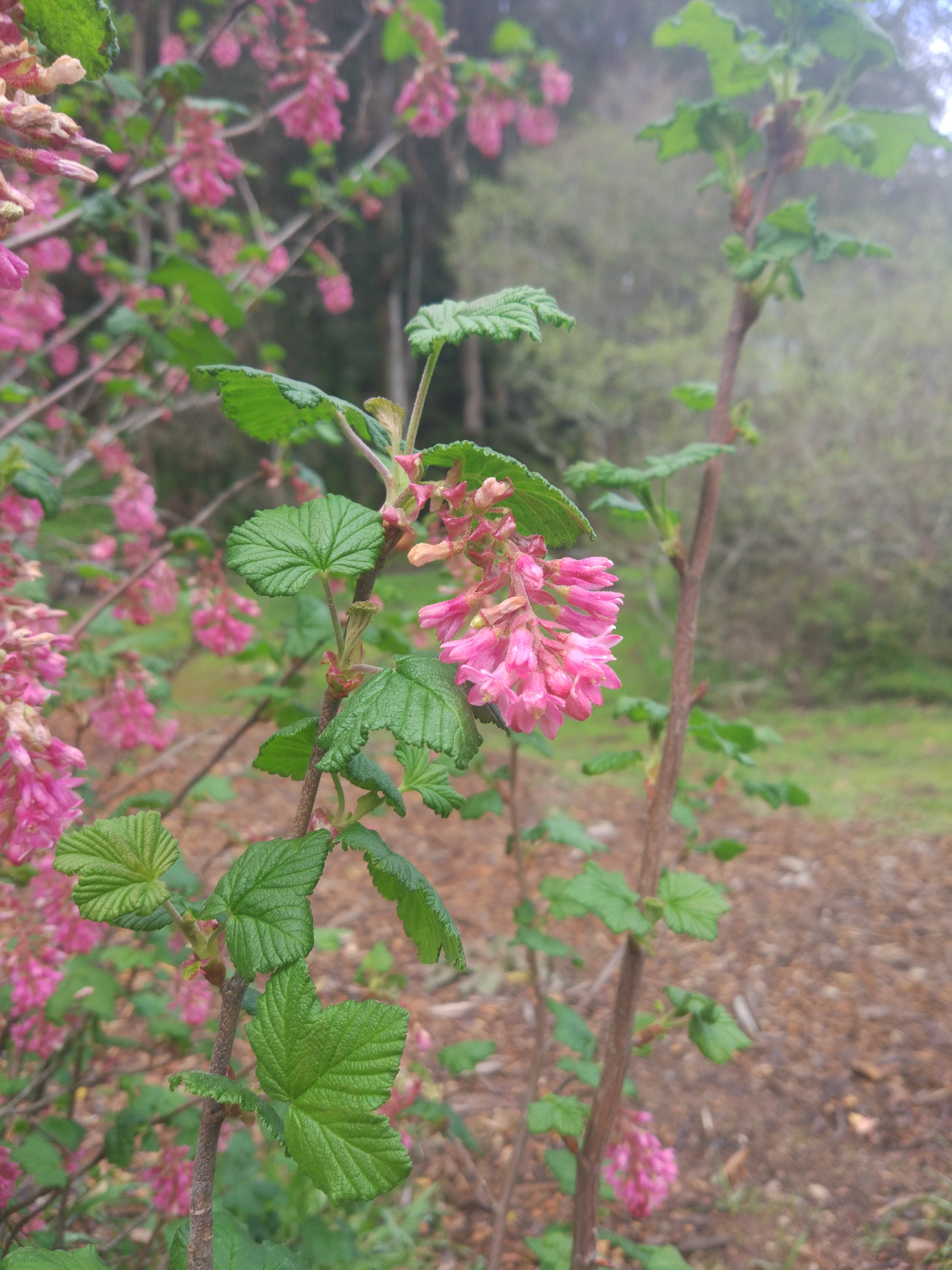
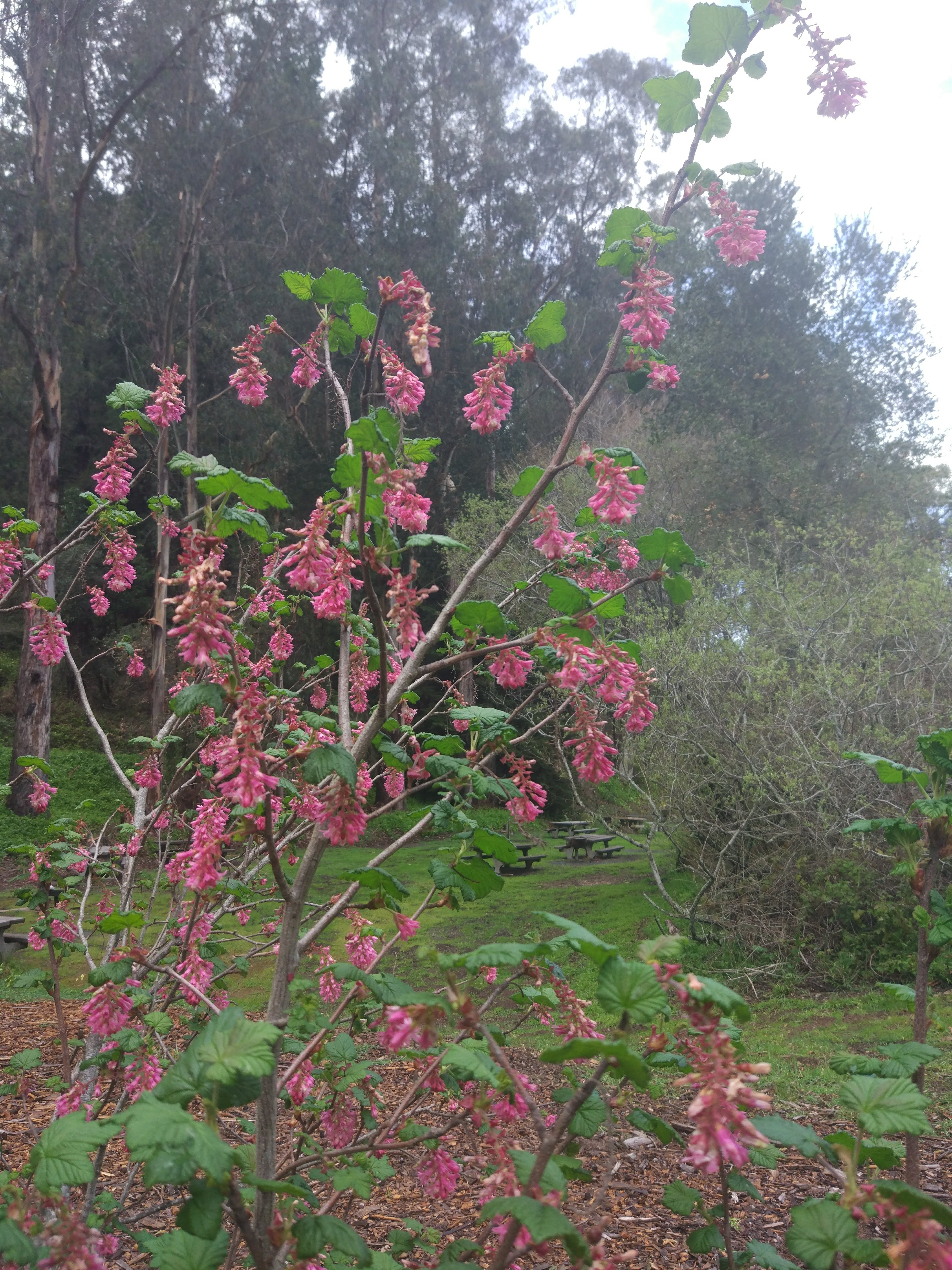
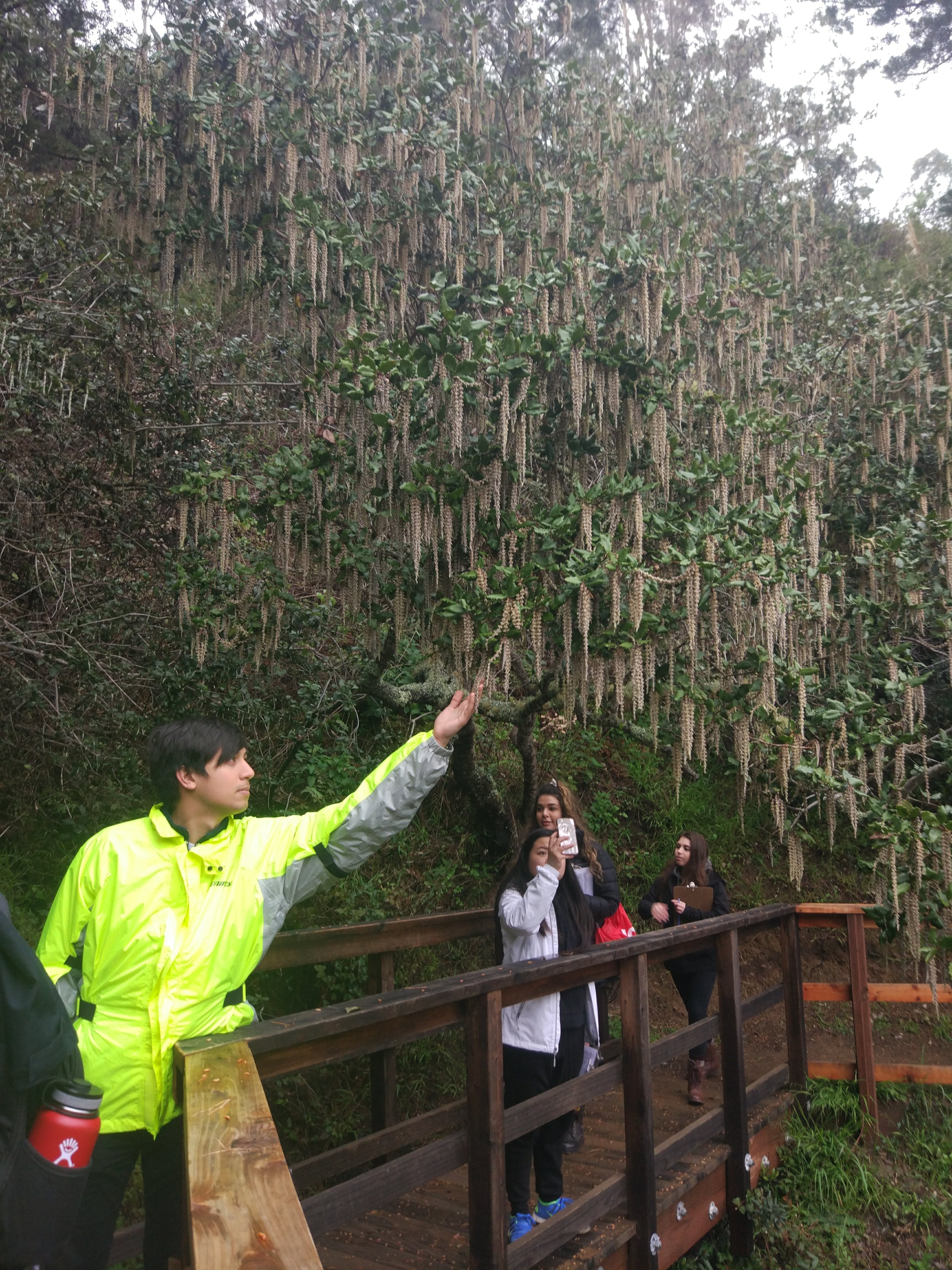
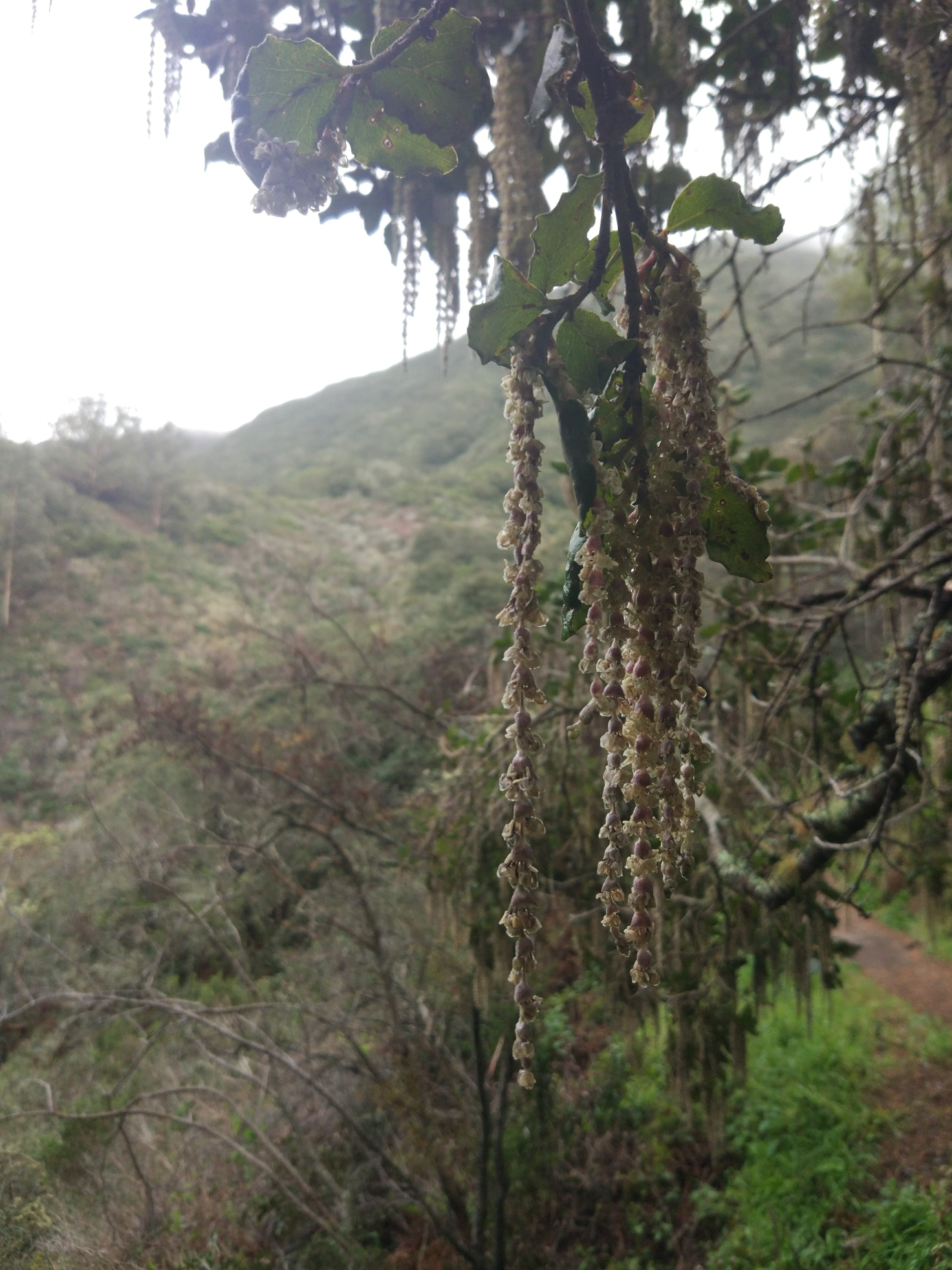
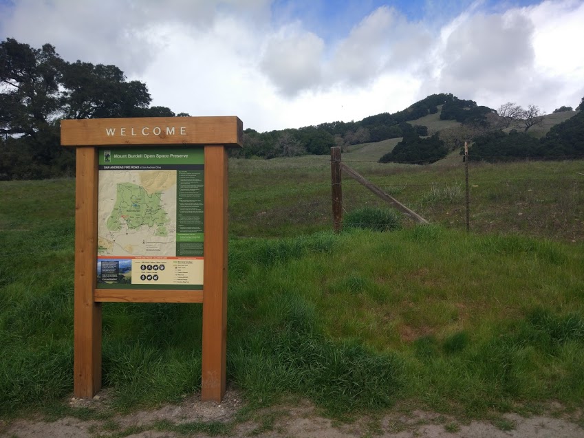
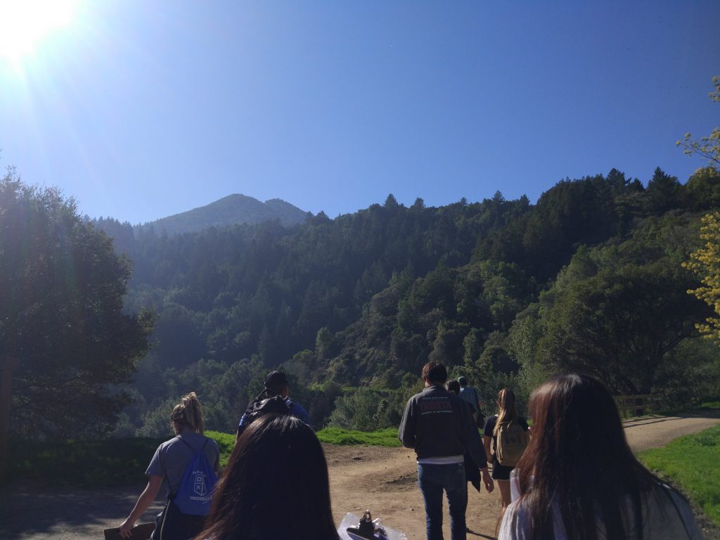
Location: 784 ft above sea level | 37.924, -122.596

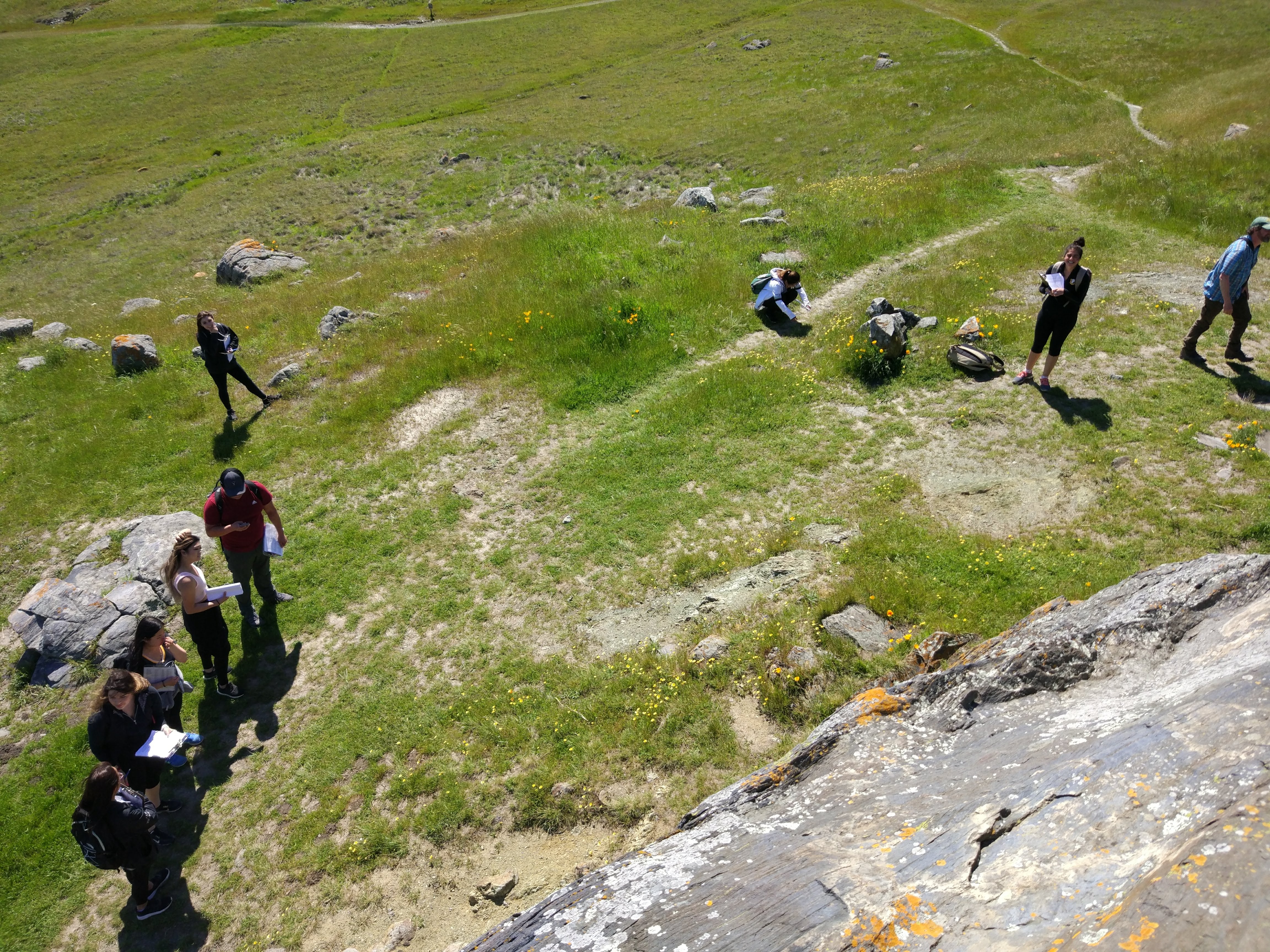
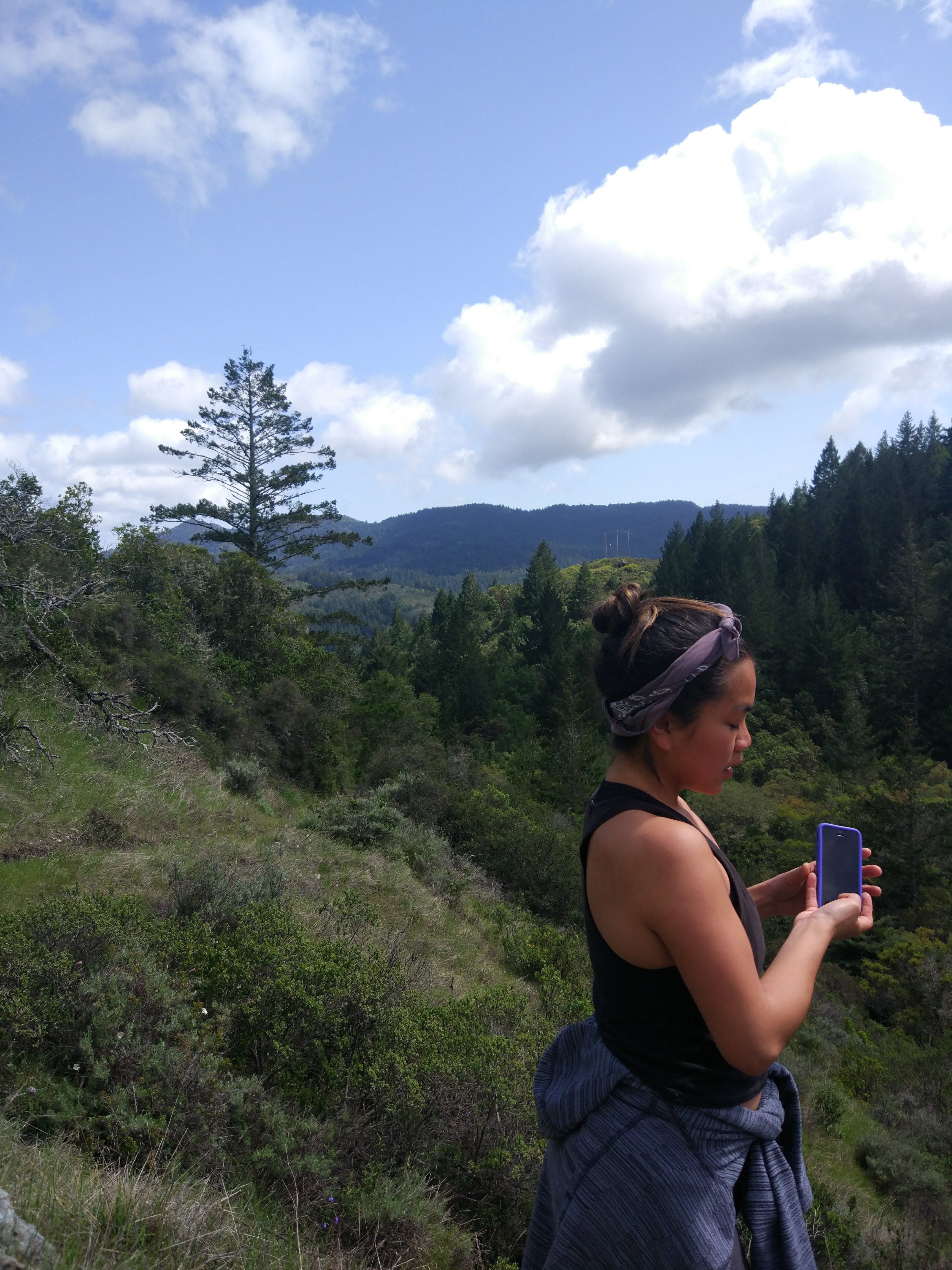
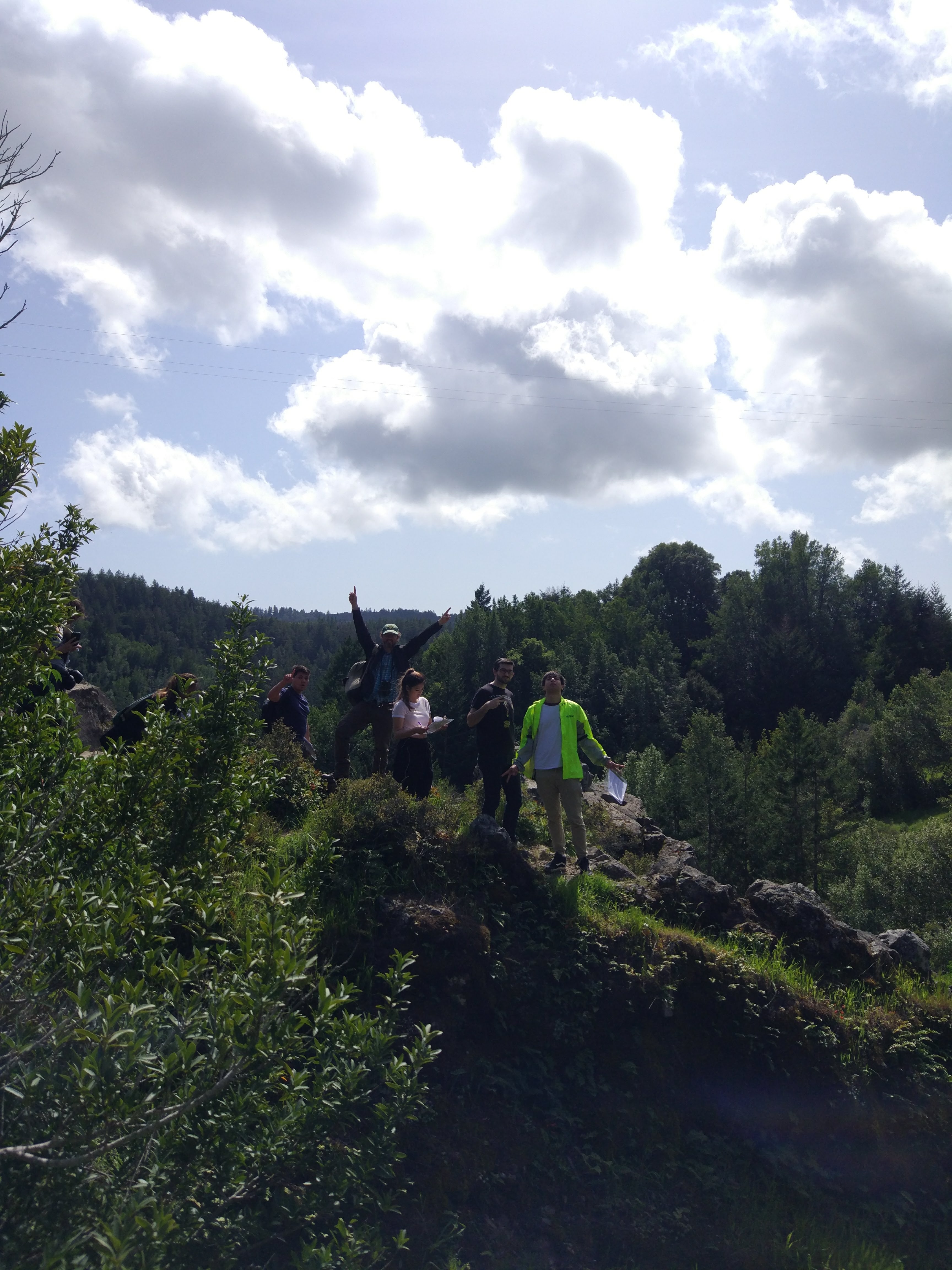
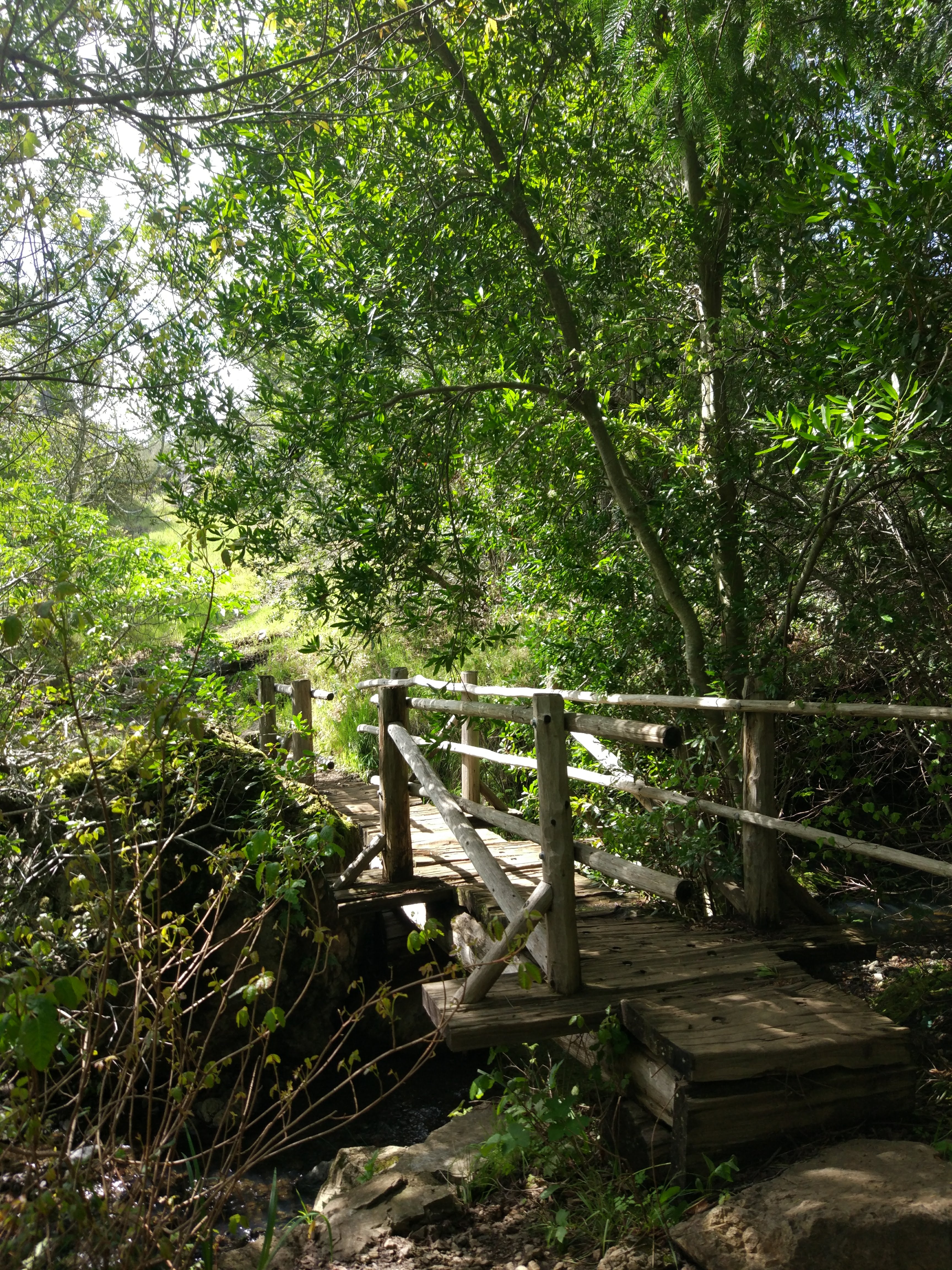
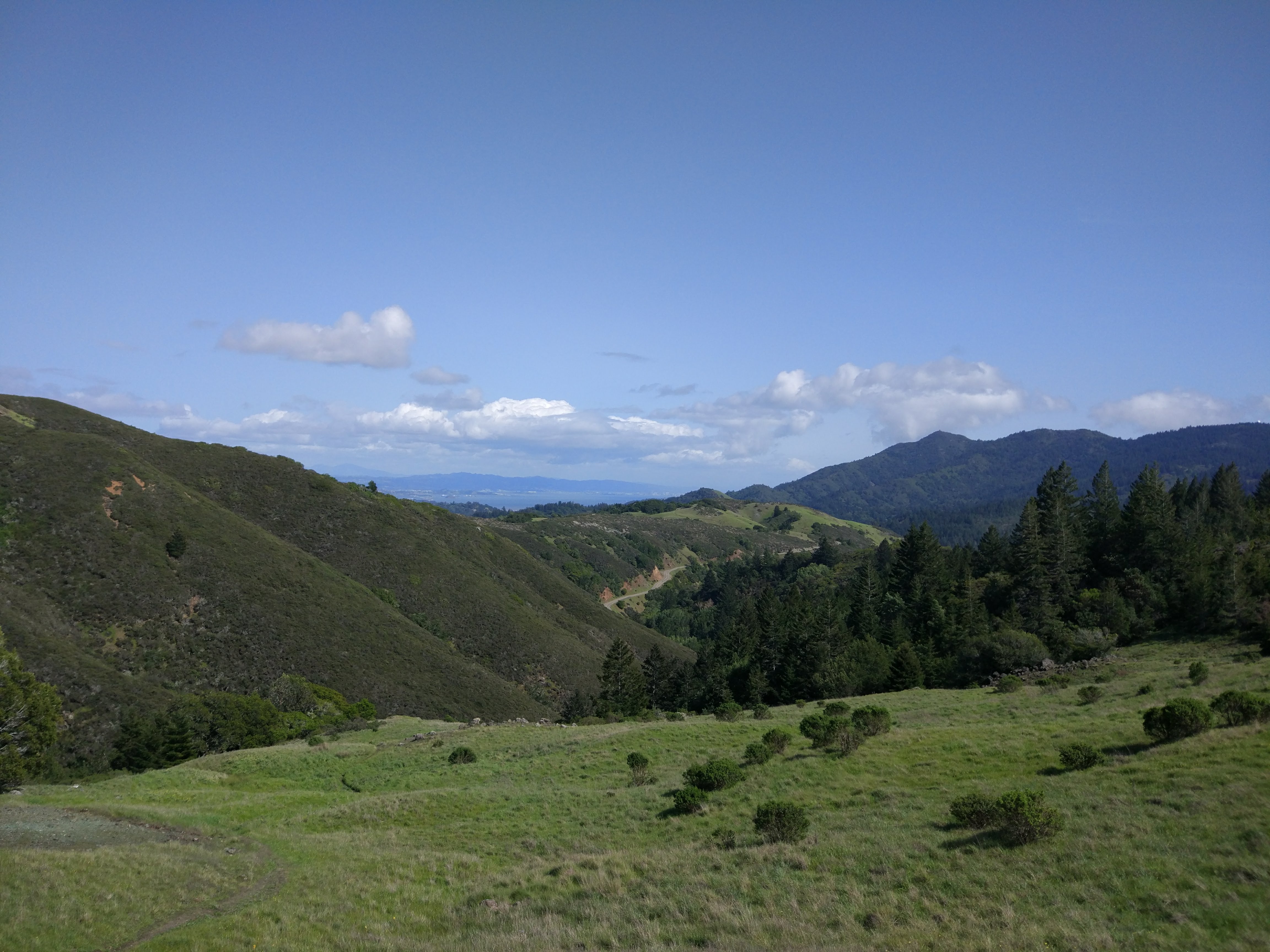
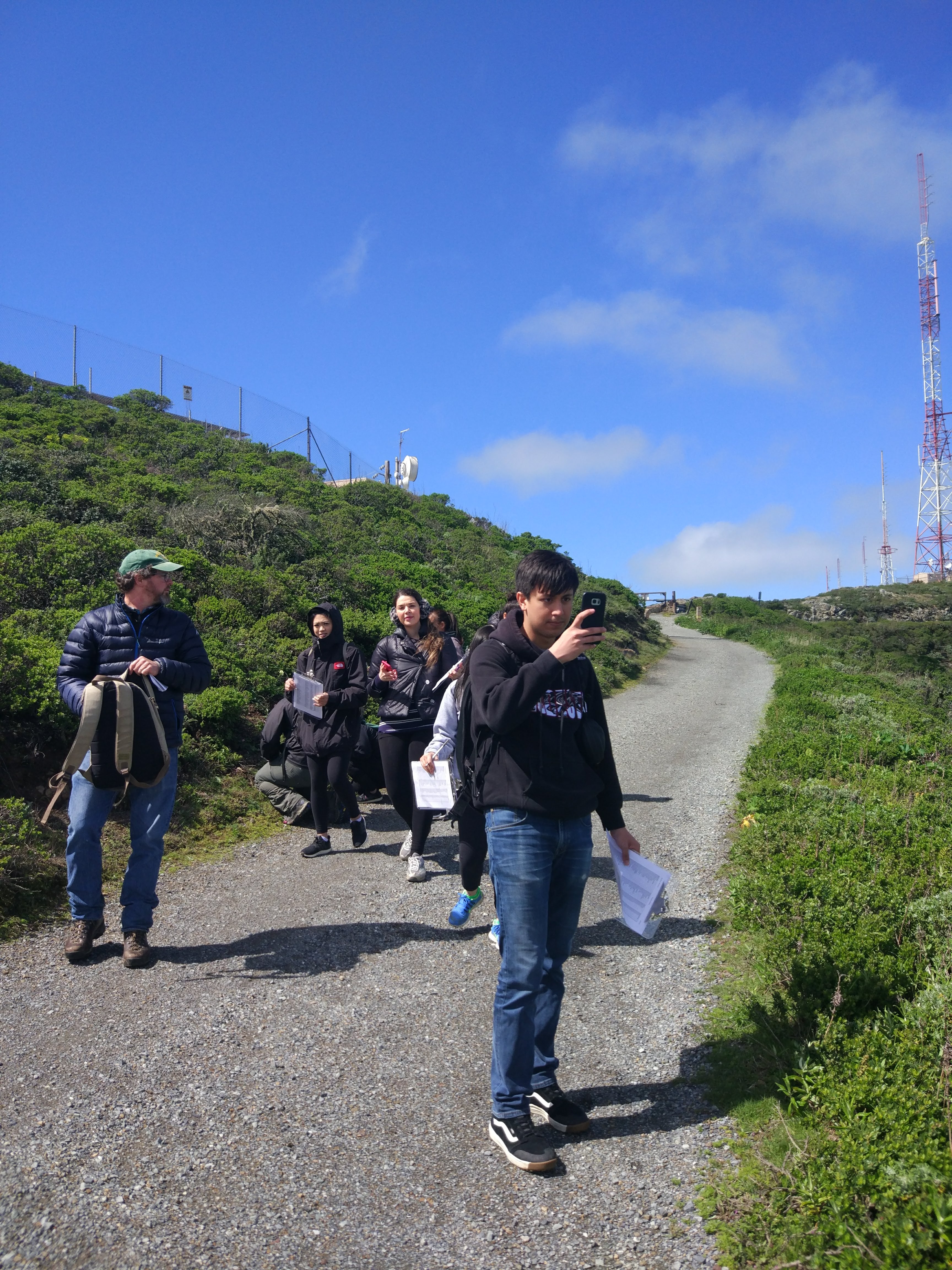
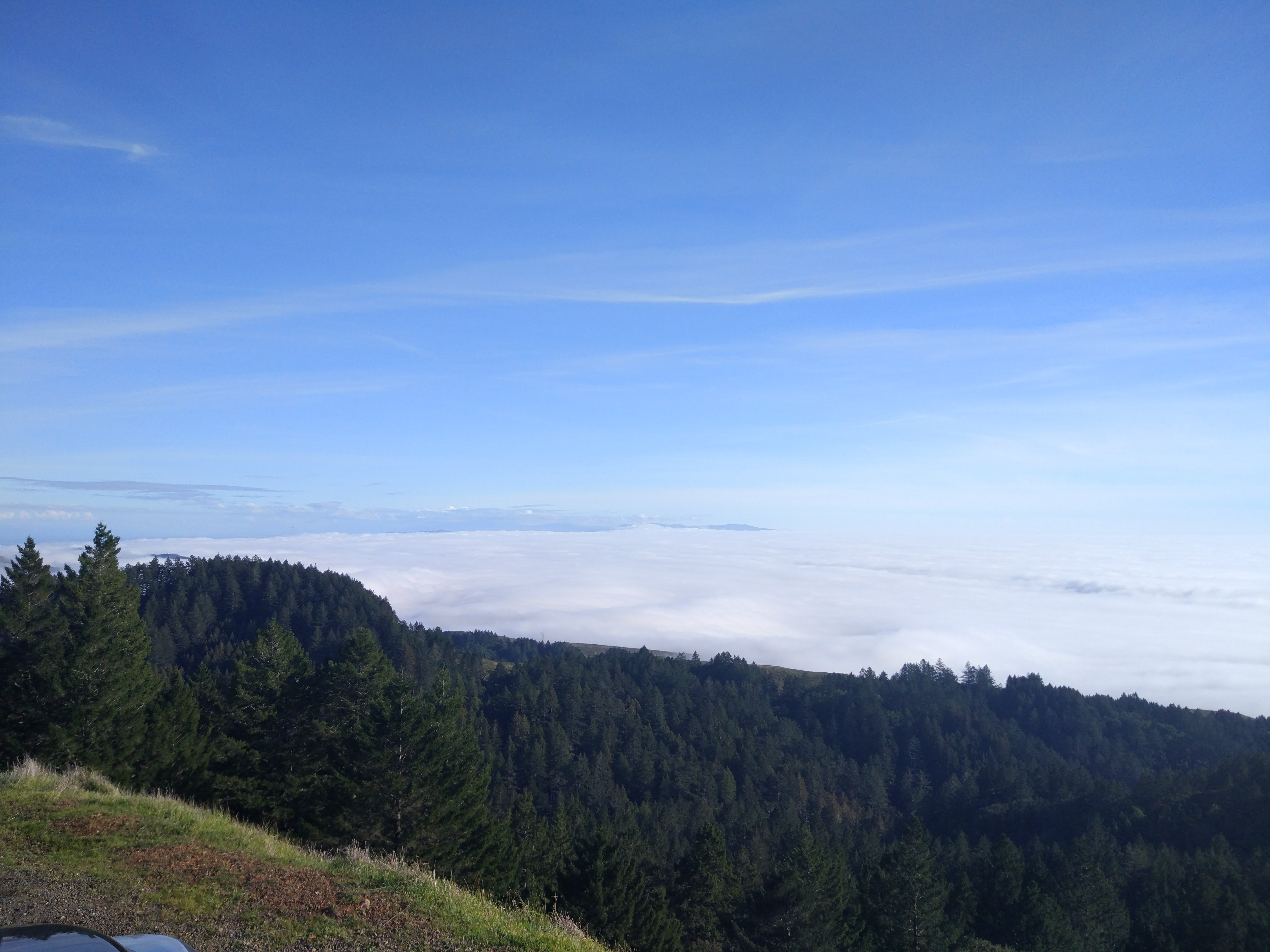
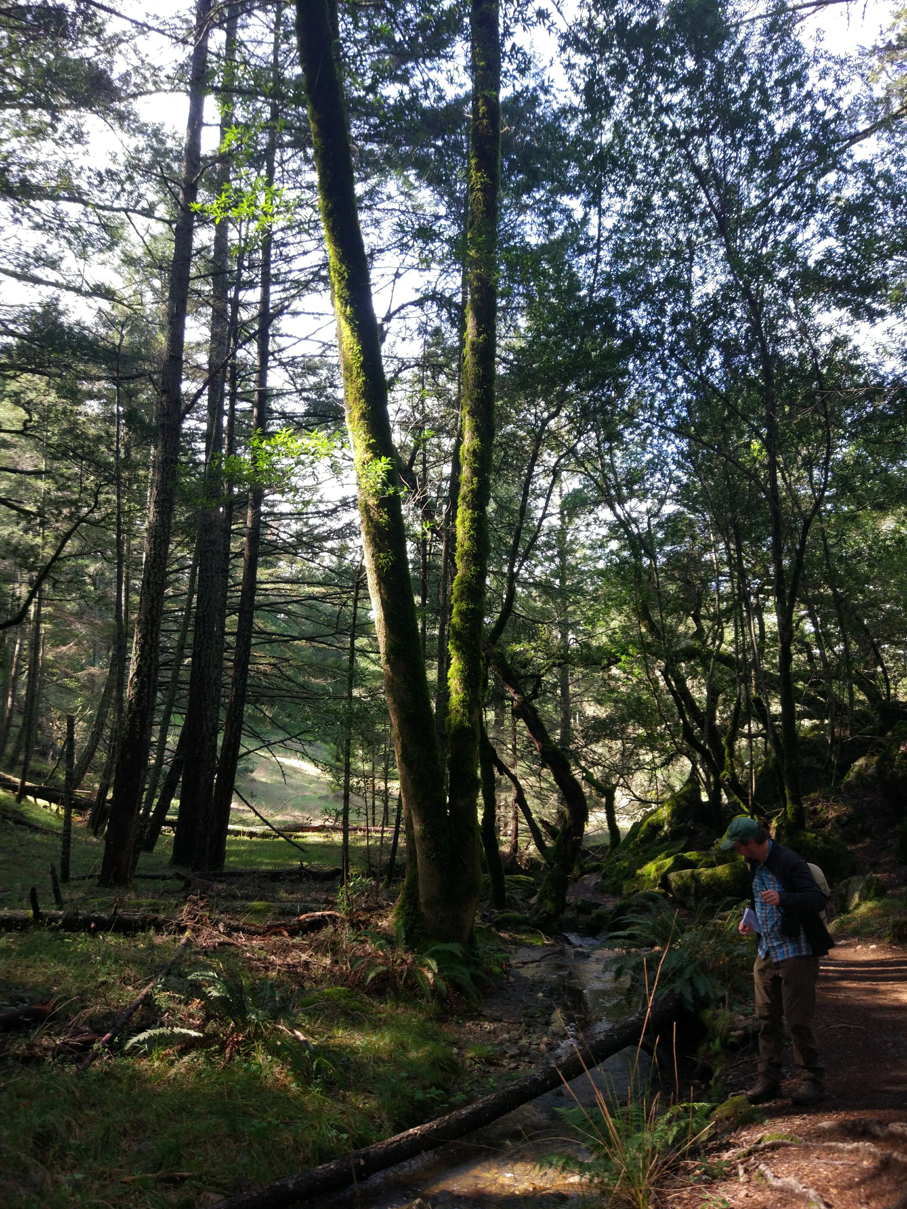
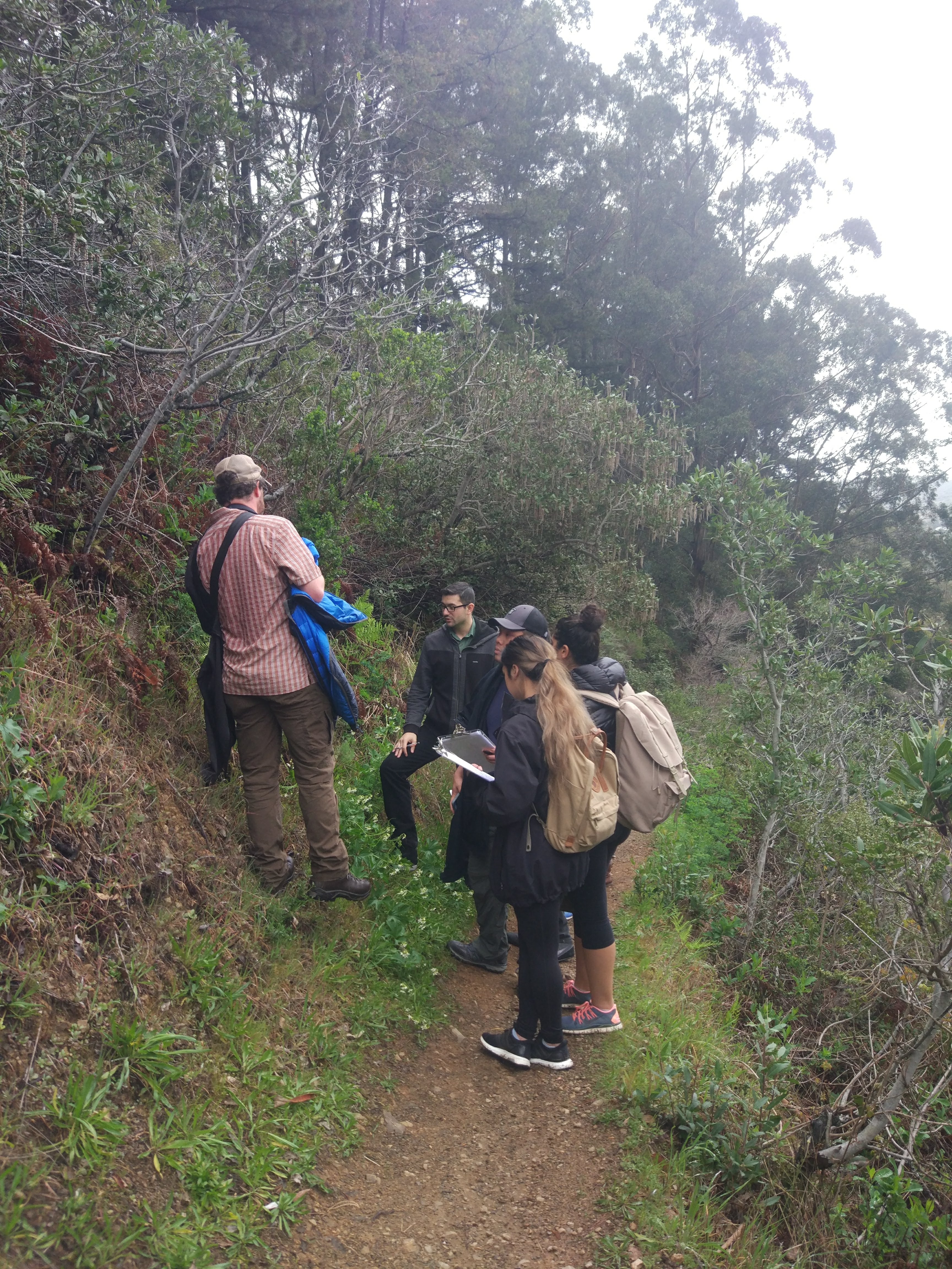
This is the first half of a carefully calculated hike which was so graciously planned to take place along the vector of gravity. This has benefited those less inclined to physical activity. The hike began from a parking lot where the side trail lead us off downward along the side of the mountain. The real genius of the hike was in the fact that other drivers were brought to pick us up at the end so that we did not have to work our way back up. We arrive around 1:25 pm and left around 4:25 pm. The weather was sunny with strong breeze and overall pleasant.

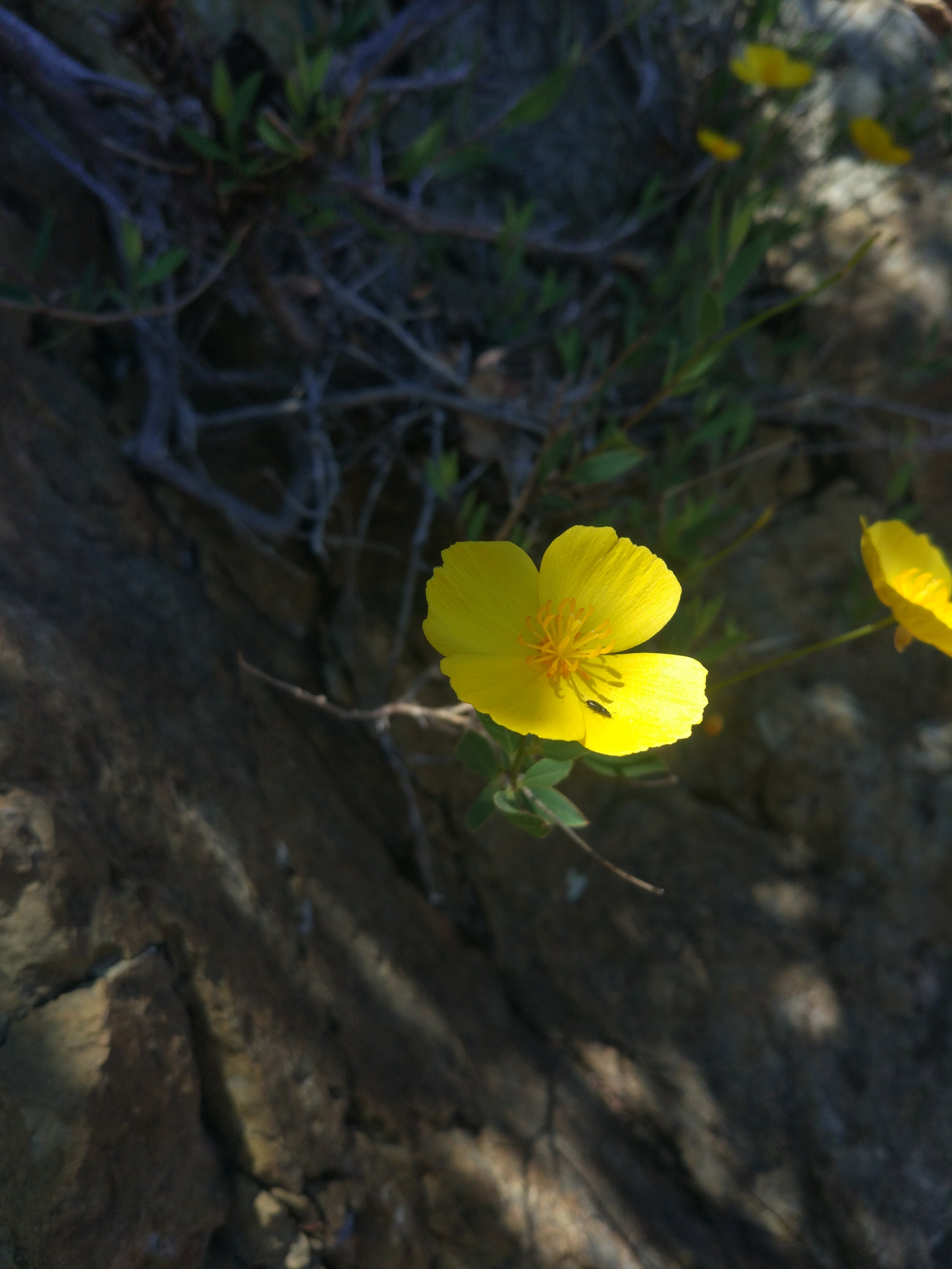
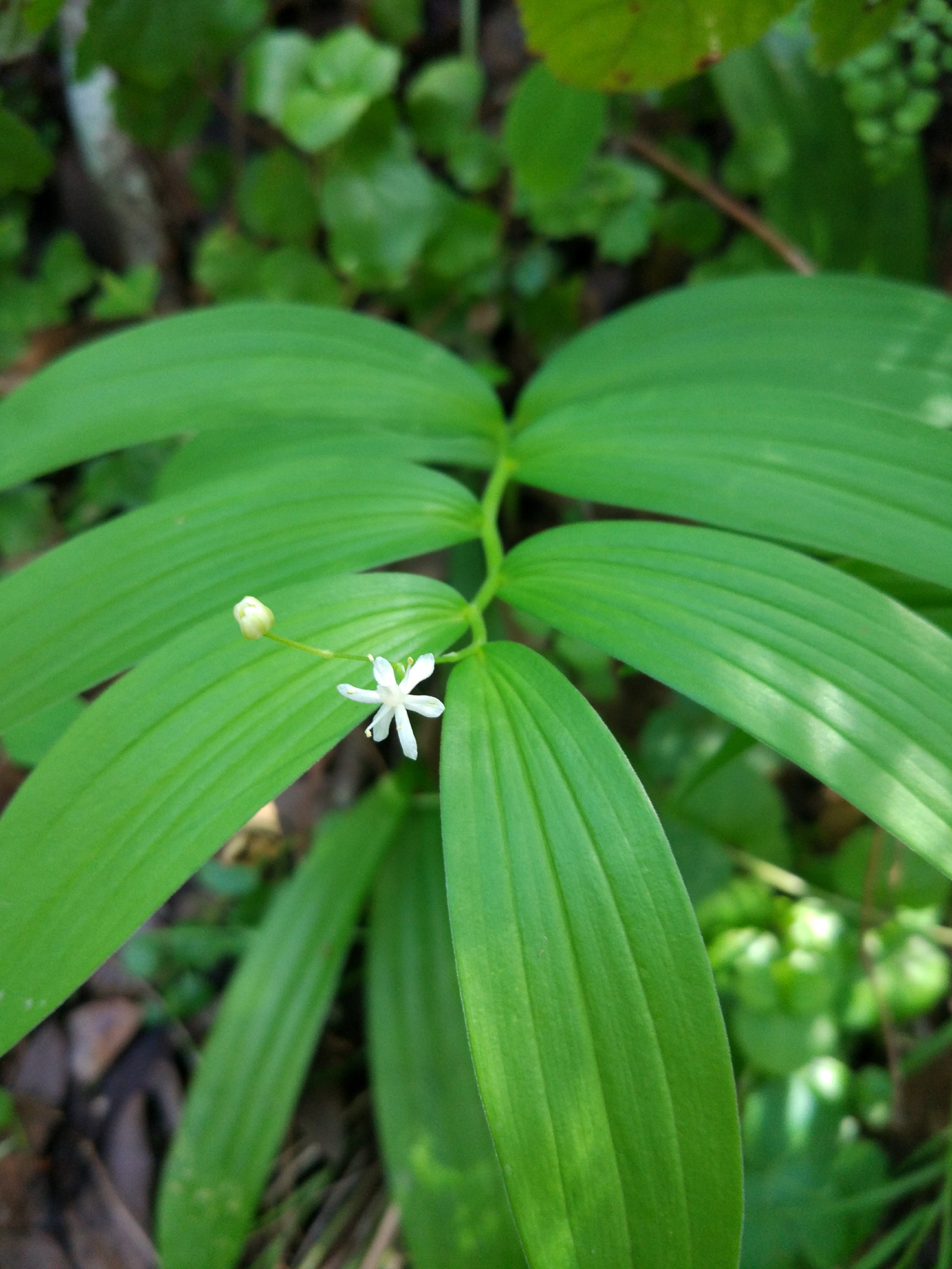
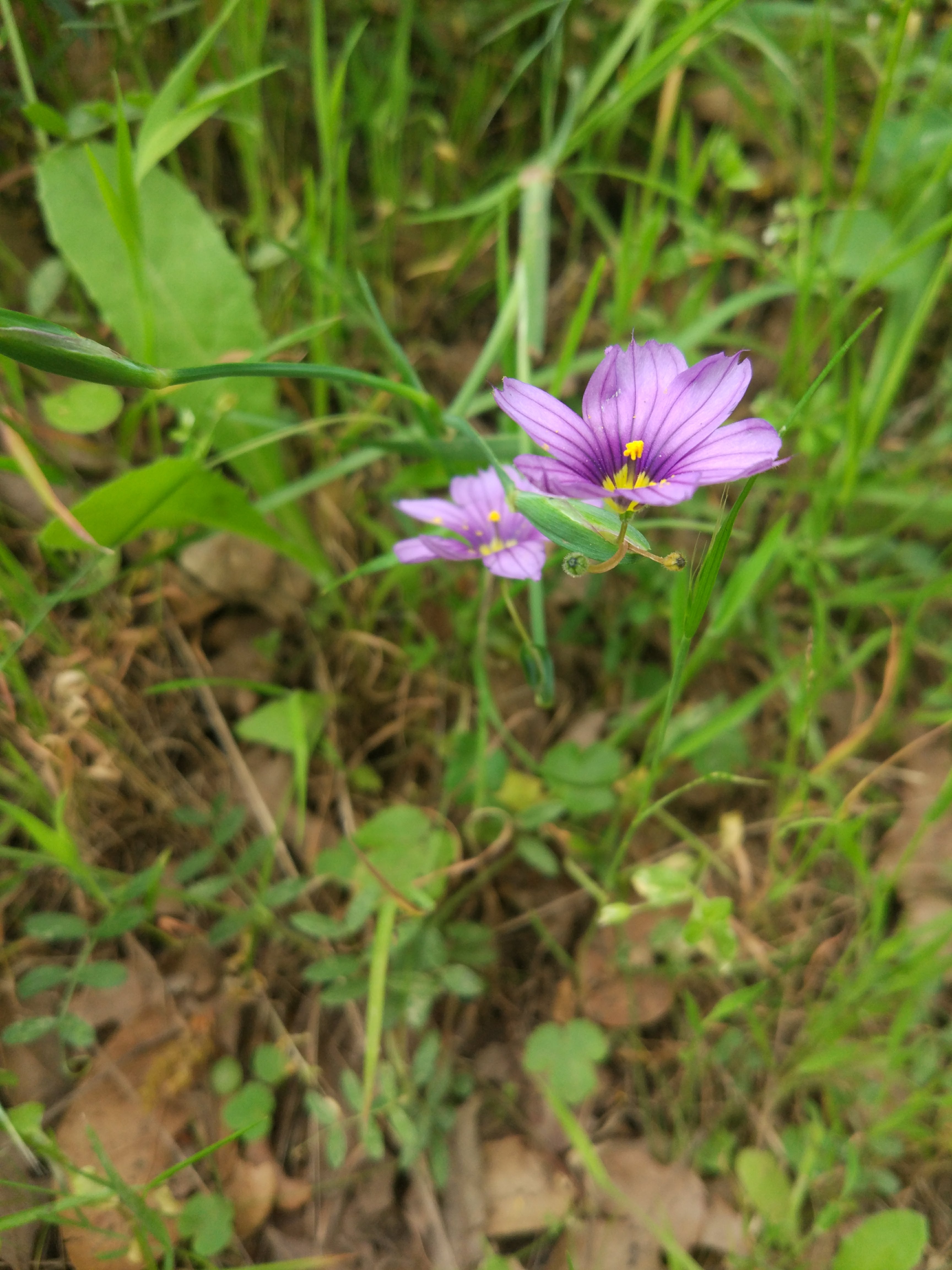
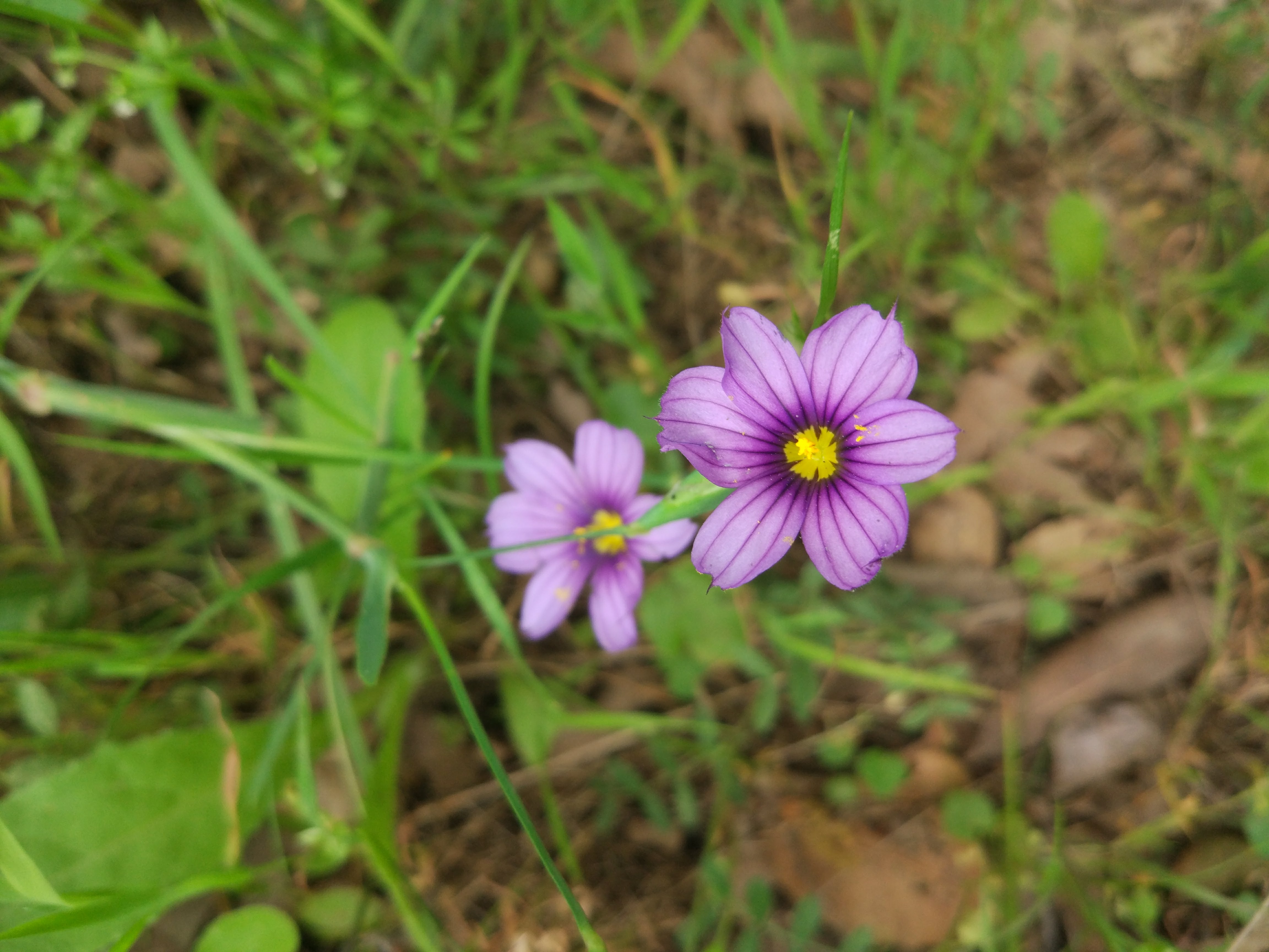
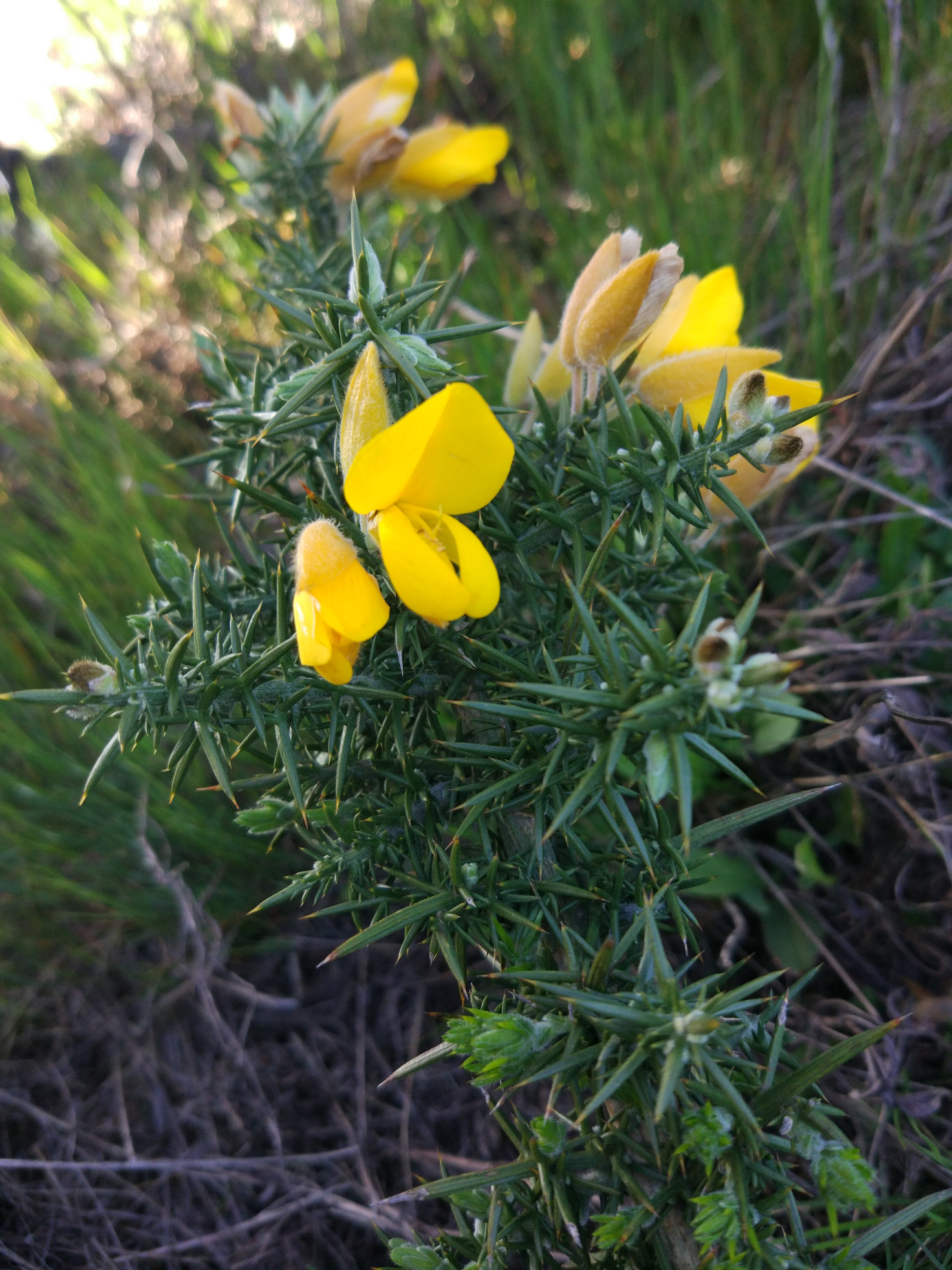
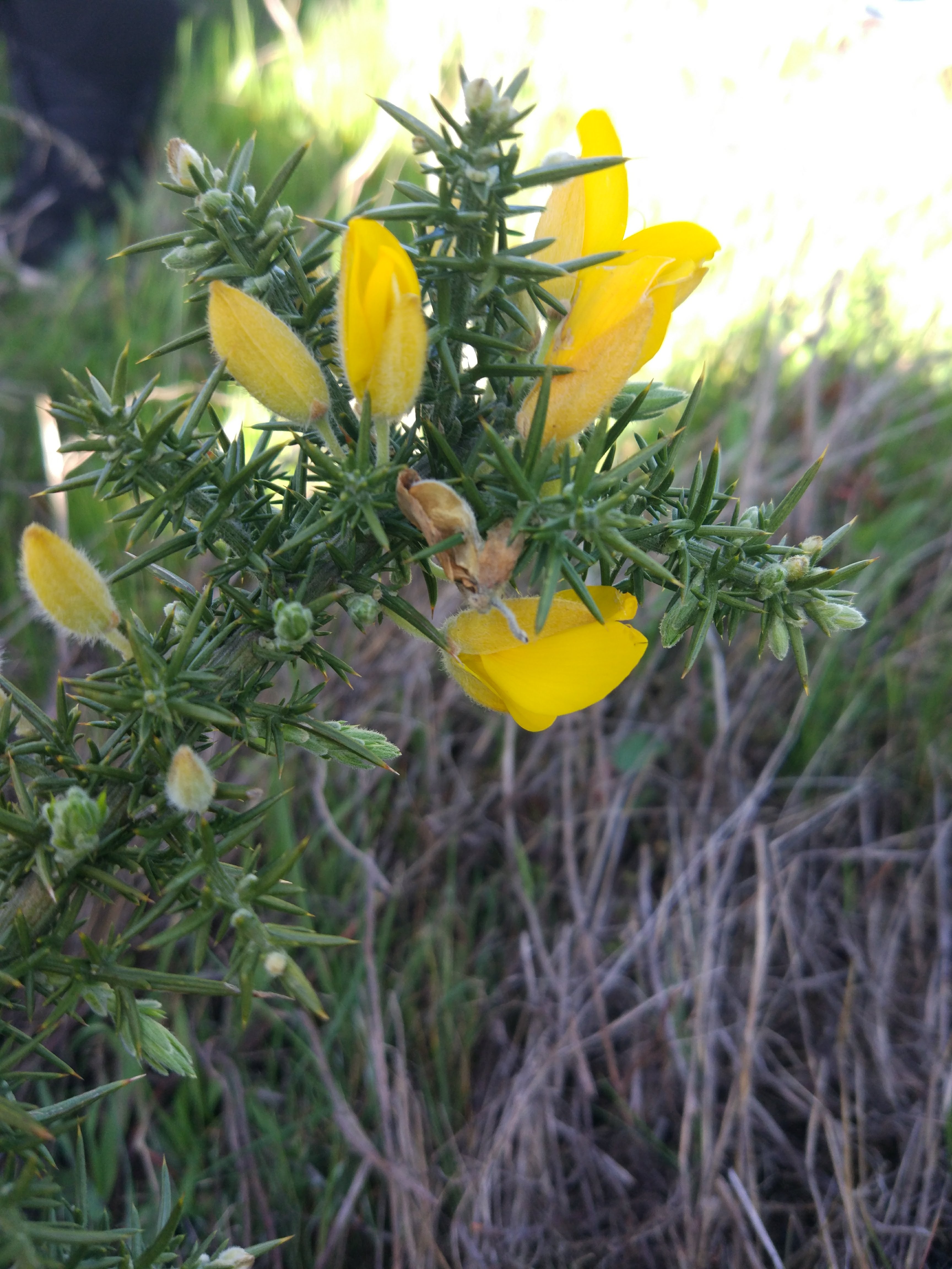
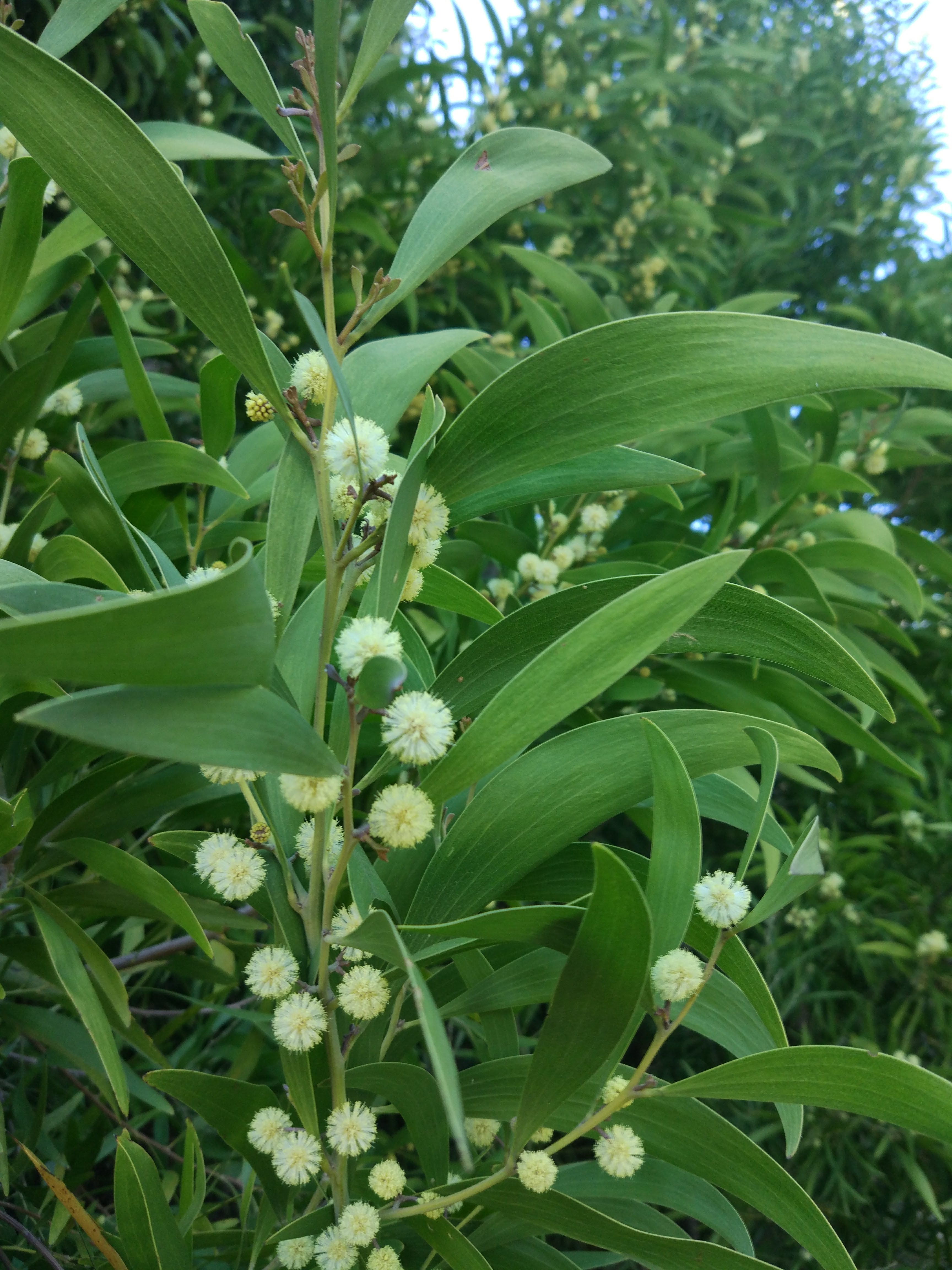
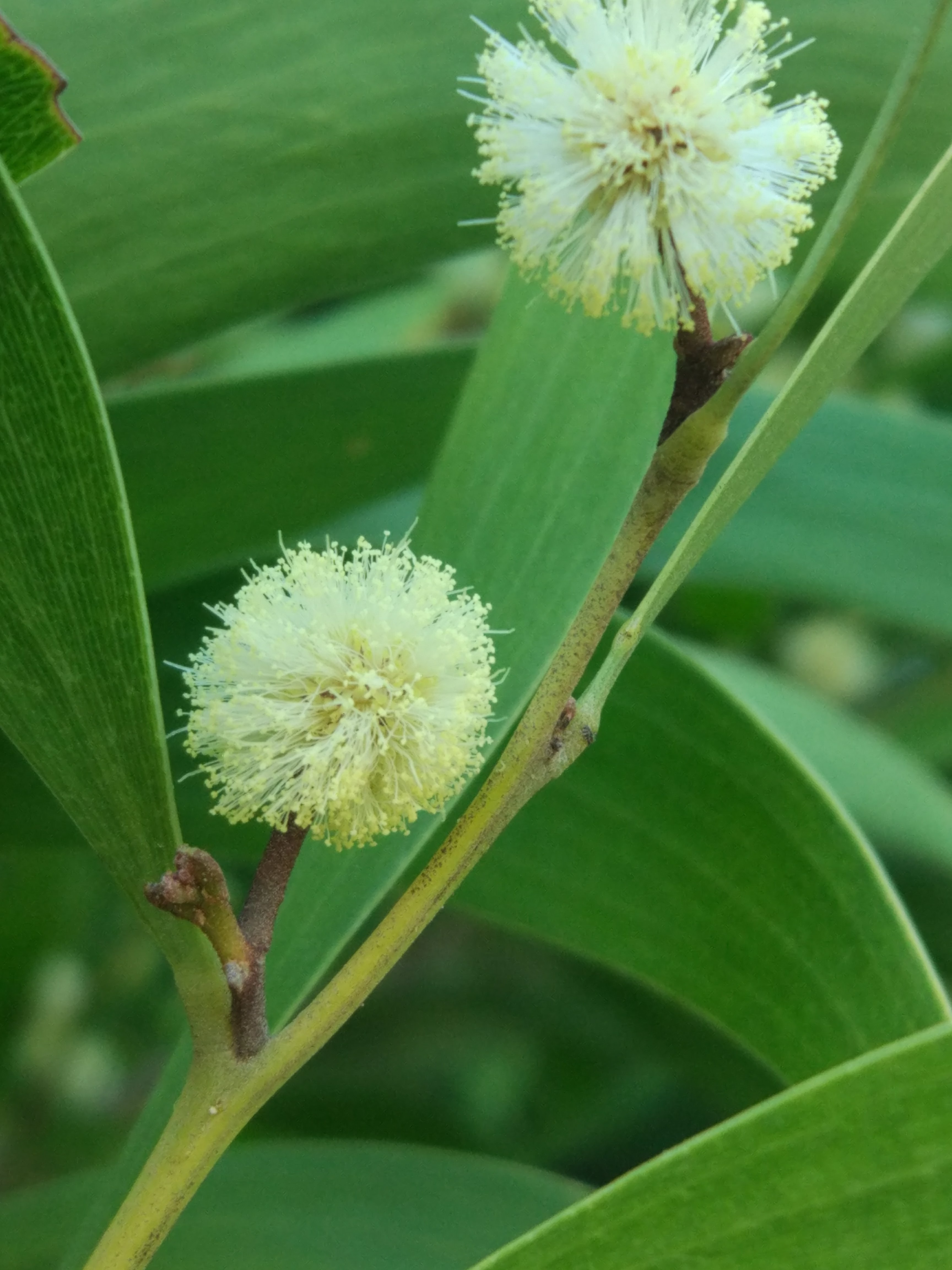
Dendromecon rigida | Bush Poppy

Habit: Herbaceous, proximal to ground, small bush
Leaf: Small and obovate, pinnate venation, opposite
Repro: Petals open, four petals, many stamen, slightly curved to flat top
Location: Near path, exxtremely disturbed sites, good sunlight exposure

 
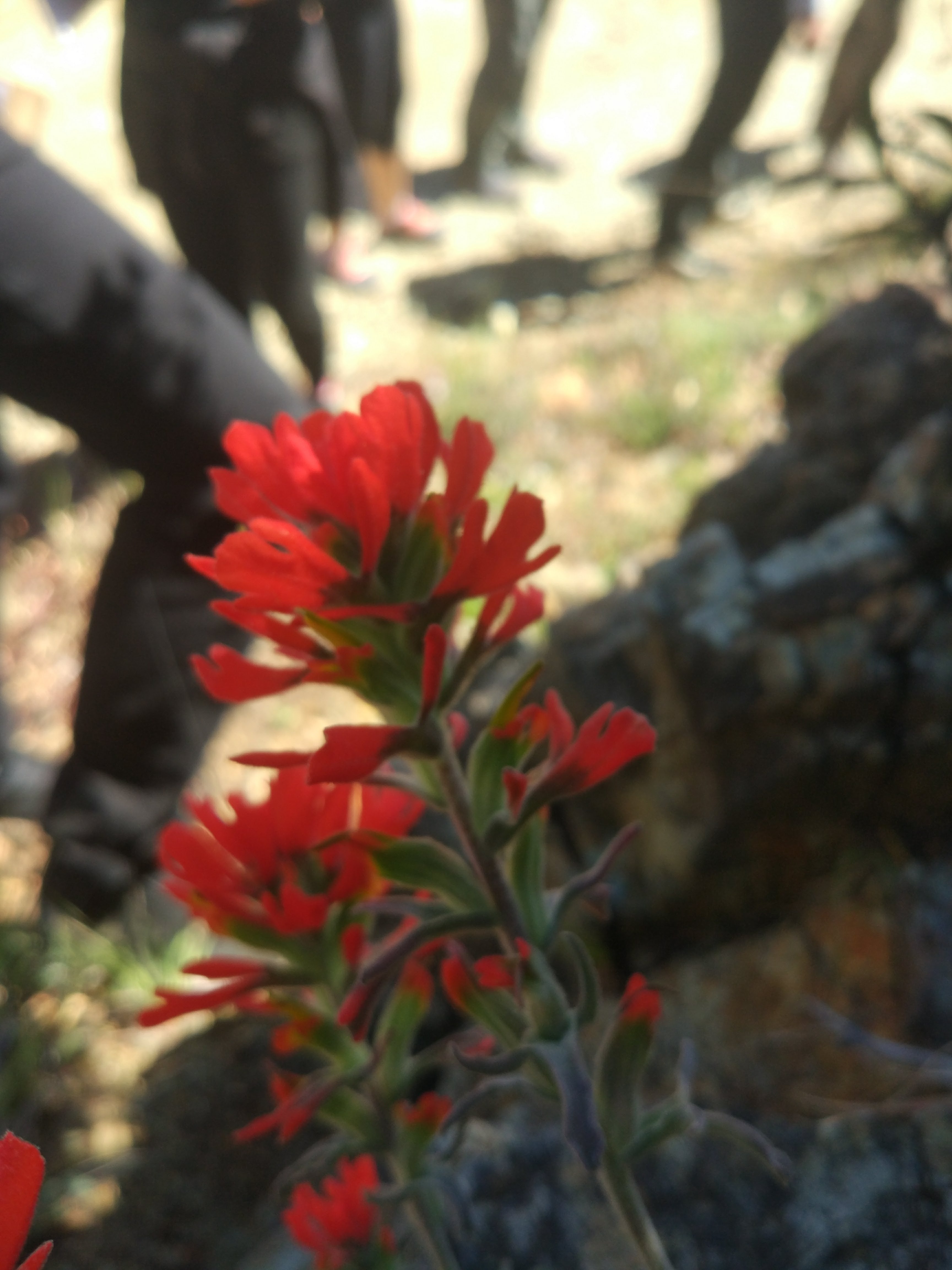
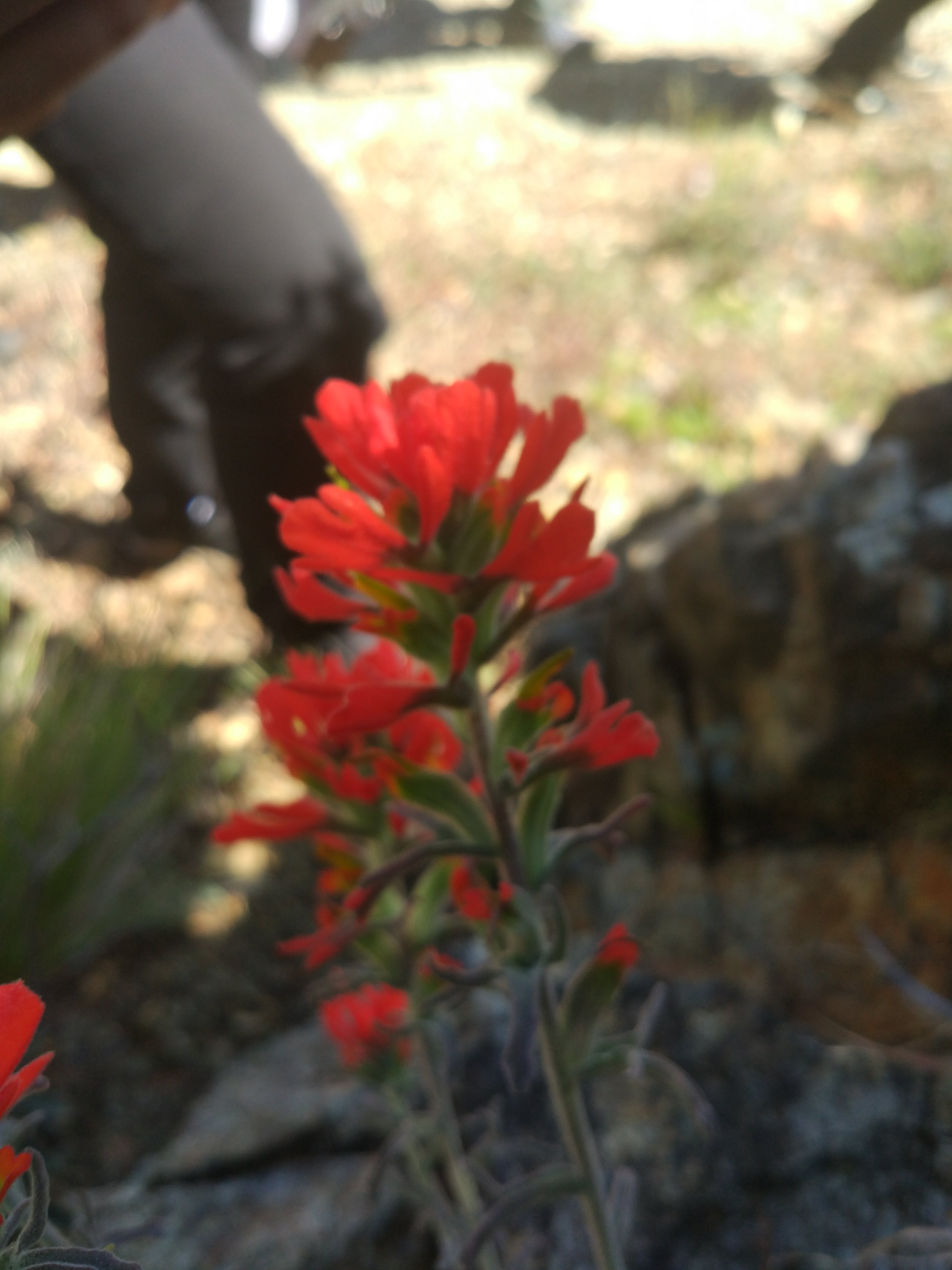
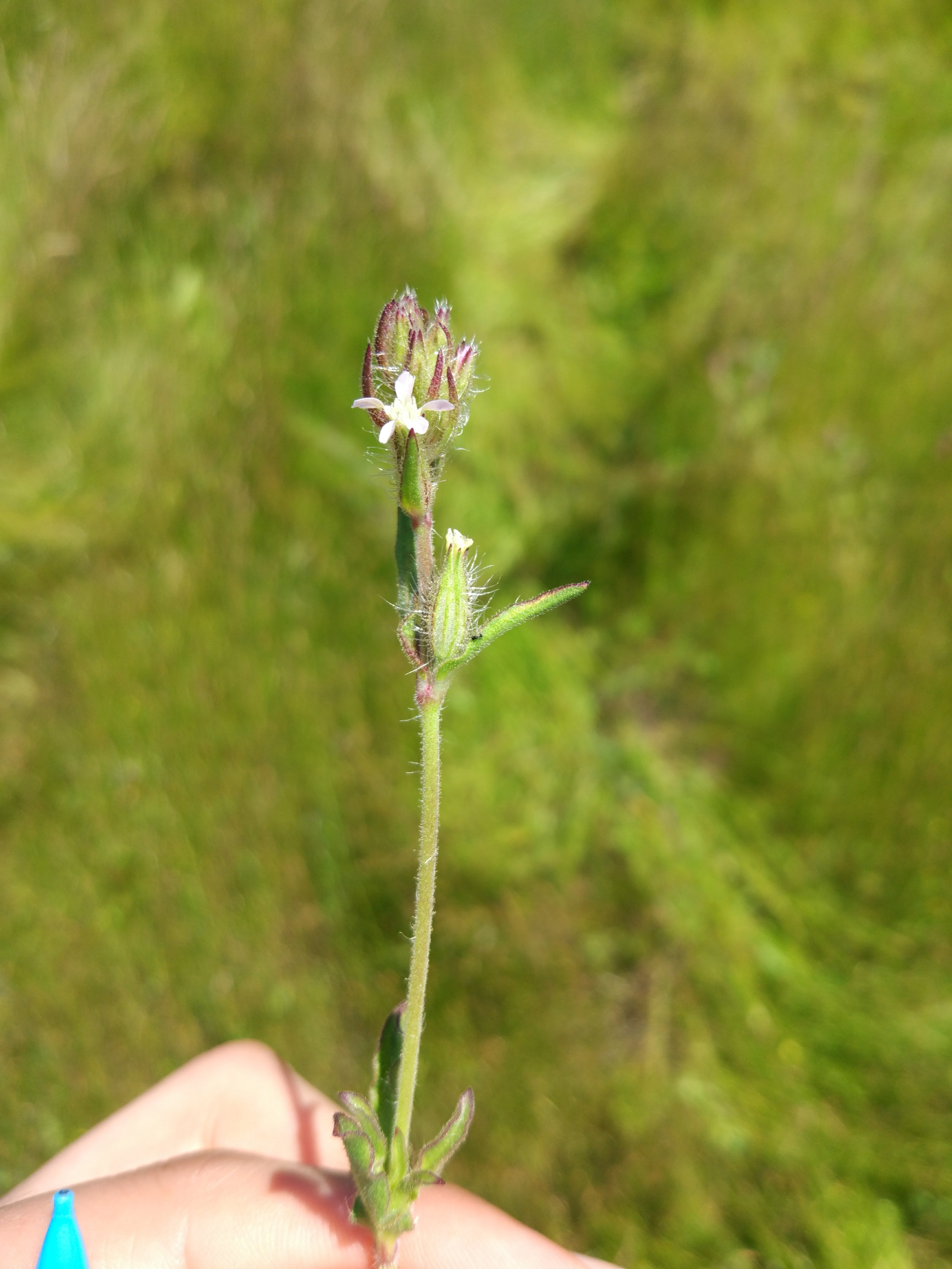
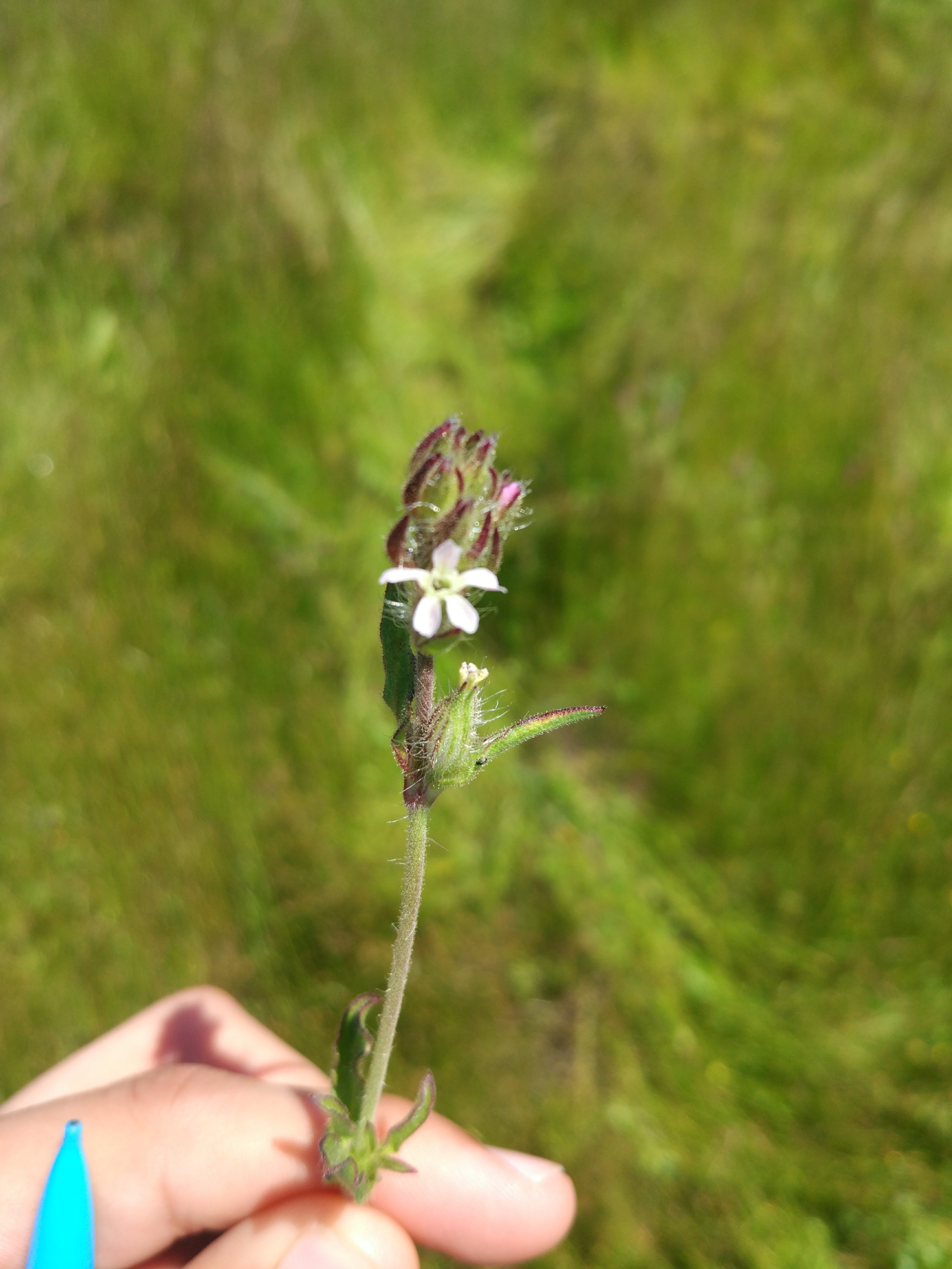
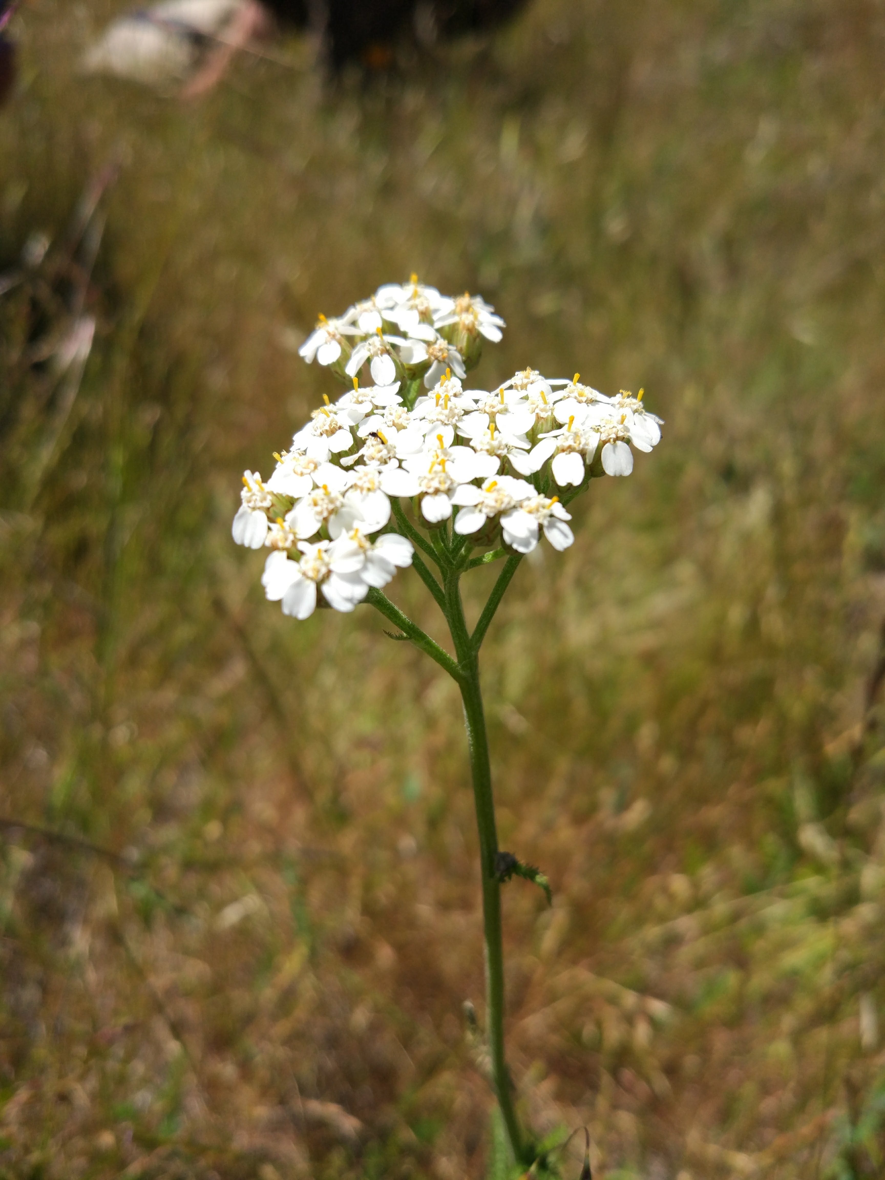
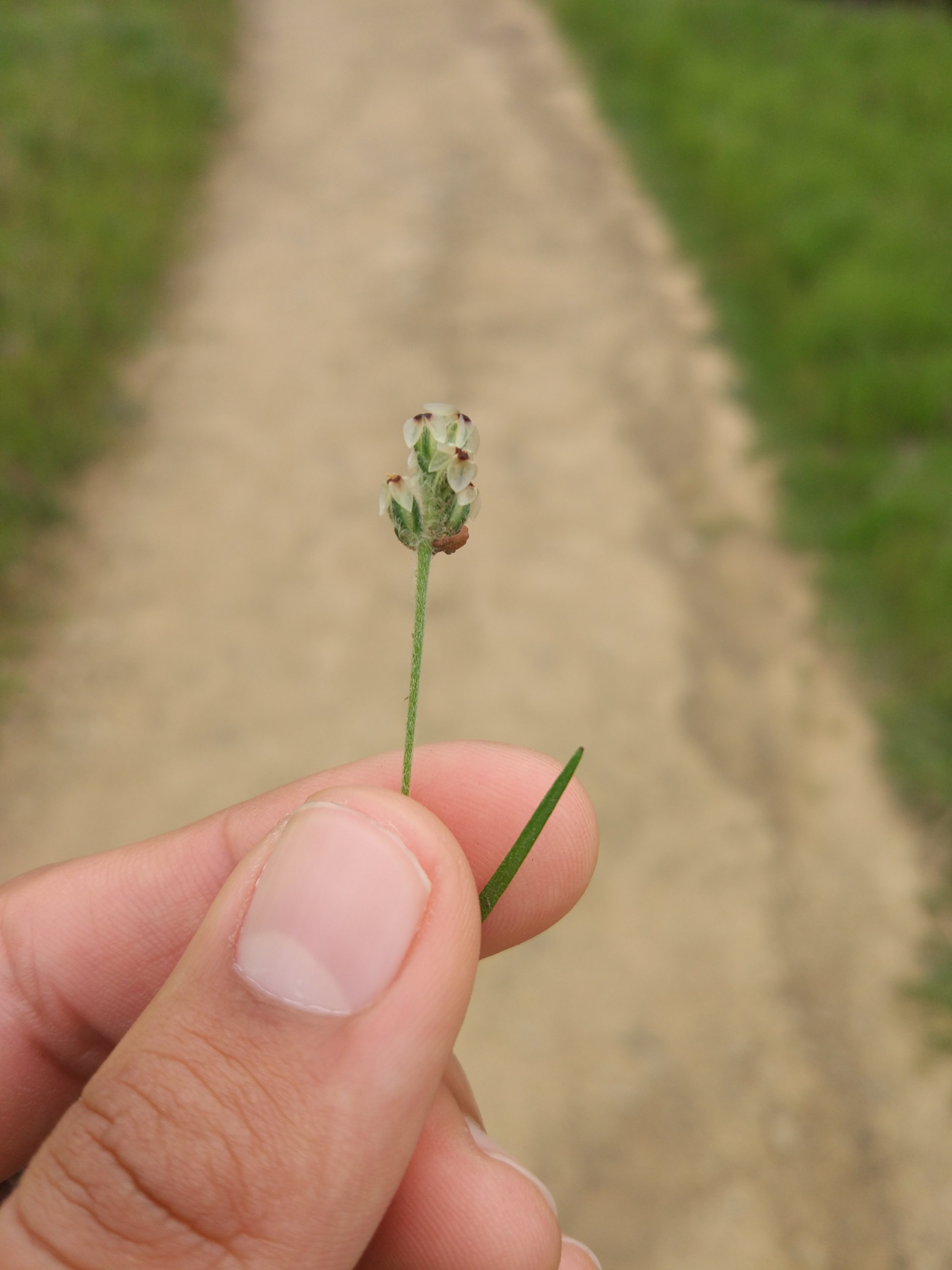
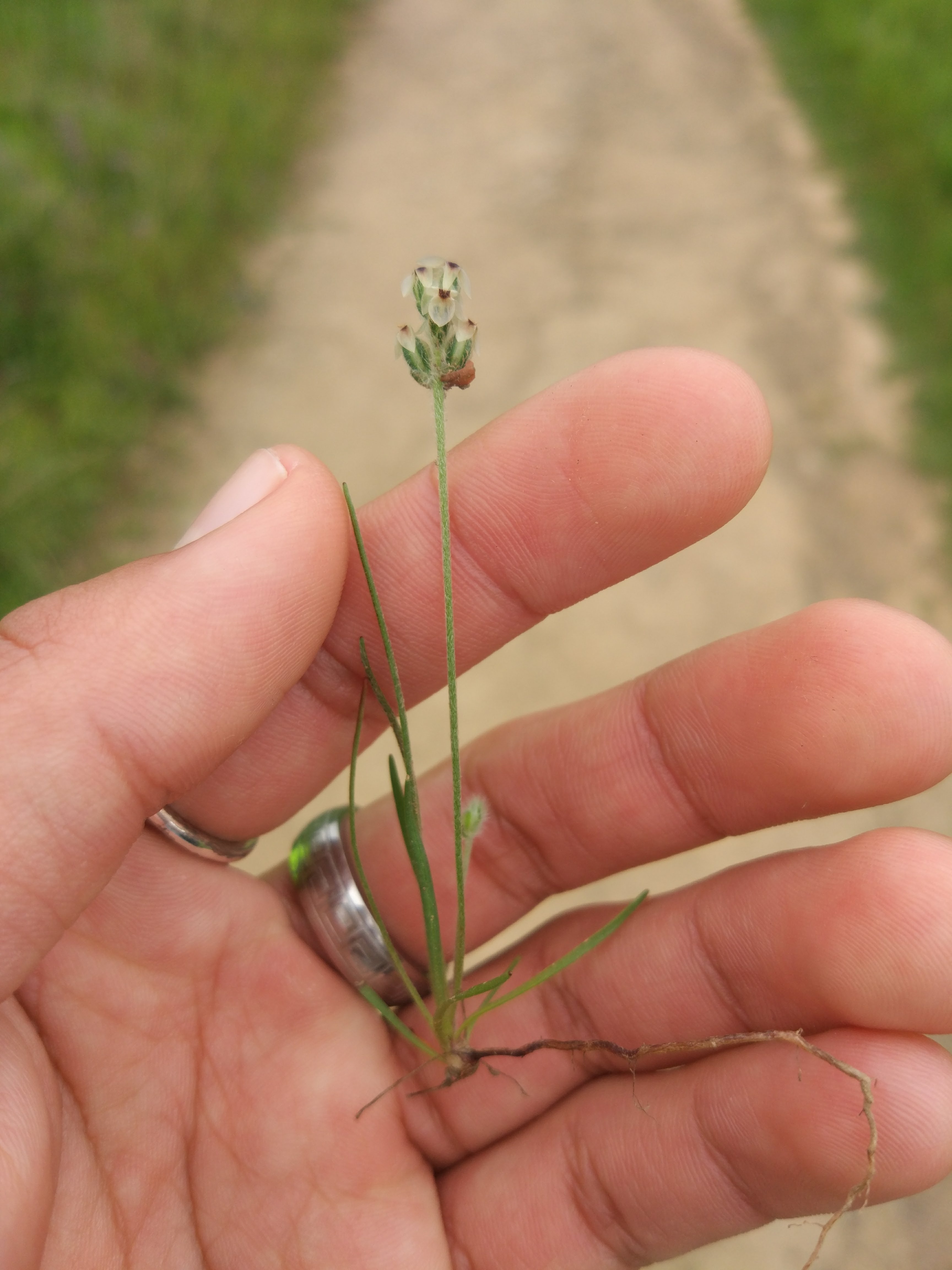
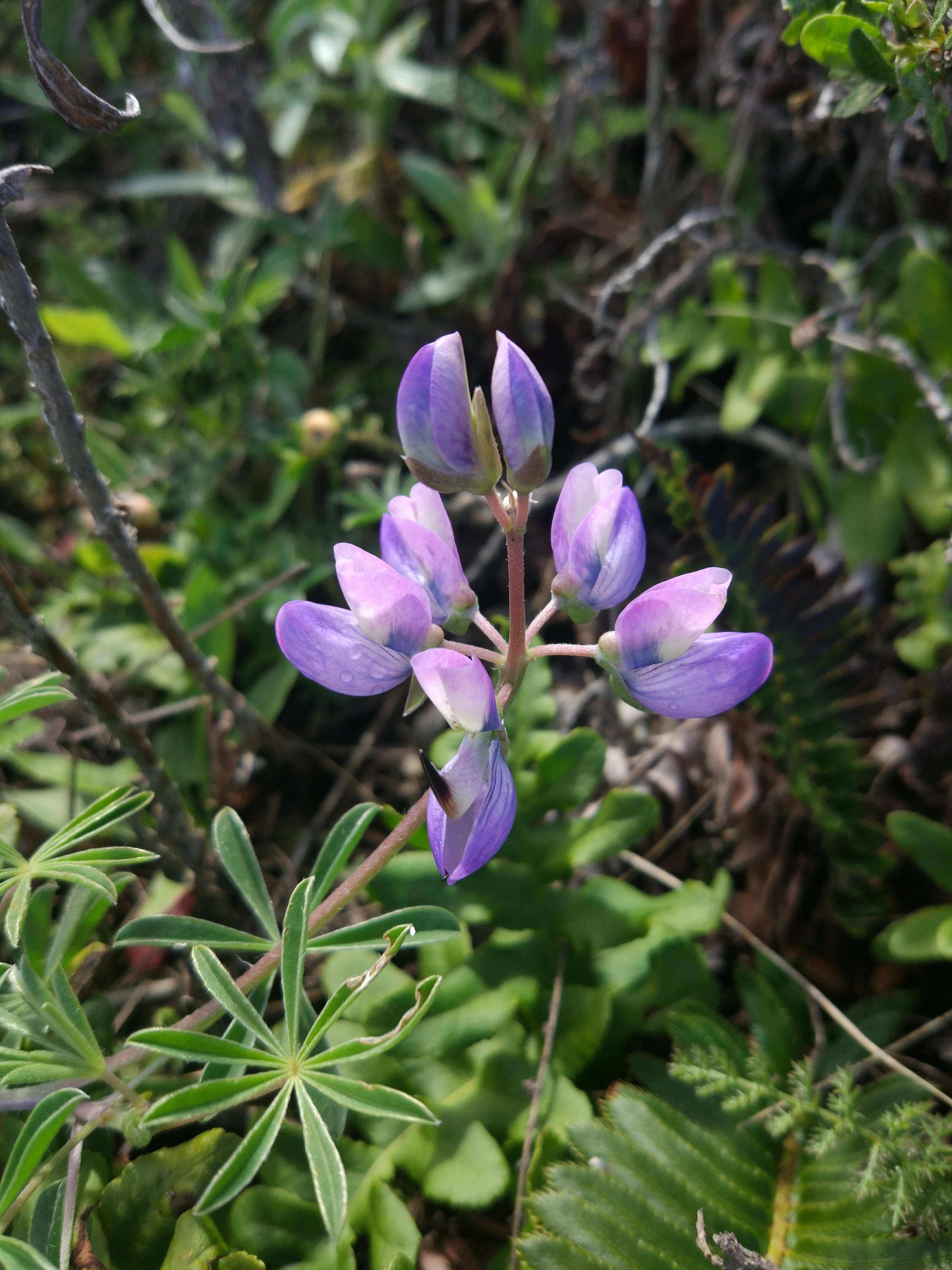
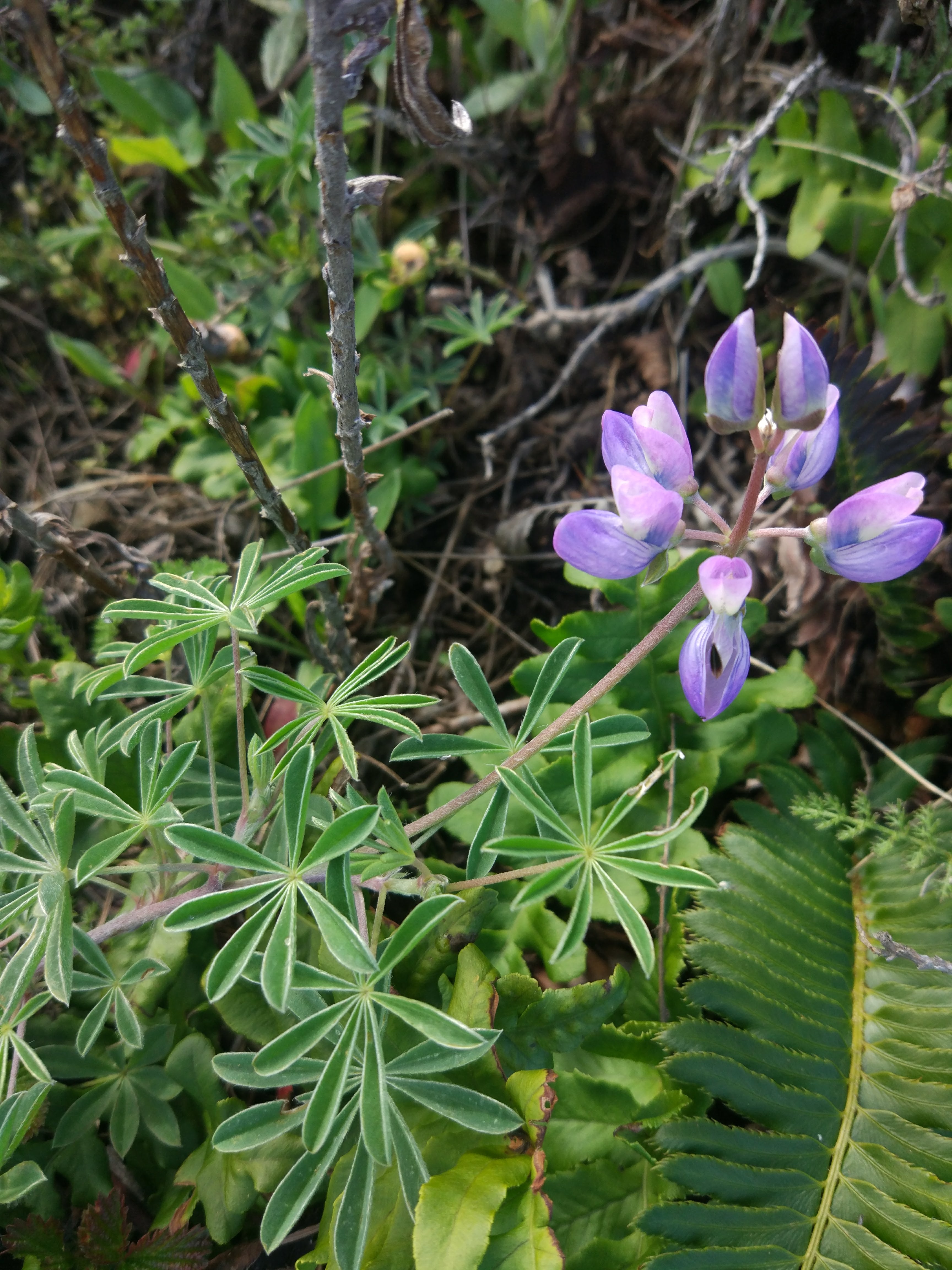
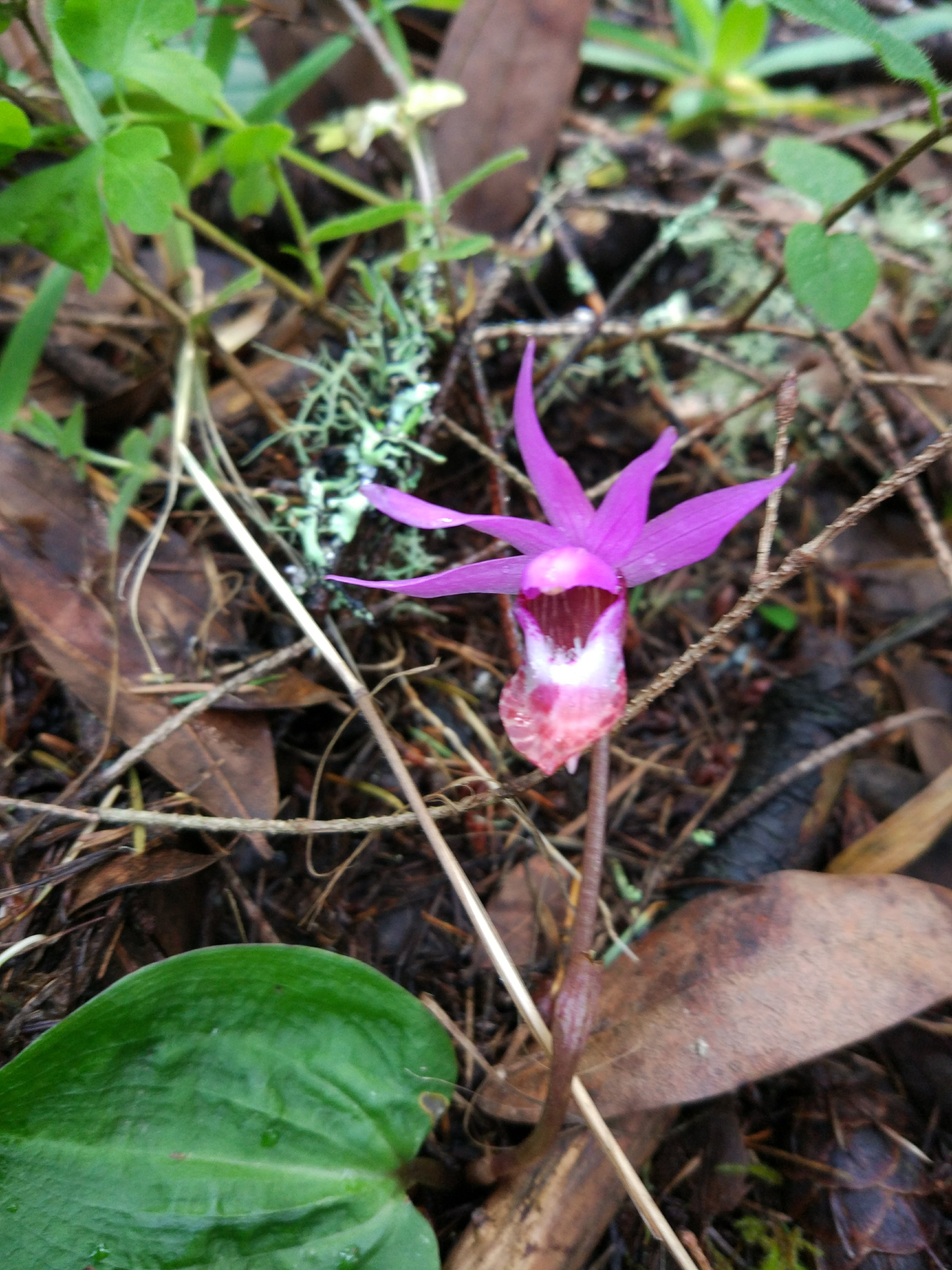
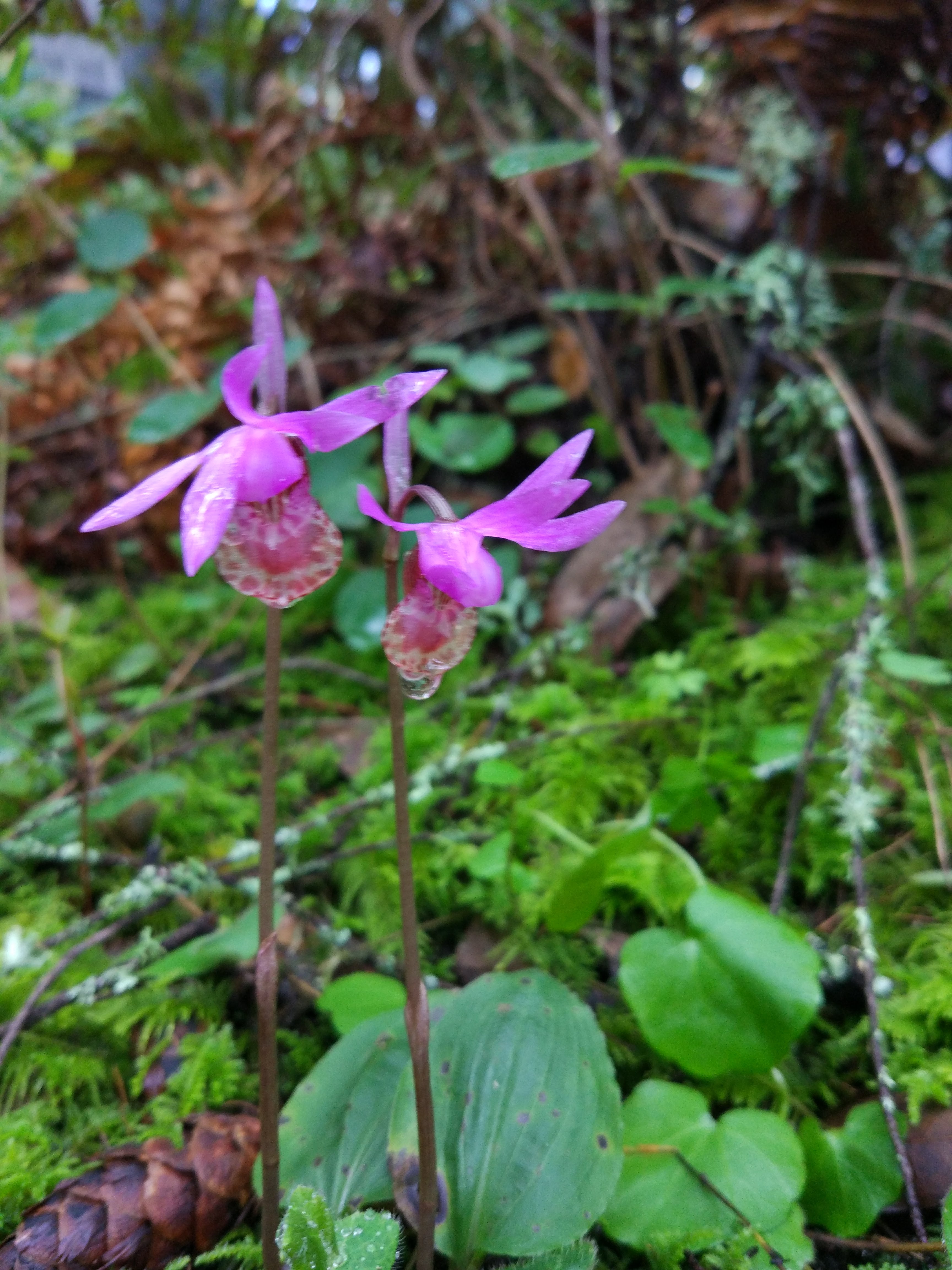
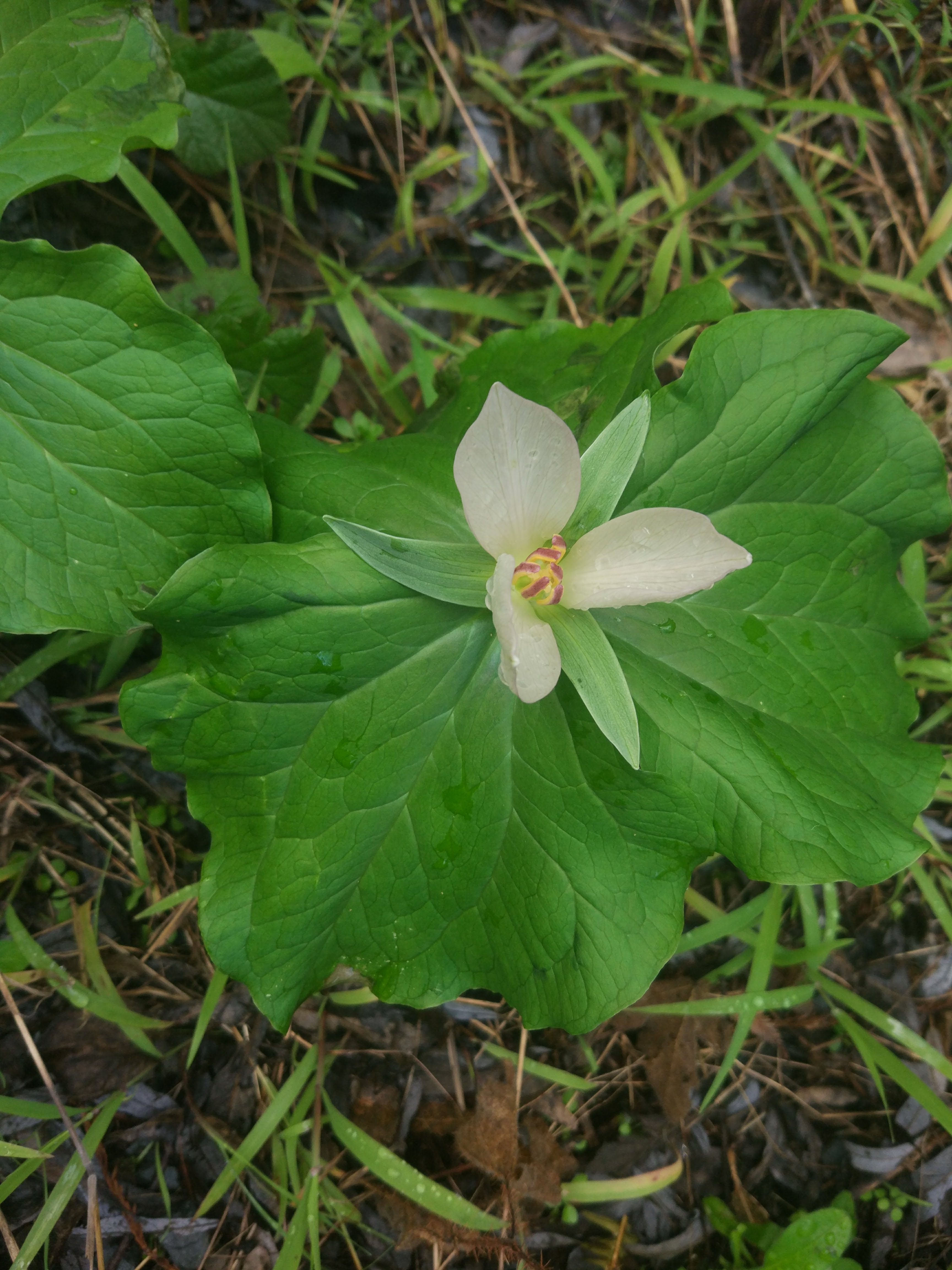
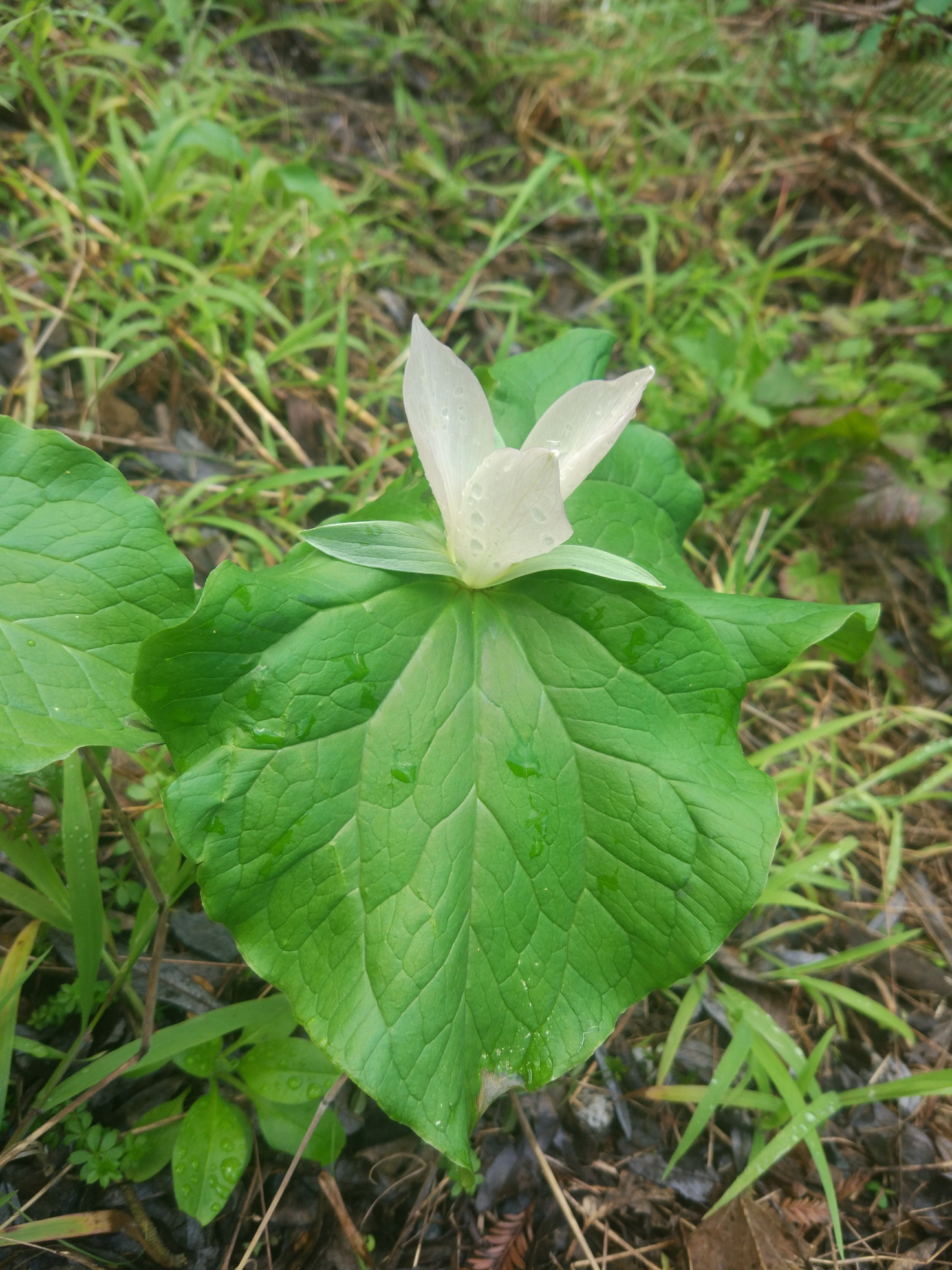
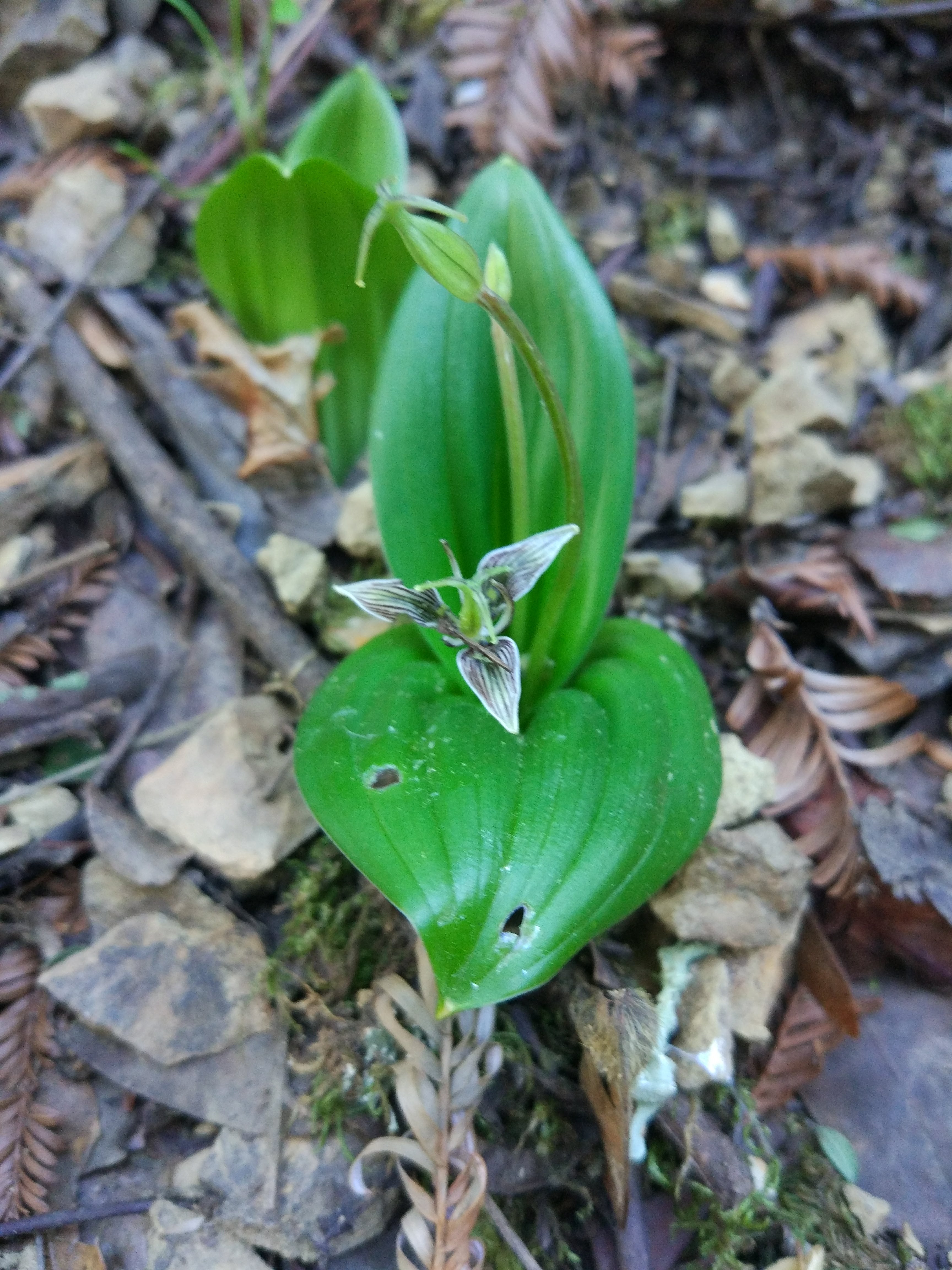
Castilleja foliosa | Wooly paintbrush

Habit: Herbaceous
Leaf: Hairy, bracts, pinnate venation
Repro: Raceme, parts of 4, brush-like inflorescence, dissected bracts
Location: Near path, disturbed or open area


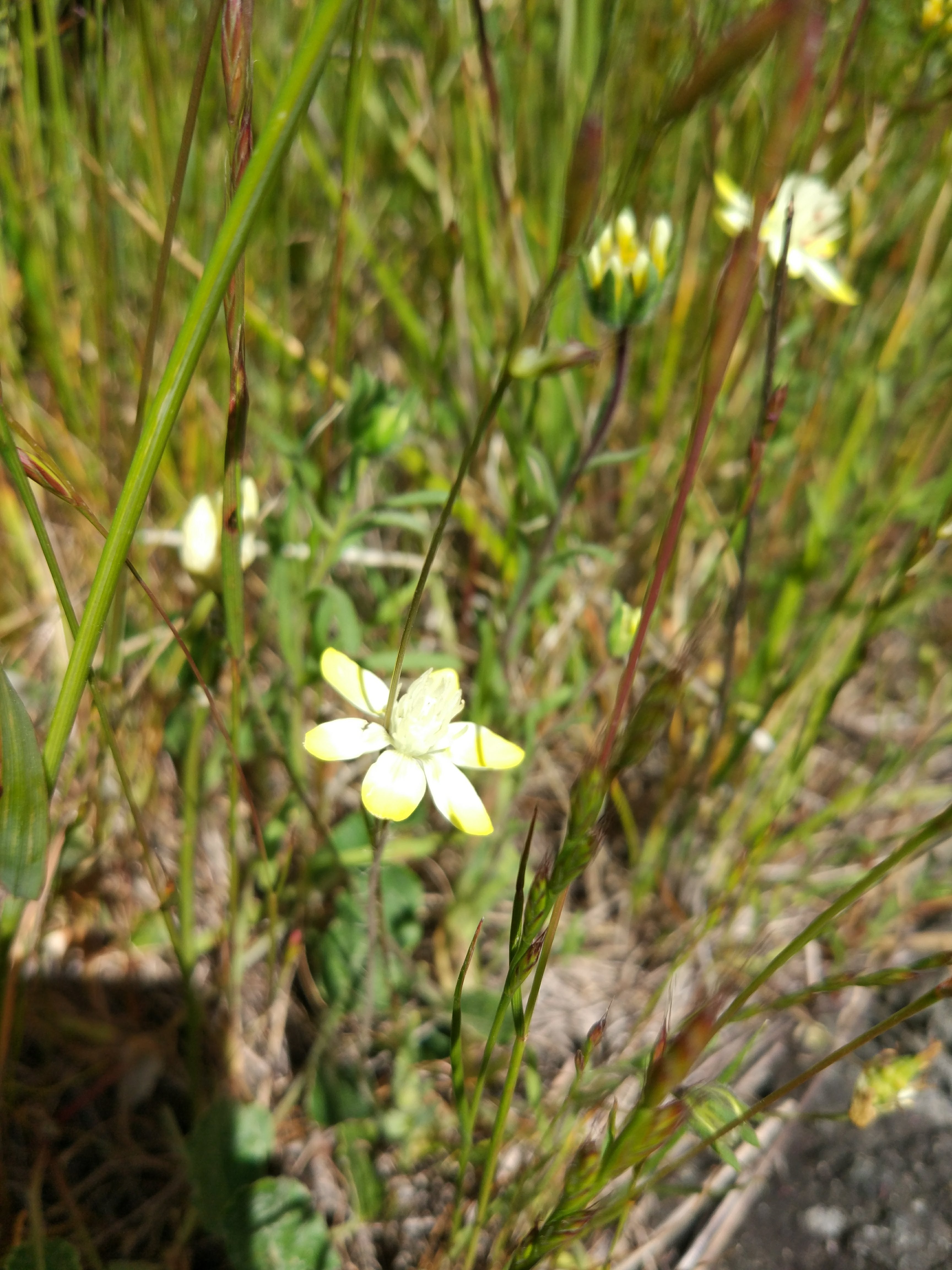
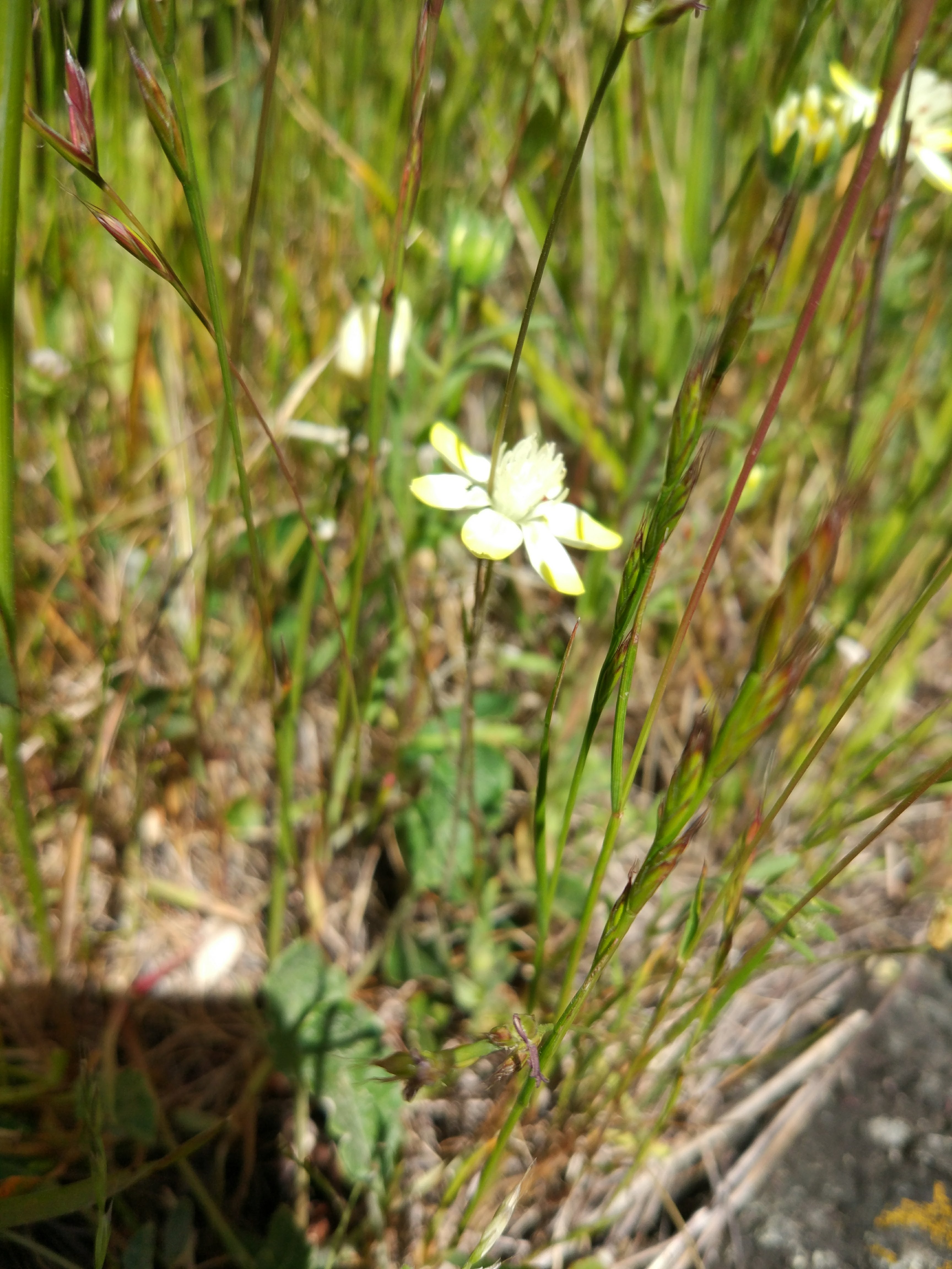
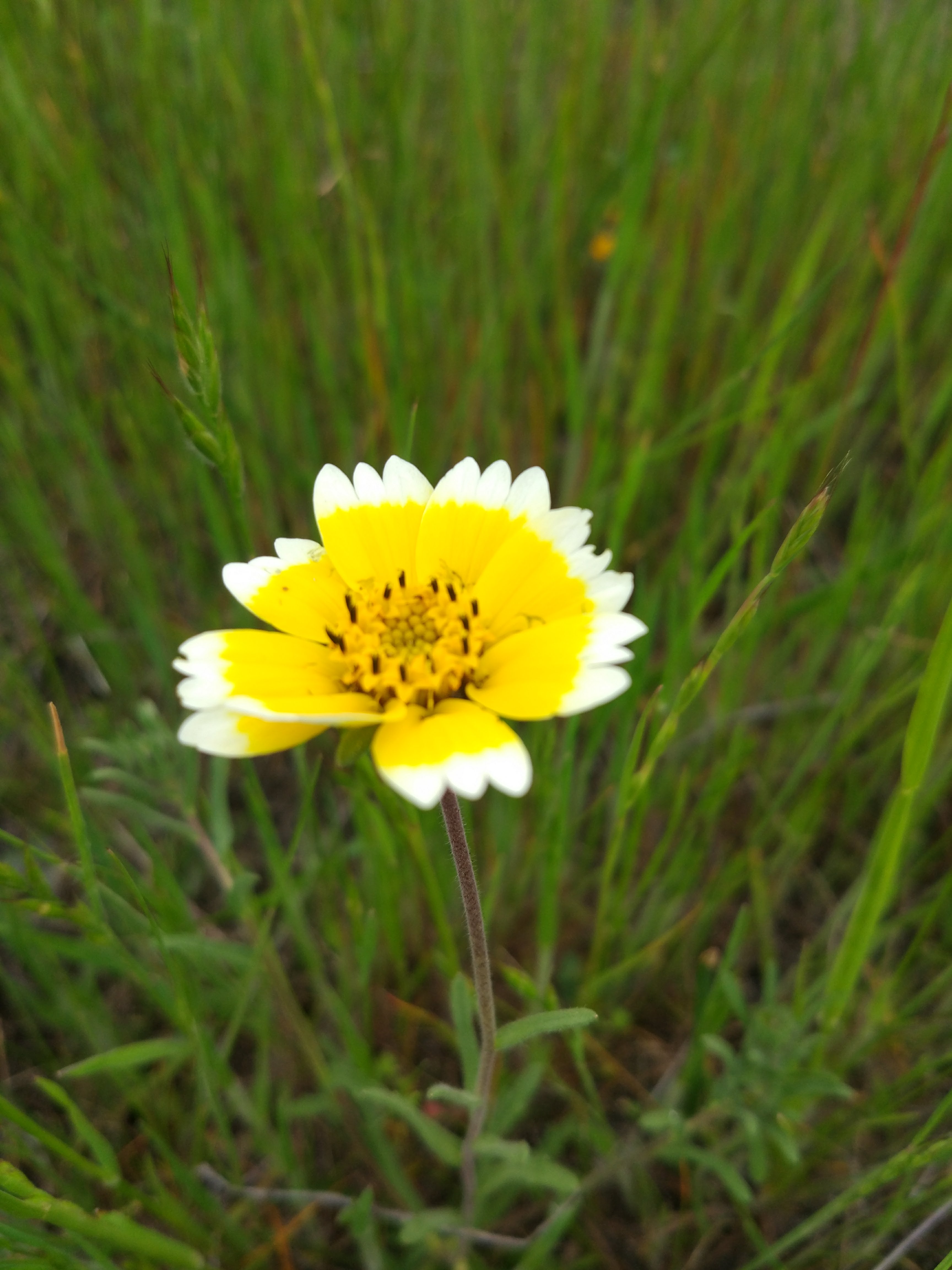
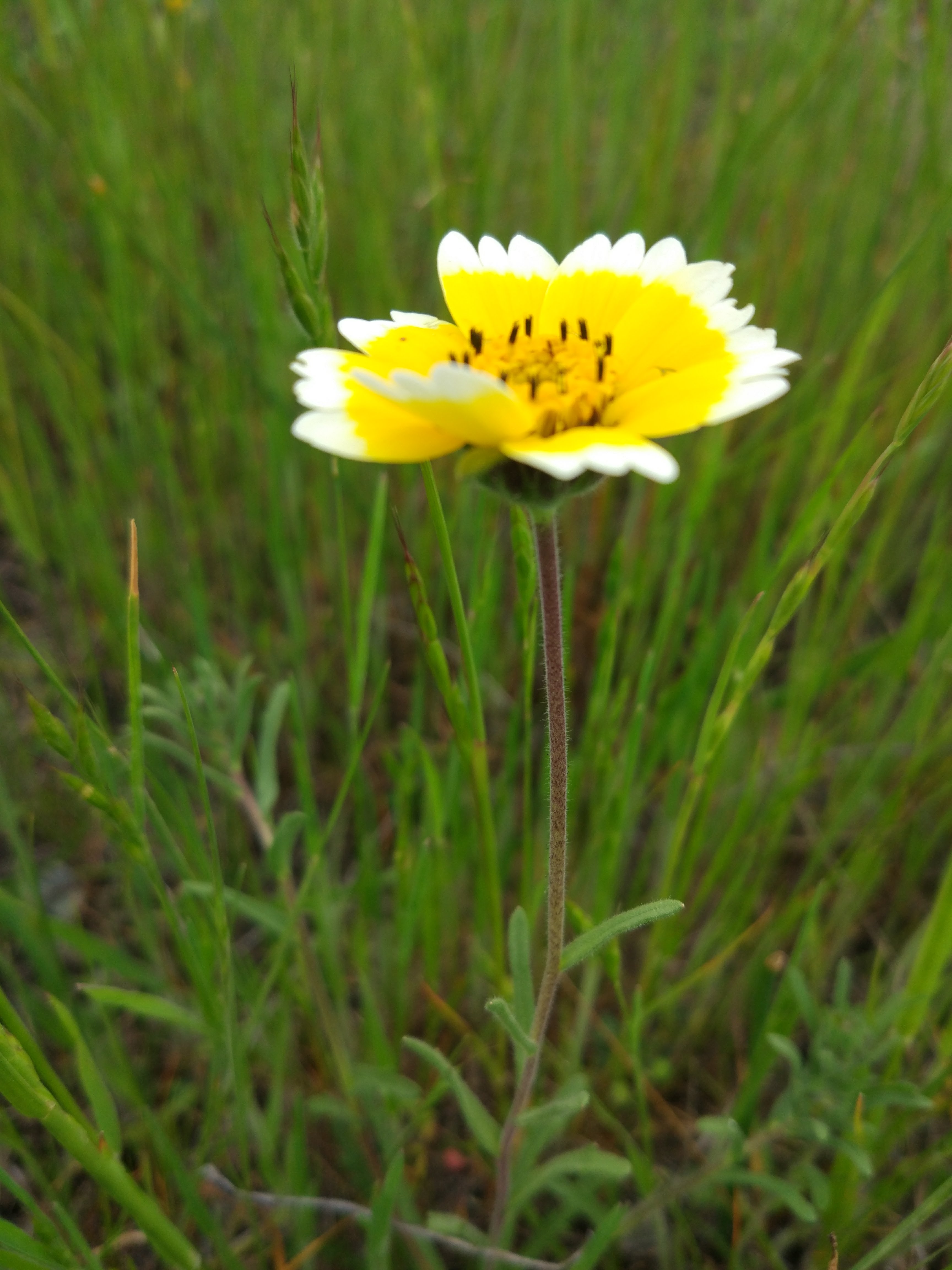
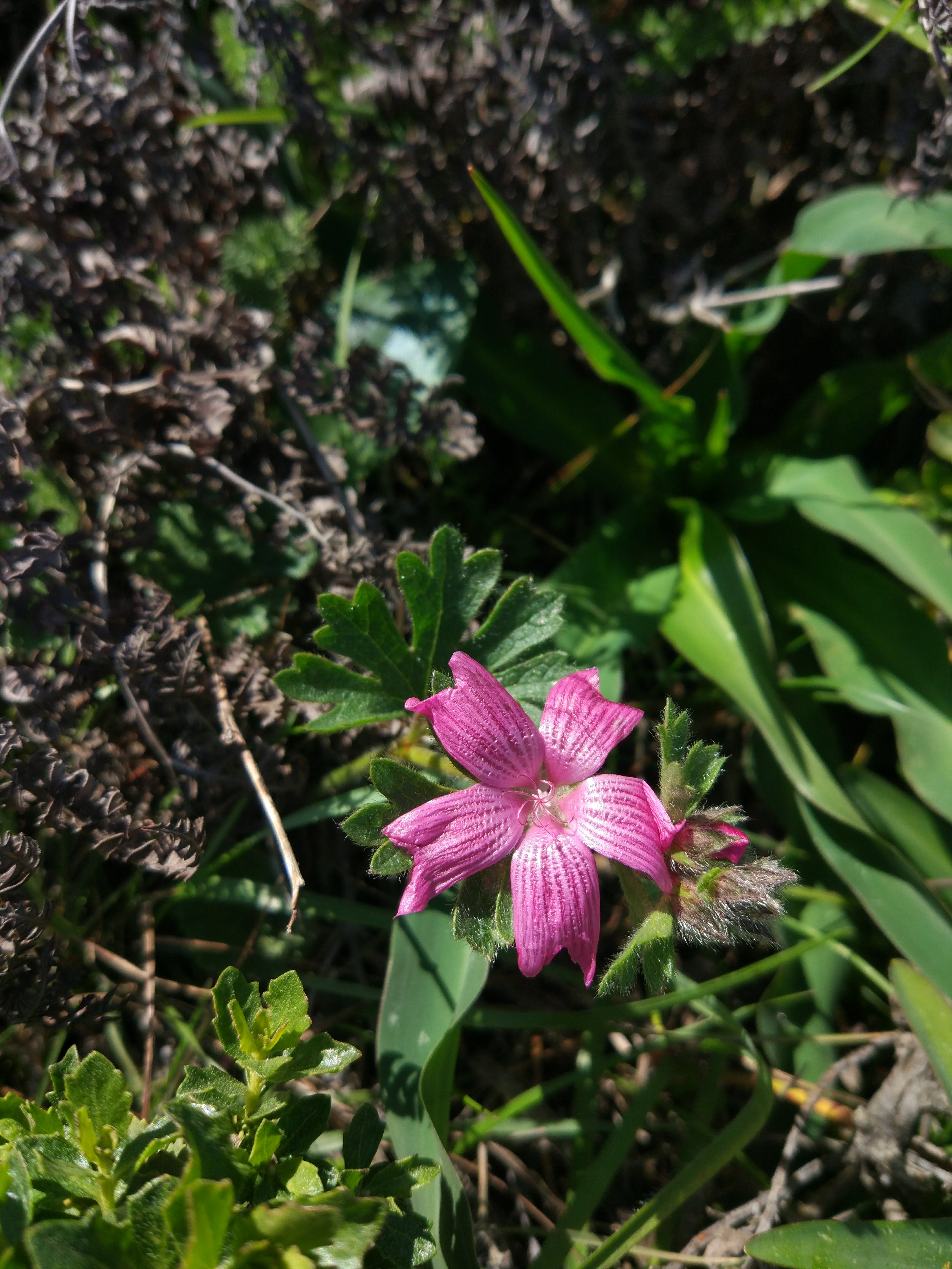
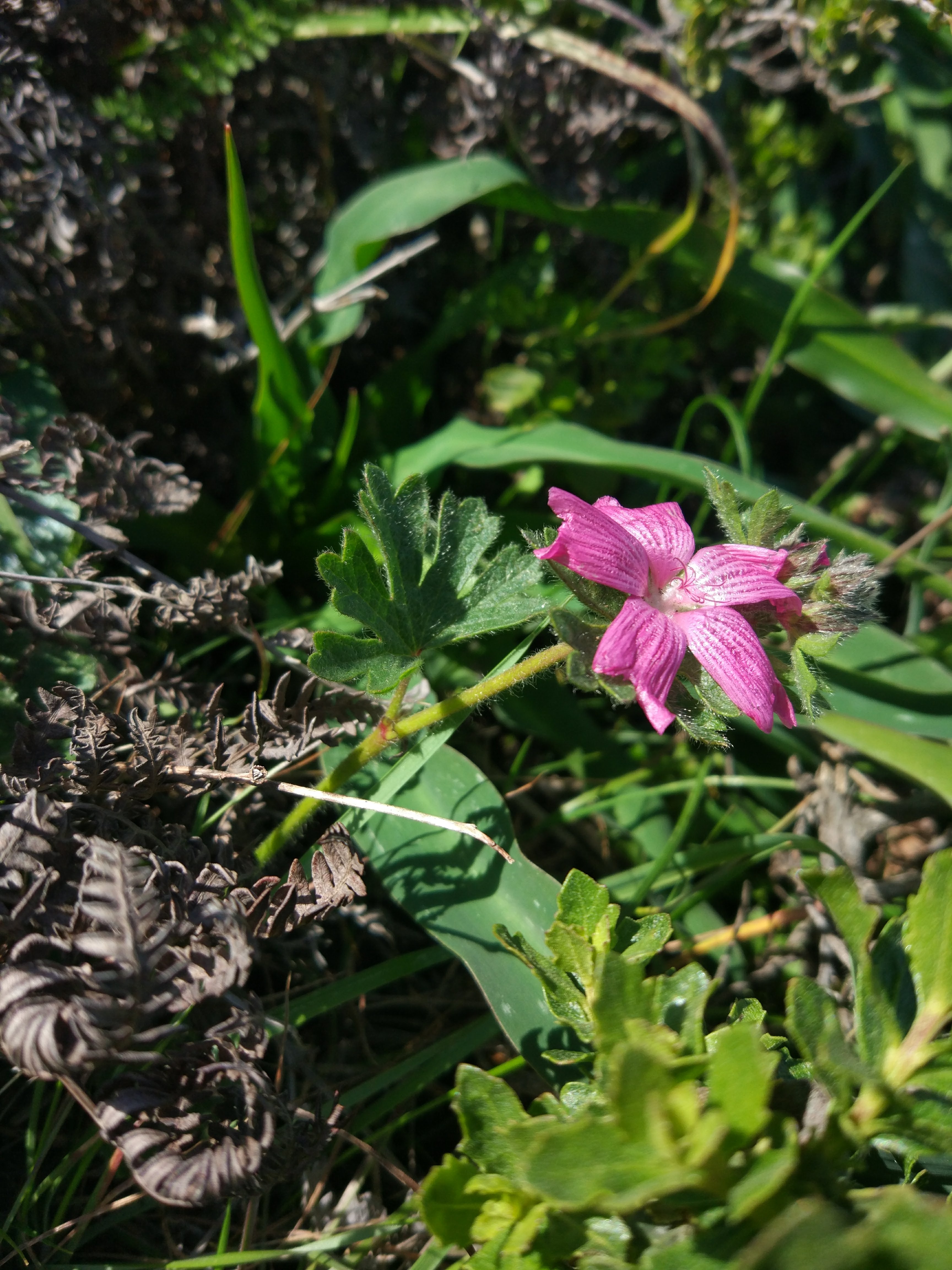
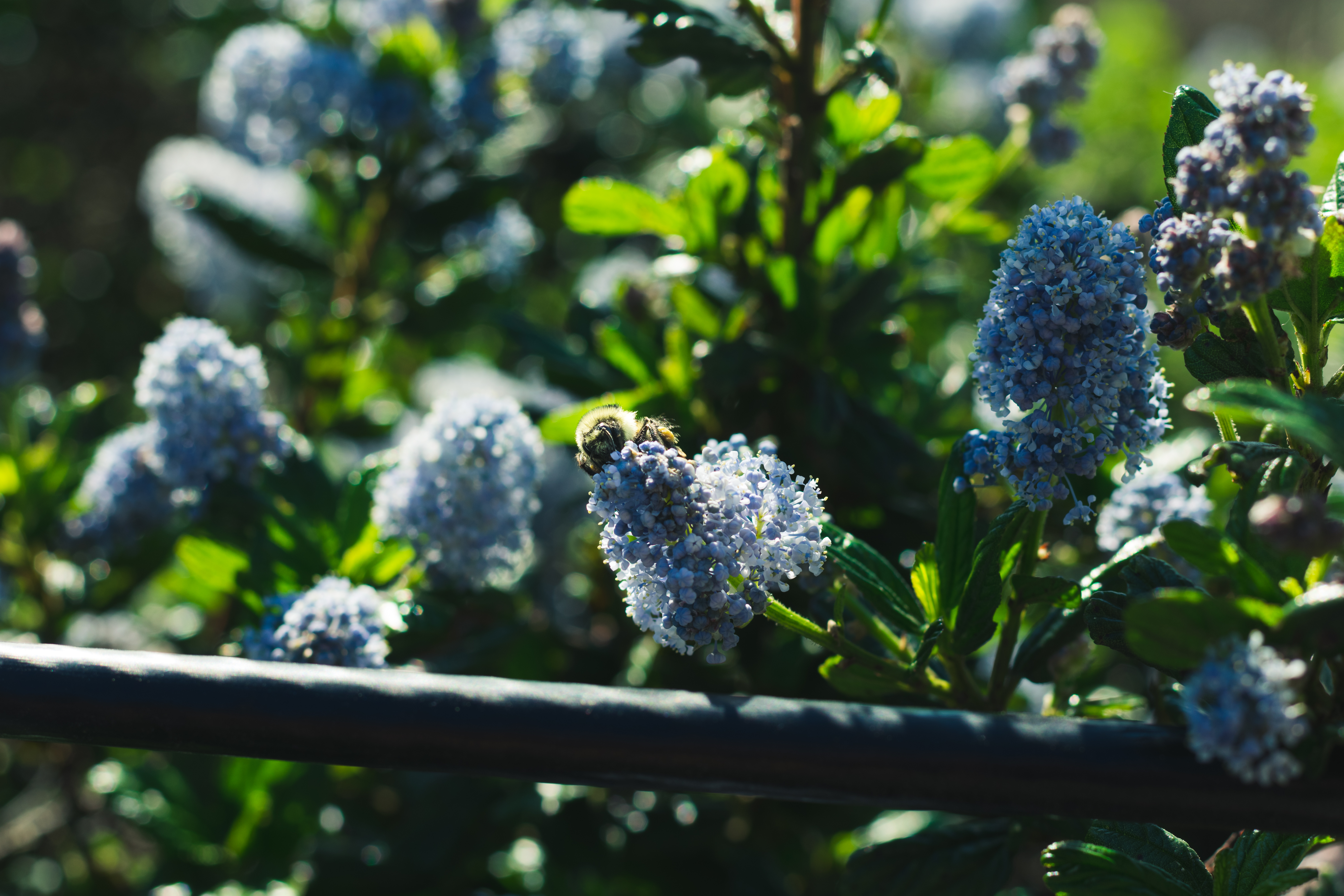
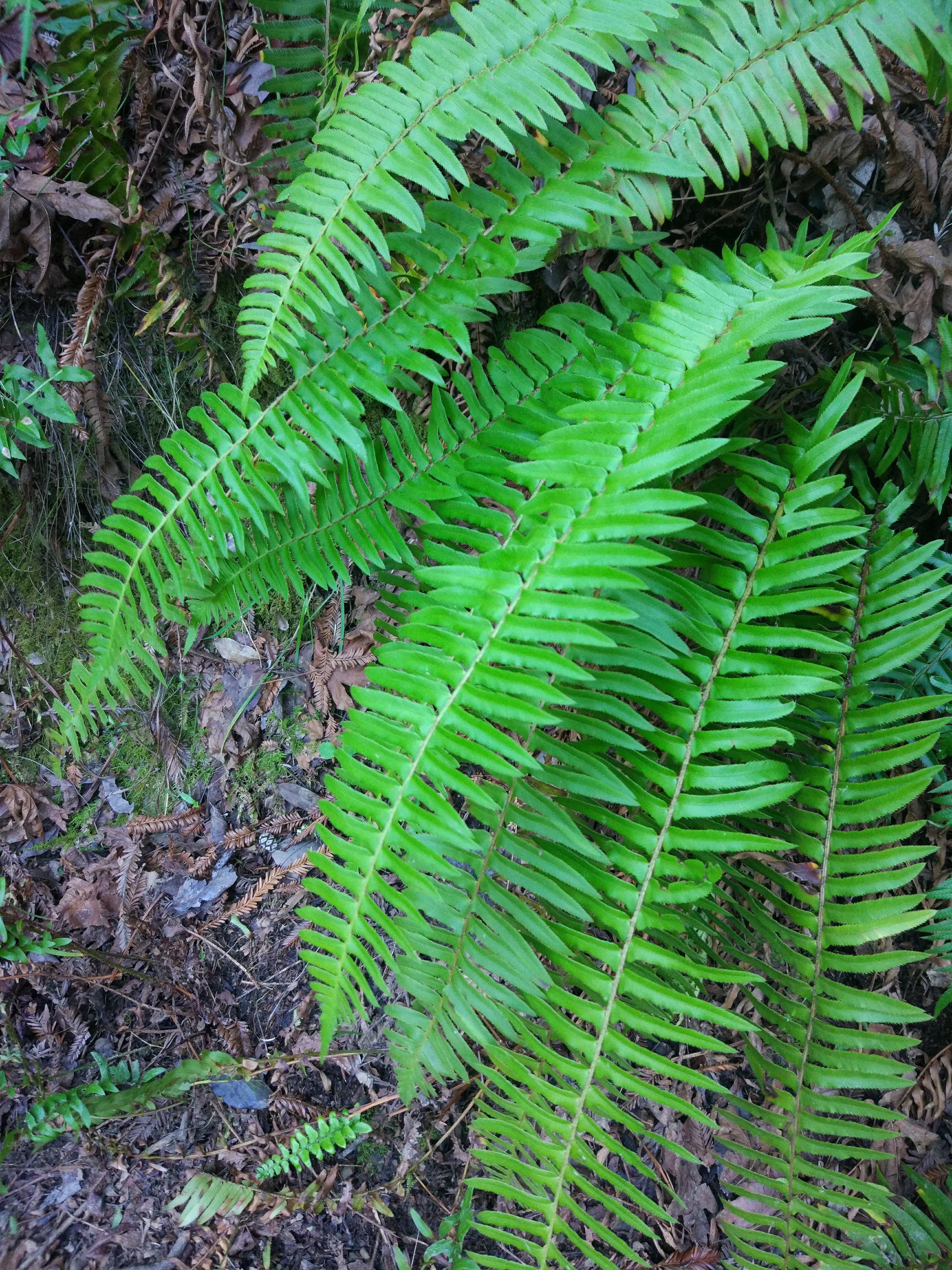
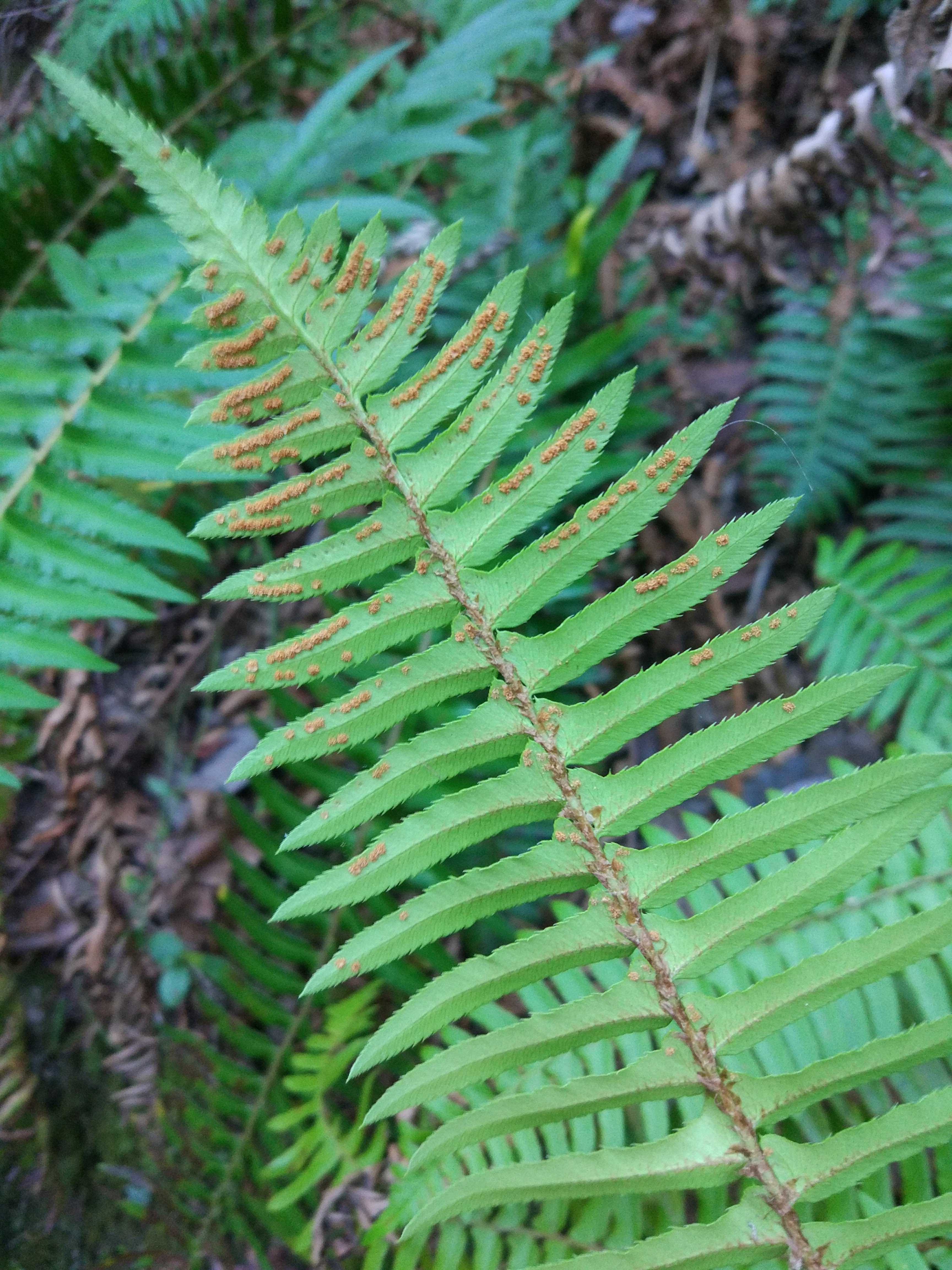
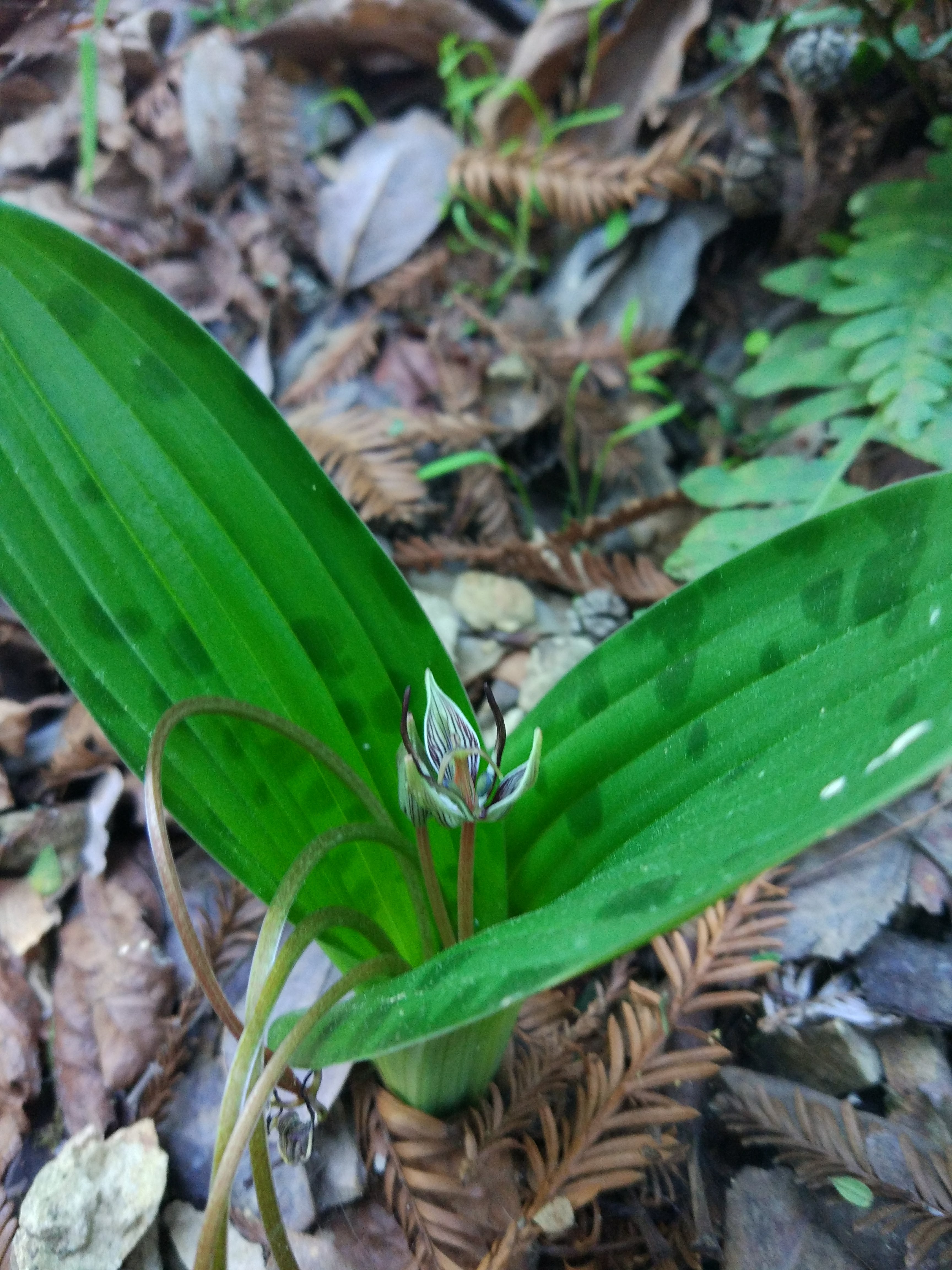
Ceanothus foliosus | Wavy-leaf Ceanothus

Habit: Subshrub, proximal to ground, small
Leaf: Obovate, parallel venation, serrated margin, glabrous,
Repro: Small head inflorescences
Location: A bit off the path, disturbed areas

Directions:

Take Balboa St to Park Presidio Blvd
Head west on Turk St toward Beaumont Ave
Continue onto Balboa St
Take US-101 N and CA-1 N to Panoramic Hwy in Tamalpais-Homestead Valley
Turn right onto Park Presidio Blvd
Continue onto Veterans Blvd
Keep left at the fork and merge onto US-101 N
Take exit 445B for CA-1 toward Mill Valley/Stinson Beach
Continue onto CA-1 N
Turn left to stay on CA-1 N
Continue on Panoramic Hwy. Drive to E Ridgecrest Blvd
Turn right onto Panoramic Hwy
Slight left to stay on Panoramic Hwy
Turn right onto Pan Toll Rd
Turn right onto E Ridgecrest Blvd

Field Journal #9 – Ring Mountain


Location: 486 ft above sea level | 37.913, -122.488

The hike began up on a residential hillside zone and as we walked past the mansions we were all tempted to find a high reward job which may or not be high risk. In reality we just walked up to the entrance of the trail which opened up from a street to a large rolling hills plain with a view to Mt. Tamalpais. The general feel for the area was like this and was not a very intense hike from our starting point. Lots of disturbed and serpentine rich areas were found on our hike and we were able to find many previously observed species and a few new species.

Silene gallica | Common catchfly

Habit: Herbaceous, proximal to ground, small
Leaf: Long elliptical or lanceolate simple leaves, acute, entire margins, small, parallel venation
Repro: Petals relaxed, petals parts of 5, hairy funnel,
Location: Near path, distrubed or open area, good sunlight exposure

Achillea millefolium | Yarrow

Habit: Herbaceous, erect, somewhat proximal to ground
Leaf: Long elliptical compound leaves, acute, highly dissected, feather-like, mainly basal
Repro: Petals white, petals parts of 5, large inflorescence, inner revolute, head-like inflorescences
Location: WAys away from path, disturbed or open area, strong sunlight

Platystemon californicus | Cream cups

Habit: Herbaceous, proximal to ground
Leaf: Lanceolate simple leaves, acute, entire margins, caudal,
Repro: Petals white and yellow, strong many anthers, bulb like anther structure, partly reflex petals, petals parts of 6
Location: Near path, open area, good sunlight exposure

Directions:

Get on US-101 N from Balboa St, Park Presidio Blvd and Veterans Blvd
Head west on Turk St toward Beaumont Ave
Continue onto Balboa St
Turn right onto Park Presidio Blvd
Continue onto Veterans Blvd
Keep left at the fork and merge onto US-101 N
Follow US-101 N to Tamalpais Dr in Corte Madera. Take exit 449 from US-101 N
Merge onto US-101 N
Take exit 449 for Tamalpais Drive toward Paradise Drive
Take Paradise Dr and Taylor Rd to Fire Rd in Tiburon
Use the right lane to turn right onto Tamalpais Dr
Keep right to stay on Tamalpais Dr
Turn right onto San Clemente Dr
Continue onto Paradise Dr
Slight right to stay on Paradise Dr
Turn right onto Taylor Rd
Continue onto Fire Rd

Field Journal #8 — Carson Falls

 
Location: 972 ft | 37.970, -122.645

The trail began from the road and went up through some forested areas and climbed further up through some plains and serpentine rich areas. The hike looped back around through some a different steep path with turn backs. Many species were not new but the abundance of all the species reminded us of how many  we recognized. We left around 1:20 PM and returned around 5:05 PM. The weather was warm and partly cloudy but overall on neither extreme.

Iris douglasiana | Douglas iris

Habit: Herbaceous, proximal to ground
Leaf: Long elliptical or lanceolate simple leaves, acute, entire margins, basal, parallel venation
Repro: Petals translucent, dissected-like flowers, large inflorescence, feathers weak petals, elliptical acuminate petals
Location: Near path, distrubed or open area, good sunlight exposure

Calochortus umbellatus | Oakland Mariposa Lily

Habit: Herbaceous, extremely proximal to ground, whole plant was near 5 inches tall
Leaf: Long elliptical or lanceolate, acute, entire margins, basal, parallel venation, simple
Repro: Petals thin, small flowers, truncate to acuminate petals, bract-like petals thin elliptical or lanceolate-like, parts of 3
Location: Far off path, extremely disturbed or open area, serpentine, extreme sunlight

Maianthemum stellatum | Starry False Lily of the Valley

Habit: Herbaceous, proximal to ground
Leaf: Long elliptical, acute, entire margins, alternate, one plane or ranked, parallel venation, thin
Repro: Petals extremely small, star-like flowers, elliptical petals, parts of 3?
Location: Immediately off path, amongst other plants, shaded


Directions:

Take US-101 N and Sir Francis Drake Blvd to Bolinas Rd in Fairfax
Head west on Turk St toward Beaumont Ave
Continue onto Balboa St
Turn right onto Park Presidio Blvd
Continue onto Veterans Blvd
Keep left at the fork and merge onto US-101 N
Use the right 2 lanes to take exit 450B toward San Anselmo
Merge onto Sir Francis Drake Blvd
Turn left onto Pacheco Ave
Turn right onto Broadway
Turn left onto Bolinas Rd
Drive to Bolinas – Fairfax Rd/Fairfax – Bolinas Rd
Slight left to stay on Bolinas Rd
Continue onto Bolinas – Fairfax Rd/Fairfax – Bolinas Rd
Turn right onto Kent Pump Road
Destination is on right after 2 mi

Field Journal #7 – Edgewood Park


Location: 231 ft | 37.473, -122.278

The trail began at a parking lot and crossed a small wooden bridge before traveling up a path towards some rolling hills in the distance. Much of the first portion was under the shade of trees while the latter half was more open in the hills and pastures where we found some disturbed serpentine areas. The area presented a lot of previously identified species but we could now see a number of new species and even families not observed before. Parts of the trail were significantly different to one another which provided different ecosystems upon which the species could thrive. We left around 1:10 PM and left near 4:25 PM or so to attempt to beat the oppressive temporal regime imposed by our overlords over at Google. Sadly we were only able to break-even thanks to the redirection of traffic thanks to the the very same puppeteers. The day was mildly cloudy with a slight breeze and began to rain on our trip back but with no problems otherwise.


Plantago erecta | California plantain

Habit: Herbaceous, extremely proximal to ground, whole plant was near 5 inches tall
Leaf: Long elliptical or lanceolate, acute, entire margins, basal, parallel venation, thin
Repro: Petals translucent, small flowers, small inflorescence, pseudo-reflexed petals, oval to round petals, bracts present, capitulum-like, parts of 5?
Location: In an open area with lots of other species, off the path, pervasive


Layia platyglossa | Tidy Tips

Habit: Herbaceous, acutely hairy, purple stem, weed-like, proximal to ground to bush-like height
Leaf: Leanceolate-like, lobed or highly dissected, opposite, raceme-like
Repro: Determinate flowers, flew flowers, largest component, obvious disk flowers
Location: Immediately off path, found in edges of pastures or in disturbed areas

 
Sisyrinchium bellum | Blue eyed grass

Habit: Herbaceous, proximal to ground
Leaf: Lanceolate, parallel venation, alternate,
Repro: Bracts, striped petals, 6 petals, petals obtuse/blunt with pointed or acute ending
Location: Immediately off path, in small clusters

Directions:

Get on I-280 S/State Hwy 1 S in Daly City from 19th Ave
Head south on 29th Ave toward Balboa St
Turn left onto Fulton St
Turn right onto Crossover Dr
Use any lane to turn slightly right to stay on Crossover Dr
Continue onto 19th Ave
Pass by Chase Bank (on the right in 0.8 mi)
Use the right 3 lanes to turn slightly right onto Junipero Serra Blvd
Use any lane to take the ramp onto I-280 S/State Hwy 1 S
Follow I-280 S to Edgewood Rd. Take exit 29 from I-280 S
Merge onto I-280 S/State Hwy 1 S
Continue to follow I-280 S
Take exit 29 for Edgewood Rd
Keep left at the fork, follow signs for San Carlos/Redwood City
Follow Edgewood Rd to Old Stage Coach Rd in Emerald Hills
Turn left onto Edgewood Rd
Turn right onto Old Stage Coach Rd
Turn left to stay on Old Stage Coach Rd

Field Journal #6 – San Bruno State Park

 
Location: 682 ft | 37.776,-122.493

Trail began from the parking space atop the hill at the base of a radio tower. We traveled downward through a winding path which looped back to the road leading back up to the parking space. Most of the area was green and full of many species — which made the area seem like the perfect review space. The area was highly diverse but had little in the way of trees which must have prevented shade niche species. We arrived to the trail around 1 PM and left around 3:30 PM to stop by a popular food joint for whatever reason. The day was sunny but more on the colder side due to the altitude and plenty of wind.

 
Lupinus albifrons | Silver bush lupine

Habit: Subshrub, clustered structures, inflorescence above rest of structure
Leaf: Whorled-like, involute, dissected
Repro: Typical banner wing and keel, spike-like, possibly determinate,
Location: Immediately off path, amongst many other species


Sidalcea malviflora | Checker mallow

Habit: Herbaceous, low to ground
Leaf: Dentate, small leaves
Repro: Open, relaxed petals, bract, few flowers
Location: Immediately off path, sunny spots, exposed


Ulex europaeus | Gorse

Habit: Herbaceous, clustered, dense, low to ground
Leaf: Specialized into thorns, no other leaf-like structures
Repro: Typical banner wing and keel, revolute banner, non-axial sporadic inflorescences, raceme
Location: Distant from path, amongst grasses on pasture, highly exposed, strong sunlight

Directions:

Take Balboa St to Park Presidio Blvd
Head west on Turk St toward Beaumont Ave
Continue onto Balboa St
Take 19th Ave to Sullivan Ave in Daly City. Take exit 48 from I-280 S/State Hwy 1 S
Turn left onto Park Presidio Blvd
Continue onto Crossover Dr
Continue onto 19th Ave
Pass by Chase Bank (on the right in 0.8 mi)
Use the right 3 lanes to turn slightly right onto Junipero Serra Blvd
Use any lane to take the ramp onto I-280 S/State Hwy 1 S
Take exit 48 for Sullivan Ave toward Eastmoor Ave
Keep right at the fork, follow signs for Mission St
Take E Market St and Guadalupe Canyon Pkwy to your destination
Turn right onto Sullivan Ave
Use the right 2 lanes to turn right at the 1st cross street onto Washington St
Pass by Planet Fitness (on the right)
Use any lane to turn left onto San Pedro Rd
Continue onto E Market St
Pass by Bank of America Financial Center (on the left)
Continue onto Guadalupe Canyon Pkwy
Turn left
Turn right

Field Journal #5 – Mt. Tamalpais

 
Location: 2572 ft above sea level | 37.924, -122.597 | Rock Springs Trailhead

Mt. Tamalpais is large range of mountains found north of San Francisco where we find the Rocks Springs Trailhead and up the road was Trojan Point, the vista where the previous photos were taken. High up above the fog that formed around San Francisco that day, we find forests and large swaths of similar ecosystems with many smaller niches. The trail started directly from the parking space for the vehicles and looped up and around an upward trail through the hills atop the mountain. Laid amongst forested, chaparral, and riparian niches the trail moved through different areas with almost distinct dominant species such as Tamalpais specific shrubs and Douglas Firs.


Calypso bulbosa | Fairy Slipper

Habit: Herbaceous, small, low to the ground
Leaf: Simple, opposite, two, basal, parallel venation, broadly acute, chordate, entire margin
Repro: Purple, banner/lip below, petals and sepals indistinguishable, 5 stepals, mottled lip, orchid column petal
Location: Off the trail, in the clear open air, shaded by taller trees, found on hillsidesm

Permula hernendosii | Mosquito Bill

Habit: Herbaceous, small, low to the ground
Leaf: Simple, ovate, basal, parallel venation, broadly acute, entire margin
Repro: Bracts, petals part of 4, purple, reflexed, stigma/ovary exposed
Location: Off the trail, in the clear open air, mildly shaded

Ceanothus jepsonii | Musk Brush

Habit: Herbaceous, small, low to the ground
Leaf: Simple, opposite, ovate, entire margin, palmate venation, broad, slightly dentate
Repro: Capitula/umbel-like, inflorescent bunches, purple, small flowers
Location: Off the trail, in the clear open air, strong sunlight, strong presence/dominant

While the trip started out cloudy and with a high chance of rain in San Francisco, the day was much warmer in Mt. Tamalpais and was far from cloudy. We left USF around 1 pm and returned right at 5 pm with less clouds in the sky than when we first departed. Mt. Tamalpais was open and spacious almost like a plateau up top, a distant space from the surrounding areas. The hike was an upward loop that came back around to the initial spot. Much of the trail was spent taking in the wonderful scenery and looking for the species of interested dotted throughout the hike.

Directions:

Take Balboa St to Park Presidio Blvd
Head west on Turk St toward Beaumont Ave
Continue onto Balboa St
Take US-101 N and CA-1 N to Panoramic Hwy in Tamalpais-Homestead Valley
Turn right onto Park Presidio Blvd
Continue onto Veterans Blvd
Keep left at the fork and merge onto US-101 N
Take exit 445B for CA-1 toward Mill Valley/Stinson Beach
Continue onto CA-1 N
Turn left to stay on CA-1 N
Continue on Panoramic Hwy. Drive to W Ridgecrest Blvd
Turn right onto Panoramic Hwy
Slight left to stay on Panoramic Hwy
Turn right onto Pan Toll Rd
Turn left onto W Ridgecrest Blvd


Field Journal #4 – San Pedro Valley, Pacifica

 
Location: 194 ft above sea level | 37.578, -122.476 | San Pedro Valley Park

South of Pacifica, the hike began in a riperian biome and moved gradually up the mountainous terrain which seem to harbor plenty of water as it was on the ocean facing side. As such the area was covered in extensive green flora with sparse plant areas dotted every now and then. Save for the one areas of monospecies dominated areas (pompous poeiceae and the manzanita forest), the species were pretty well dispersed and found throughout. Non natives seemed to have a strong foothold the whole way up the mountain. The hike was not too taxing and looped back around at the peak with a lot of shade from silver tassels and manzanitas among other common trees. The hike was struck heavily by rain and we sought shelter under trees as best we could. The rest of the hike was mainly cloudy and then cleared up as we left. We arrived around 1:20 PM and left around 4 PM.

Trillium albidum | Giant white wakerobin

Habit: Herbaceous, small, low to the ground
Leaf: Simple, lobed to dissected, palmate venation, broadly acute, chordate
Repro: Bracts, petals part of 3, white
Location: Off the trail, in the clear open air, strong sunlight

Oemleria cerasiformis | Oso berry

Habit: Shrub, slim, few leaves
Leaf: Simple, lobed, palmate venation, broad ovate and short, obtuse
Repro: Funnel shaped, pendant, clustered flowers, unisexual, bract
Location: Off the trail, clear area and open air, strong sunlight


Garrya elliptica | Coast silk tassel

Habit: Tree
Leaf: Simple, elliptic, pinnate venation, broadly acute, opposite
Repro: Pendant, unisexual, pistillate and staminate inflorescences,
Location: Off the trail, strong sunlight, competition for light

Maianthemum racemosum | Soloman’s plume

Habit: Herbaceous, small, low to the ground
Leaf: Simple, lobed to dissected, pinnate venation, broadly acute,
Repro: Fused bracts, capitula, head-like, many flowers in one inflorescence, umbel panicle, many observable stamen,
Location: Partly inward towards the field, amongst other herbs, strong sunlight, competition for light

Directions:

Take Great Hwy to Skyline Blvd
Head south on 29th Ave toward Balboa St
Turn right onto Fulton St
Use any lane to turn left onto Great Hwy
Parts of this road may be closed at certain times or days
Follow Skyline Blvd and CA-1 S to Fassler Ave in Pacifica
Turn right onto Skyline Blvd
Use the right lane to merge onto CA-1 S via the ramp to Pacifica/Santa Cruz
Continue on Fassler Ave. Take Terra Nova Blvd to Trout Farm Rd
Use the left 2 lanes to turn left onto Fassler Ave
Turn right onto Terra Nova Blvd
Turn right onto Oddstad Blvd
Turn left onto Trout Farm Rd

Field Journal #3 – Mt. Burdell


Location: 315 ft above sea level | 38.129, -122.604 | Mt. Burdell Hike/Trail, Novato, CA

The location was north of the suburban/urban city Novato and found in the hills in the area. The day was cold for nothern California weather and clouds threatened to rain. Eventually it did lightly rain for 10 minutes, but we trekked on. Area was mainly open fields with major hills and many oak trees dotted throughout. Area was on the edge of the elevated area and the view of the nearby city was ever-present. A lot of wind gets carried throughout the hiking area. Other than grasses, spp of interest were sparse and far between for the most part.


Toxicoscordion fremontii | Mountain Deathcamus

Habit: Herbaceous, one straight growth from basal structures
Leaf: Monocot typical shoot-like structure, parallel venation, linear lanceolate, entire, simple
Repro: Inflorescence of more than 5 flowers, parts of 5, dioecious, perfect flowers, raceme, head-like, capitula
Location: In the middle of a field, away from path, sparse distribution even amongst the clusters, no shade


Taraxia ovata | Sun Cup

Habit: Herbaceous, very low to the ground
Leaf: Elliptic, wavy, partially lobed, pinnate venation, simple
Repro: 4 petals, 8 stamen, brassicaceae mimic, cup-like structure,
Location: Immediately off the path, no shade, heavy sunlight and  traffic


Sanicula bipinnatifida | Purple Sanicle

Habit: Herbaceous, small, low to the ground
Leaf: Simple, lobed to dissected, pinnate venation, broadly acute,
Repro: Fused bracts, capitula, head-like, many flowers in one inflorescence, umbel panicle, many observable stamen,
Location: Partly inward towards the field, amongst other herbs, strong sunlight, competition for light

The hike began at the entrance of the trail off a residential street and looped around the edge of the reserve and back through the same path. Arrived around 1:30 pm and we left around 4:15. As mentioned previously, the weather was colder with winds and clouds around before a light rain. Chaparral-like biome with very sparse spp that were not poecieae.

Directions:
Continue onto Veterans Blvd
Keep left at the fork and merge onto US-101 N
Follow US-101 N to Atherton Ave in Novato. Take exit 463 from US-101 N
Merge onto US-101 N
Take exit 463 for Atherton Ave toward San Marin Dr
Take San Marin Dr to San Andreas Dr
Use the right lane to turn left onto Atherton Ave
Continue onto San Marin Dr
Turn right onto San Andreas Dr
Continue straight to stay on San Andreas Dr

Field Journal #2 – Presidio


Location: 160 ft above sea level  |  37.798, -122.480  |  Presidio and Batteries to Bluffs Trail, North San Francisco

The hike began at Immigrant Point, a vista of the area with the view shown above. A coastal chaparral found in the northern edges of San Francisco. Many small trails are found throughout with major highways cutting through the area. Was previously military owned space with heavy non-native species introductions but now reclaimed and aided by restoration services for native species introductions. A few native species are described here:


Ceanothus thyrsiflorus | Blueblossom

Habit: Shrub to subshrub
Leaf: Alternate, simple, slightly denticulate, pinnate/reticulate venation with tertiary venation, apical buds, acutely obtuse, elliptical, glaborous, slightly revolute
Repro: True inflorescence, panicle, diecious, urn shape blooms to 2-lipped like corollas, raceme, apical buds
Location: Immediately off the path, grew by the open areas in sunlight

Solanum douglasii | White Nightshade

Habit: Herbaceous, low to ground, weed like
Leaf: Oblique, entire, simple, pinnate venation, glaborous, alternate, semi-lobed and crenate
Repro: Fused calyx/corolla structure with 5 stepal points, reflexed, anther covers ovary,
Location: On path steps, in part shade, hit by heavy sun, cluster and compact

Rubus ursinus | California blackberry

Habit: Shrub to subshrub, thorns, low to ground
Leaf: Palmately compound, dentate to denticulate, spotted and unspotted, pinnate venation with tertiary venation, alternate
Repro: 5 petals, many stamen, apex buds, diecious
Location: Immediately off the path, in plain sunlight, heavy sunlight, compact

Our hike was down a trail towards the beach and the back up steps place for tourism. Along the way we crossed a street which can serve as an isolating barrier for various species but volunteers were seen to be preferentially planting native species in several areas. We made a number of off trail observations and treks to get a better feel for the area and even enjoyed a bit of time right at the edge of the water. The day was warm and sunny with a mild breeze. We arrived around 1:15 pm latest and left around 4 pm. Coastal chaparrals seem quite similar to common Southern California chaparrals in terms of floral morphologies but with a lot more green plants. Still they seem to remain close to the ground and have simple medium sized leaves which makes sense for the environment. Species are growing in the typical California rock outcropping soils which are harsh and are therefore specialized for slow resilient growth.

Directions:
Take Turk St to 4th Ave
Head west on Turk St toward Beaumont Ave
Continue onto Balboa St
Continue on 4th Ave. Take Lake St to Washington Blvd
Turn right onto 4th Ave
Turn left onto Lake St
Turn right onto 14th Ave
14th Ave turns left and becomes Wedemeyer St
Continue onto Battery Caulfield Rd
Turn left onto Washington Blvd

Field Journal #1 — Baltimore Canyon


Baltimore Canyon contained many small trails off a fire road which went from a mountainous terrain with cleared niches, down to a riparian terrain. Many of the species observed were found throughout our trek intermingled with various non-native spp. Few deciduous spp. were observed and many plants were still green with a majority of them not in a blooming season.

 
Polystichum munitum | Western sword fern

Habit: Shrub-like
Leaf: Compound, alternate, dentate/denticulate, even 1-pinnate pinna, narrow acute parallel, truncated fused
Repro: Scora/indusium, two lines per pinnule underside
Location: Immediately off the path, grew fronds in clusters by the open/clear areas in shade


Acacia melanoxylon | Blackwood acacia

Habit: Shrub, small tree, evergreen
Leaf: Alternate, entire, narrowly acute, parralel, elliptic,
Repro: Axillary buds, inflorescence full umbel, many small flowers,
Location: Immediately off path, in open/clear areas, exposed to frequent light

Scoliopus bigelovii | Slink pod

Habit: Herbaceous, small bud like, ground proximal
Leaf: Alternate, bud-like structure, no observable stem, entire, parallel, broadly acute, spotted,
Repro: Dioecious, special stems for seeds (grow down into soil), rotate bell-shaped, tepals, groups of 3
Location: Immediately off path, close to ground, in semi shaded areas, amongst detritus