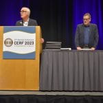

Last week, the American Geophysical Union (AGU) hosted their annual fall meeting here in San Francisco. This international conference gathers researchers, scientists, educators, students, policymakers, exhibitors, journalists, and communicators from various earth and space science fields together to share their research, network, and discuss advancements, aiming to better understand our planet and environment, as well as our role in preserving its future. Many MSEM, ENVS and GsAL faculty participated and presented in the event, including Professor David Saah who co-authored several research papers.

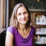
In addition to the AGU conference, MSEM partnered with the GsAL and ENVS department to put on a networking mixer last Wednesday. Students from USF environmental programs and colleagues attending the AGU conference gathered at USF’s downtown campus to mingle and share insights. The event also included a talk from Esri’s education manager and professional geographer, Dr. Joseph Kerski, as he discussed the ethics of mapping.

 Dr. Kerski enthusiastically emphasized the importance of a code of ethics for GIS professionals in their work. This code considers the impacts of our actions on others and calls for treating everyone with respect, whether colleagues, the mapping profession, employers, and society as a whole. When creating a map, think:
Is the map that you are making true?
Is it helpful?
Is it inspiring?
Is it necessary? and;
Is it kind?
With the advancement of GIS, everyone is now a map producer. Maps are spatial enablers, aiding in decision making and data visualization. Maps carry an air of authority and shape narratives, aiding in understanding–or obfuscation–of the world. Sharing the data behind the maps helps us interpret and check the story. Dr. Kerski highlighted:
“We have a lot of complex problems in our world, and with many of us at the AGU conference this week, with 26,000 of our closest friends, talking about basically everything from astronomy to zoology, and every science in between, it’s great to have access to scientific articles… But there’s an increasing pressure to share the data collected in the research, so that we can move forward in solving some of the complex issues that are affecting our everyday lives.”
Dr. Kerski also highlighted the importance of protecting personal and private data, as well as data that could lead to harm to people or places. Even with publicly-collected open-source environmental data, GIS practitioners choose how they tell a story and how they create accurate representations of patterns observed in the world. You can find more about his recommendations and best practices here.