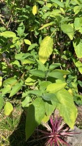
March 16, 2020
Almaden Quicksilver County Park, Santa Clara County Parks, Santa Clara County
Latitude 37°10’26.28″N
Longitude 121°49’30.95″W
Elevation: 285 to 1,689 feet

Almaden Quicksilver County Park is rich in natural diversity and a landmark of California history. The park is the site of over 135 years of mining activities and former home to more than 1,800 miners and their families. The park encompasses 4,163 acres, occupying a majority of Capitancillos Ridge. During this time of the season, the park offers one of the most spectacular wildflower displays in the region. Remnants of the mining era also offer an exciting look into the mining operations of the latter part of the 19th century.
On a sunny day the views to the east (Mount Hamilton) and back behind you to the west (the Sierra Azul) are clear, and the stillness of the well-graded climb through California bay, coast live oak, toyon, California coffeeberry, chamise, and buckeye is only broken by bird cries.
At this point in spring, you will see man-root, shooting stars, monkey flower, mule-ear sunflowers, woodland star, milkmaids, and miner’s lettuce on the left side of Mine Hill Trail. After one mile, Mine Hill Trail reaches Capehorn Pass. A picnic table at this flat spot makes a good place to consult the map, and drink some water. From this signed junction Hacienda Trail runs north through chaparral, then cuts east and loops back south to meet up with Mine Hill Trail. This is a good option if you’re ready to turn back down the hill. You could also continue on Mine Hill Trail, turning onto Castillero Trail, then picking up English Camp Trail, for a shorter loop. Turn right, pass the picnic table, then turn left onto Randol Trail.
Topography: hilly
General habitat: chaparral
Species: Marah fabaceus (manroot), Dodecatheon meadia (shooting stars), Mimulus aurantiacus (monkey flower), Wyethia helianthoides (mule-ear sunflowers), Lithophragma parviflorum (woodland star), Cardamine californica (milkmaids), Claytonia perfoliata (miner’s lettuce)
Detailed species account: Lithophragma parviflorum is a species of flowering plant in the saxifrage family known by the common name woodland star. It is a rhizomatous perennial herb growing erect or leaning with a naked flowering stem. The leaves are mainly located low on the stem, each cut into three lobes or divided into three lobed leaflets. The stem bears up to 15 flowers, each in a cuplike calyx of red or green sepals. The five petals are bright white, up to 2 centimeters long, and usually divided into three toothlike lobes.
Species Description: Western fence lizards are medium-sized lizards that can be up to 8.4 inches long. Their back and limbs are covered in spiny gray, tan, or brown scales with darker waves or blotches. Their underside is white or yellow, although adult males have large bright blue patches surrounded by black on their belly and throat. Most western fence lizards live in California but they can also be found in Oregon, Nevada, the Columbia River Gorge (between Washington and Oregon), southwestern Idaho, western Utah, and northwestern Baja California. The lizards habitats include grassland, sagebrush, broken chaparral, woodland, coniferous forest, and even farmland. Western fence lizards breed between April and July, females lay a single clutch of 3 to 17 eggs, which hatch 2 months afterwards.They tend to avoid dense moist forests and harsh deserts. Western fence lizards feed on beetles, ants, flies, caterpillars, and spiders. Upon observation, the lizard appeared to be male, with a large bright blue patch on the belly and throat. The lizard ran along the ground quickly, until remaining still on a leaf allowing for observation.
Narrative: The day before my trip it rained heavily. The ground was moist when arrived at the trail at about 9 AM. The sky was mostly cloudy, with patches of sunlight showing through. The hike was not extremely rigorous. The trail was wide with few slopes. I hiked the trail slowly, taking breaks often to observe wildlife. Although the trail experiences large amounts of foot traffic, wildlife still flourishes. Throughout the hike, I noticed remnants of the mine. I could not observe any immediate effects of the mine on wildlife, but I would be interested in conducting further studies.


