
Geospatial analysis is an increasingly important skill in environmental management, which is why the MS in Environmental Management (MSEM) program at USF features the option for a Geographic Information System (GIS) certificate, through the USF Geospatial Analysis Lab (GsAL).
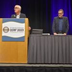
This past week GsAL hosted the 6th annual GeoEducation Summit in partnership with BayGeo, a nonprofit organization whose mission is to connect and grow the geospatial community in the San Francisco Bay Area. The GeoEducation summit gathers GIS specialists from various industries to showcase the latest developments, trends and innovations in the field of geographic education and geospatial sciences. By bringing together educators, students, and professionals, USF’s GeoEducation summit embodies a multidisciplinary approach to advancing education and science in this field, fostering a community that works to tackle global issues like climate change, urbanization, and disaster management.
Below we highlight just a few of this year’s knowledgeable presenters, including Nora Shevick from Felt, Edoardo Neerhut from Meta, and Darin Jensen from Guerilla Cartography. All of the guest speakers presented their current work with various GIS software programs/mediums across their different industries.

Nora Shevick discussed the accessibility of Felt, an online mapping tool that allows for easy sharing and collabortation among professionals and communities to help record geospatial data in real time. Felt’s system allows multiple stakeholders to participate simultaneously in building a map. Industries such as architecture, engineering, construction, utilities, technology, consulting, and education have all begun to implement Felt into their everyday work flows given its easy integration.

The next speaker of the event was Edoardo Neerhut from Meta. Edoardo presented the latest collaboration efforts between Meta, Esri, Humanitarian OpenStreetmap Team (HOT), and Mapillary to develop the latest mapping software – Rapid. Location data has long been a part of social media; from being able to check in to restaurants on facebook and sharing business recommendations, to finding significant landmarks or notifying your loved ones that you are safe during a natural disaster event. Meta recently developed Rapid, which integrates artificial intelligence with OpenStreetMap mapping tools to efficiently add data to open resource maps. Edoardo’s presentation then raised a question from the audience of what mapping tools could be implemented for rapid response or disaster risk reduction, in which he discussed one of Meta’s partners, the Humanitarian OpenStreetmap Team (HOT).

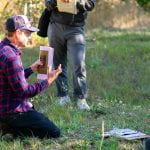
HOT is an international team dedicated to humanitarian action and community development through open mapping. They work together to provide map data which revolutionizes disaster management, reduces risks, and contributes to achievement of the Sustainable Development Goals. One of their most recent projects in Morocco and Libya involved responding to the earthquake and flooding disasters. Mappers used high definition, post-disaster imagery to try and identify inaccessible roads and damaged infrastructure that first responders can incorporate in their logistics for rescue.

The final speaker we highlight is Darin Jensen with Guerilla Cartography. Guerilla Cartography’s mission is to promote cartographic arts and expand collaborative art of mapmakers, researchers, and designers. Their atlases are made to focus on unconventional themes, issues and stories through the art and science of cartography, and emphasizes community engagement, activism, and the use of maps for raising awareness and promoting social change. Check out their most recent project, Interculturality as a Shelter.
After spending the morning at the GeoEducation Summit, one of the main take-aways from all of the presentations is that GIS is a highly transferable and versatile skill spanning numerous industries. By bringing together a diverse community of students, geospatial enthusiasts, and experts, the GeoEducation Summit provides a platform for learning, networking, and sharing ideas that hold the potential to create real change. If you’re passionate about geographic information systems and their applications, mark your calendars for next year’s Summit Event – it’s an opportunity you won’t want to miss.
Finally, if you’re a current MSEM student and interested in GIS, check out the graduate certificate information page!