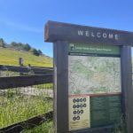
Location + Site description: Steep Ravine’s geographic coordinates are 37.8852043°N, -122.6285919°W. The elevation gain is approximately 1,300 feet surrounded by giant red wood trees and many different ferns. Dominant species consisted of Pteridaceae, Apiaceae, and Rosaceae. The hike consisted of … Continue reading
Ring Mountain (04.27.2023)
Location + Site Description: Ring mountain’s geographic coordinates are 37.9099° N, 122.4858° W. The elevation gain is about 602 feet where the hike path loops around at different inclines. The area was surrounded by grasses, the Poaceae family, consisting of … Continue reading
Lucas Valley, Big Rock (04.20.2023)
Location + Site description: Big Rock in Lucas Valley’s geographic coordinates is 38.045920ºN, -122.620570ºW. The elevation gain is about 1,118 feet surrounded by mountains and open grasslands full of beautiful California poppies! We saw many different flowers flowering during this … Continue reading
Edgewood Park & Natural Preserve (04.13.2023)
Location + Site description: Edgewood Park & Natural Preserve geographic coordinates are 37.4740ºN, 122.2785ºW. The elevation gain ranges from 357 to 682 feet surrounded by oak trees, lots of poison oak, and open grassland when you reach the top. We … Continue reading
Marin Headlands (04.06.2023)
Location + Site Description: Marin Headlands’ geographic coordinates are 37.8262ºN, 122.4997ºW. The elevation of the headland is 584 feet which is surrounded by gorgeous California native flowers along the coastal side. We saw a great amount of flowers from the … Continue reading
Mt. Tamalpais, Ridgecrest & Homestead Fire Road (03.23.2023)
Location + Site Description: Mt. Tamalpais to Ridgecrest and Homestead Fire Road trail’s geographic coordinates are: 40.741895°N, 73.989308°W (Ridgecrest) and 37.889385°N, 122.554904°W (Homestead). The elevation of Mt. Tamalpais is about 2,572 feet which is surrounded by oak woodlands and coastal … Continue reading
San Pedro Valley Park (03.02.2023)
Location + Site Description San Pedro Valley Park geographic coordinates are 37.5779°N, 122.4757°W. The elevation gain of the mountain was 2,408 feet which is surrounded by many eucalyptus trees and beautiful manzanitas that are very distinct in color. The trail … Continue reading
The Presidio, Batteries to Bluffs (02.23.2023)
Location + Site Description: Batteries to Bluffs’ geographic coordinates are: 37.799997°N, -122.479468°W. The elevation gain is approximately 500 feet which is surrounded by the pacific ocean of Marshall’s beach and offers a beautiful view of the Golden Gate Bridge. We … Continue reading
Mt. Tamalpais, Laurel Dell (02.15.2023)
Location + Site Description: Mt. Tamalpais to Laurel Dell trailhead’s geographic coordinates are: 37.923435°N, 122.627502°W. The elevation of the mountain is about 2,572 feet which is surrounded by oak woodlands with lots of coastal shrubs. We saw a great amount of … Continue reading