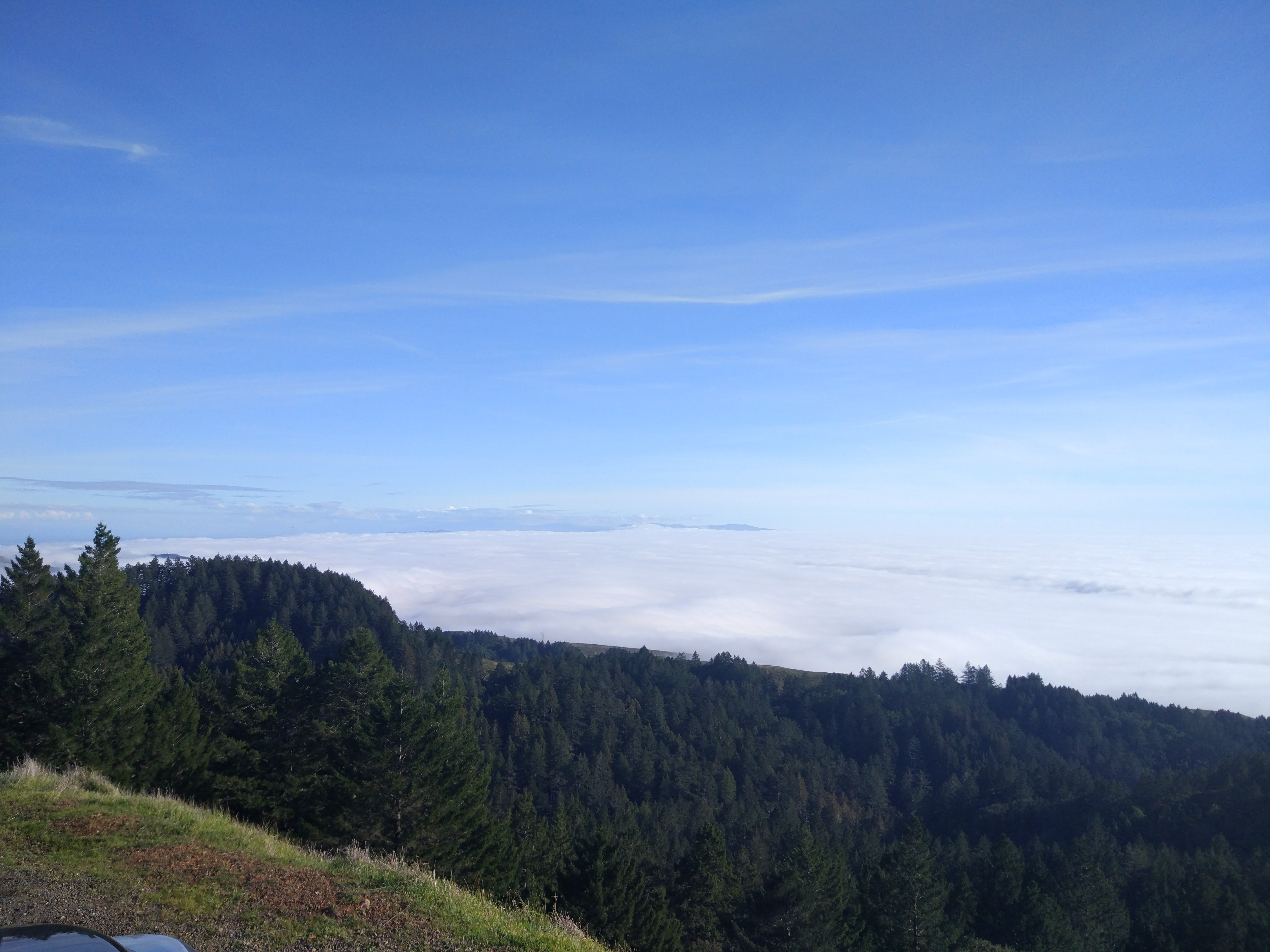

Location: 2572 ft above sea level | 37.924, -122.597 | Rock Springs Trailhead
Mt. Tamalpais is large range of mountains found north of San Francisco where we find the Rocks Springs Trailhead and up the road was Trojan Point, the vista where the previous photos were taken. High up above the fog that formed around San Francisco that day, we find forests and large swaths of similar ecosystems with many smaller niches. The trail started directly from the parking space for the vehicles and looped up and around an upward trail through the hills atop the mountain. Laid amongst forested, chaparral, and riparian niches the trail moved through different areas with almost distinct dominant species such as Tamalpais specific shrubs and Douglas Firs.
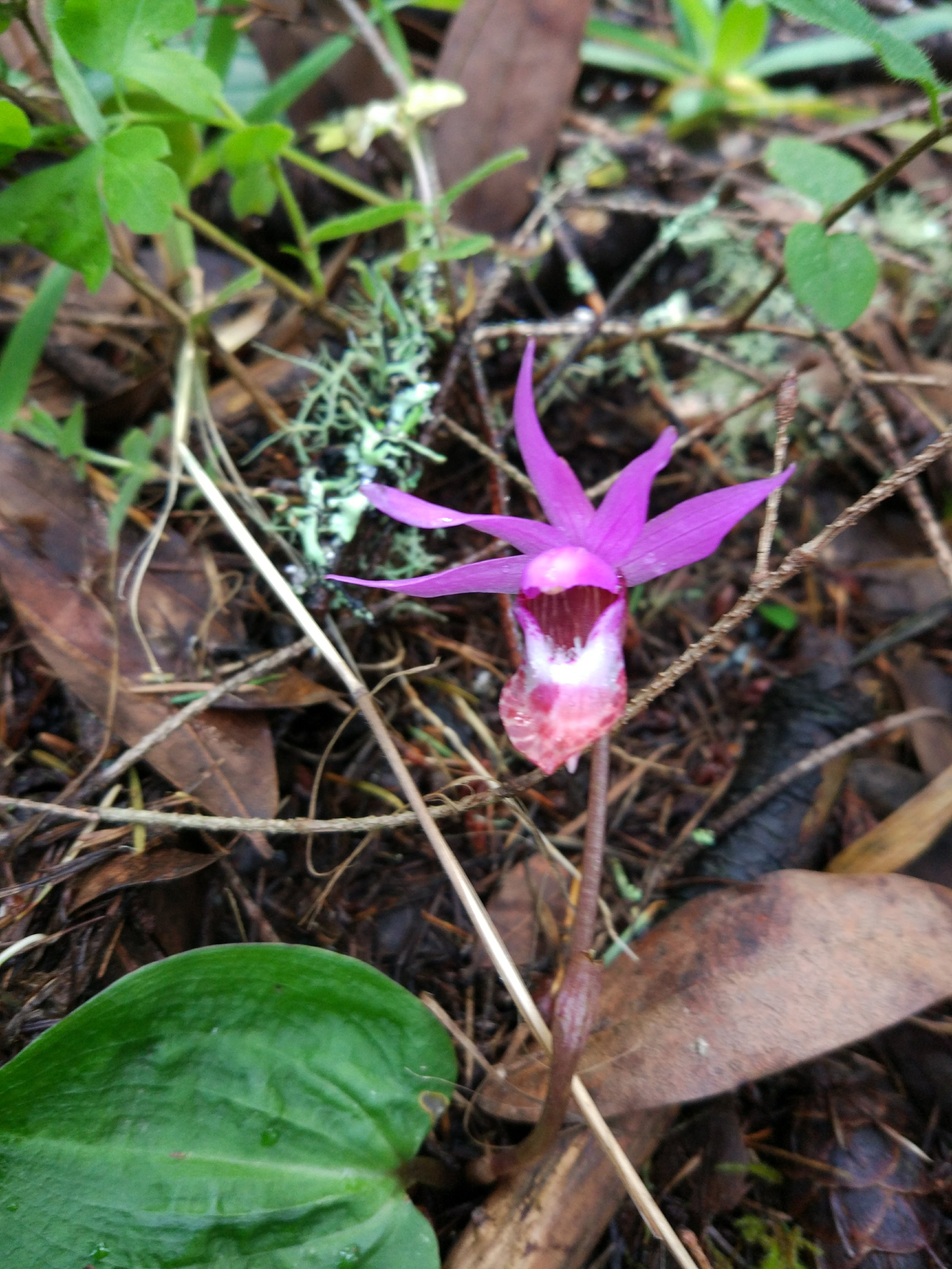
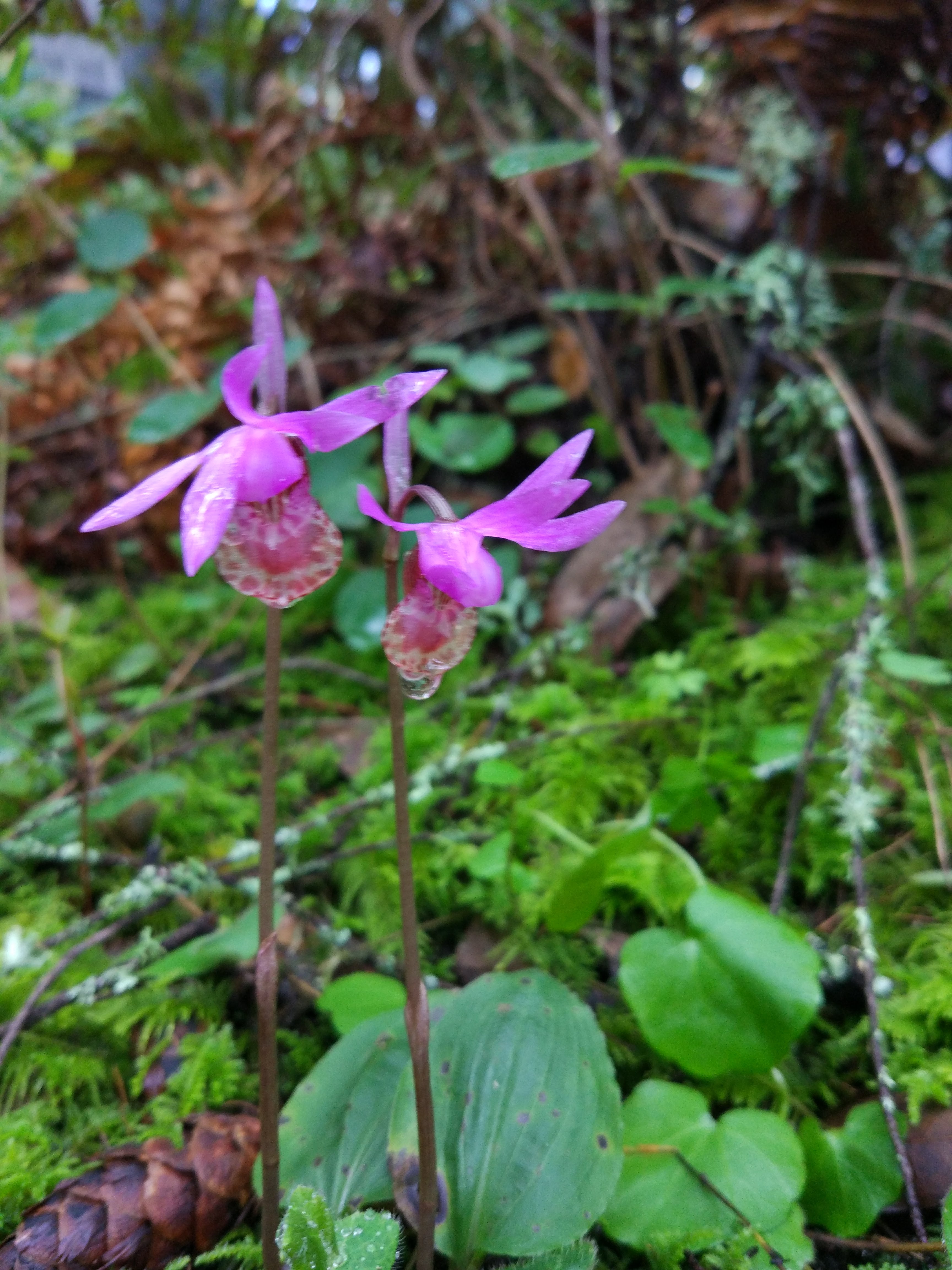
Calypso bulbosa | Fairy Slipper
Habit: Herbaceous, small, low to the ground
Leaf: Simple, opposite, two, basal, parallel venation, broadly acute, chordate, entire margin
Repro: Purple, banner/lip below, petals and sepals indistinguishable, 5 stepals, mottled lip, orchid column petal
Location: Off the trail, in the clear open air, shaded by taller trees, found on hillsidesm

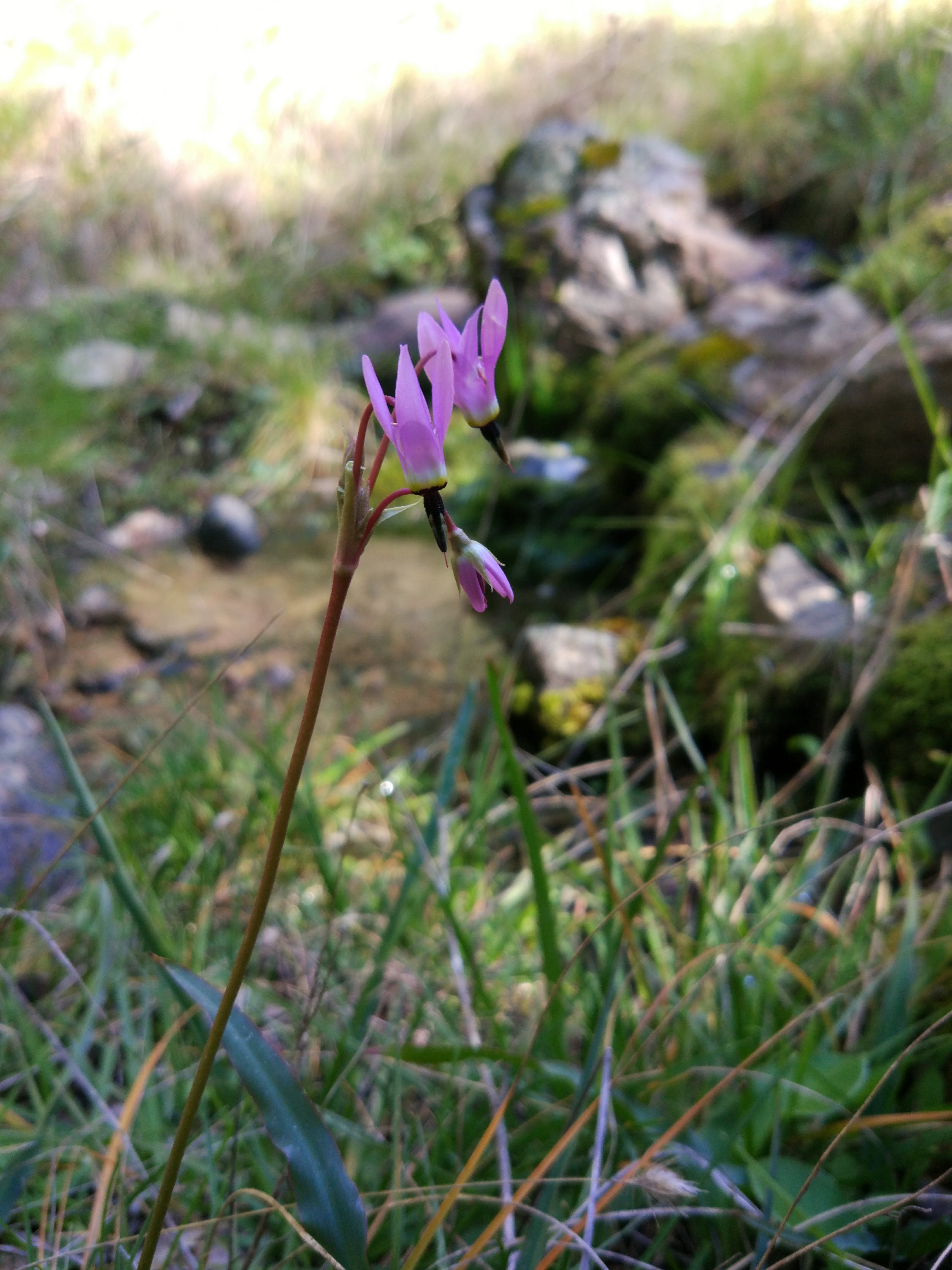
Permula hernendosii | Mosquito Bill
Habit: Herbaceous, small, low to the ground
Leaf: Simple, ovate, basal, parallel venation, broadly acute, entire margin
Repro: Bracts, petals part of 4, purple, reflexed, stigma/ovary exposed
Location: Off the trail, in the clear open air, mildly shaded


Ceanothus jepsonii | Musk Brush
Habit: Herbaceous, small, low to the ground
Leaf: Simple, opposite, ovate, entire margin, palmate venation, broad, slightly dentate
Repro: Capitula/umbel-like, inflorescent bunches, purple, small flowers
Location: Off the trail, in the clear open air, strong sunlight, strong presence/dominant
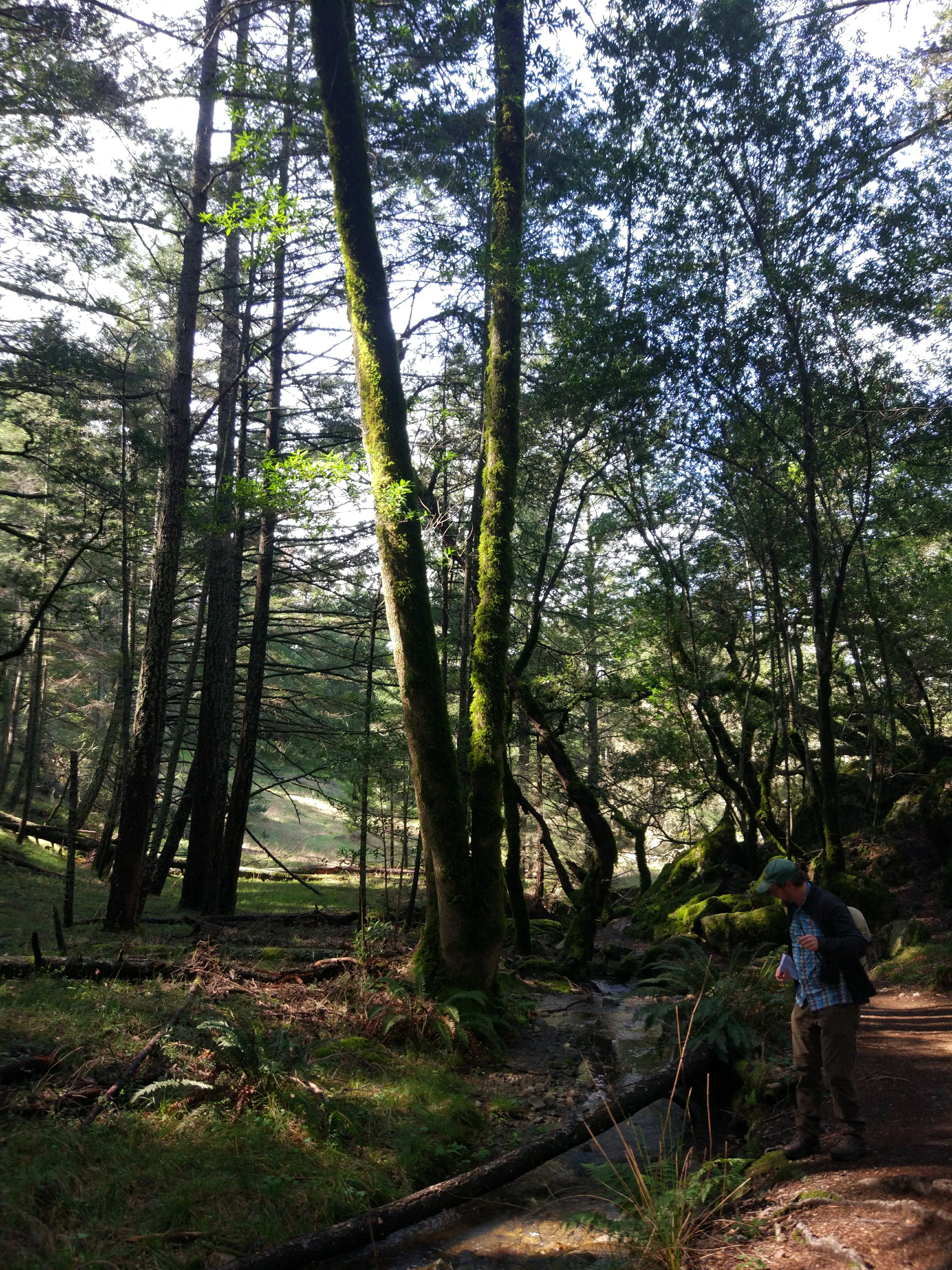
While the trip started out cloudy and with a high chance of rain in San Francisco, the day was much warmer in Mt. Tamalpais and was far from cloudy. We left USF around 1 pm and returned right at 5 pm with less clouds in the sky than when we first departed. Mt. Tamalpais was open and spacious almost like a plateau up top, a distant space from the surrounding areas. The hike was an upward loop that came back around to the initial spot. Much of the trail was spent taking in the wonderful scenery and looking for the species of interested dotted throughout the hike.
Directions:
Take Balboa St to Park Presidio Blvd
Head west on Turk St toward Beaumont Ave
Continue onto Balboa St
Take US-101 N and CA-1 N to Panoramic Hwy in Tamalpais-Homestead Valley
Turn right onto Park Presidio Blvd
Continue onto Veterans Blvd
Keep left at the fork and merge onto US-101 N
Take exit 445B for CA-1 toward Mill Valley/Stinson Beach
Continue onto CA-1 N
Turn left to stay on CA-1 N
Continue on Panoramic Hwy. Drive to W Ridgecrest Blvd
Turn right onto Panoramic Hwy
Slight left to stay on Panoramic Hwy
Turn right onto Pan Toll Rd
Turn left onto W Ridgecrest Blvd